James Spann: Cooler air moving into Alabama; dry through Friday
James Spann forecasts a quiet weather pattern for Alabama from Alabama NewsCenter on Vimeo.
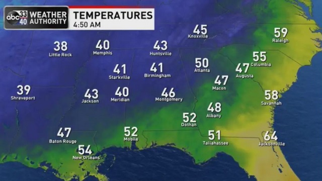
COOLING TREND: Colder spots across north Alabama are in the 30s early this morning with a clear sky, but most locations are in the 40s over the northern two-thirds of the state. Look for a sunny sky today with highs ranging from the upper 50s across the Tennessee Valley to the upper 60s near the Gulf Coast. Friday will be another sunny day with temperatures about 5 degrees cooler.
THE ALABAMA WEEKEND: The day Saturday will be mostly dry with a good supply of sunshine and a high in the low 60s. Clouds will increase late in the day, and a few showers could reach the northwest counties. Then, we will mention some risk of showers statewide Saturday night and Sunday as a disturbance aloft goes through. There will be no risk of severe storms, and probably no thunder. Rain amounts will be light with limited moisture, generally one-quarter inch or less. Some places across south Alabama won’t see enough rain to measure. The high Sunday will be in the 50s over north Alabama, with 60s to the south.
NEXT WEEK: Much of the week looks dry with seasonal temperatures. A few showers are possible near the Gulf Coast Monday, and a cold front will bring a chance of showers by Friday. For now we aren’t expecting a severe weather threat Friday, although some thunder is possible. And there’s still no sign of any bitterly cold Arctic air for the Deep South through midmonth.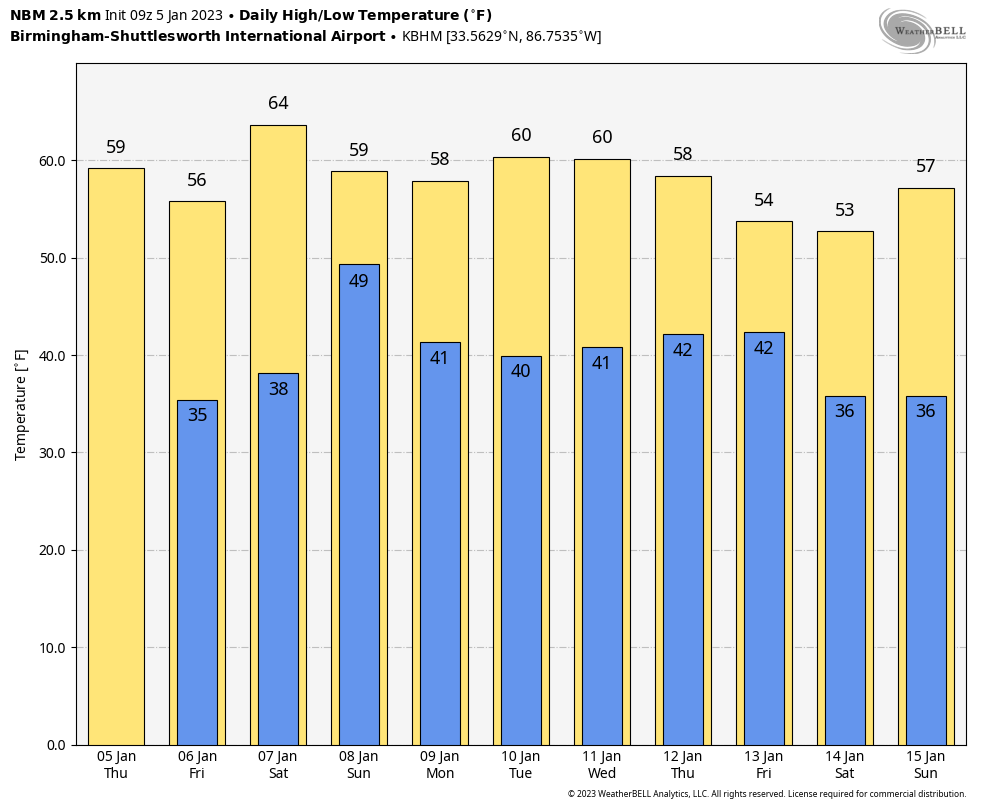 STORM SURVEY RESULTS SO FAR: National Weather Service Birmingham has identified six tornadoes from the severe weather event Tuesday into early Wednesday morning. The strongest is an EF-2 in Elmore County at Lake Jordan and near Titus. EF-1 tornadoes touched down east of Demopolis, just north of Marion, and in eastern Montgomery. EF-0 tornado damage was spotted near Booth in Autauga County and in western Macon County. Survey work will continue today.
ON THIS DATE IN 1962: Two tornadoes, about 100 yards apart and each making paths about 100 yards wide, followed parallel paths from southeast to northwest through the edge of the Crestview, Florida, residential area. These tornadoes killed one and injured 30 others.
BEACH FORECAST: Click here to see the AlabamaWx Beach Forecast Center page.
For more weather news and information from James Spann and his team, visit AlabamaWx.