James Spann: Showers for Alabama Tuesday, Wednesday; storms possible Wednesday night
RADAR CHECK: We are seeing a few sprinkles across northwest Alabama on radar this afternoon, but most of the state is dry with mid- and high-level clouds increasing. Temperatures are generally in the 60s. We will mention a chance of showers tonight and Tuesday statewide as a surface front stalls out just north of the Tennessee border. Rain amounts won’t be too heavy over the next 36 hours.
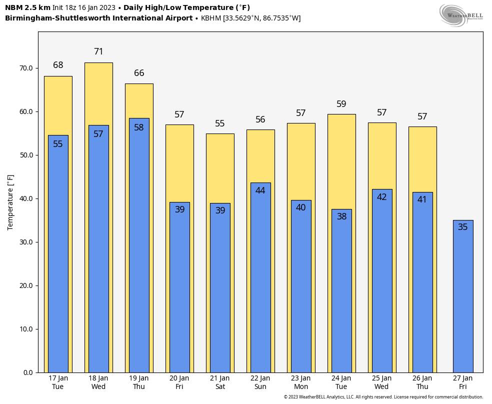
WEDNESDAY/THURSDAY: Scattered showers are possible Wednesday, but a decent part of the day should be dry and mild, with afternoon temperatures reaching the low 70s, almost 20 degrees above average for January. Then, a cold front will push a band of showers and thunderstorms into the state Wednesday night into Thursday morning.
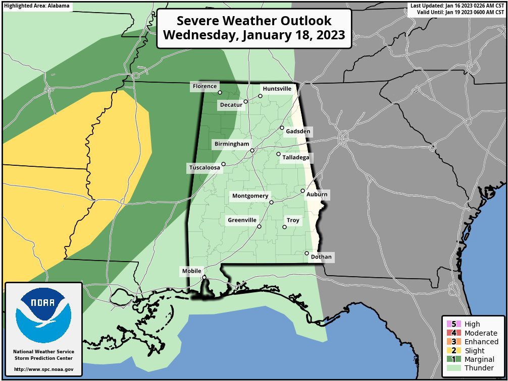
The Storm Prediction Center has defined a marginal risk (level 1 out of 5) of severe storms for the northwest corner of the state Wednesday night, but for now there is no formal risk defined for Thursday morning.
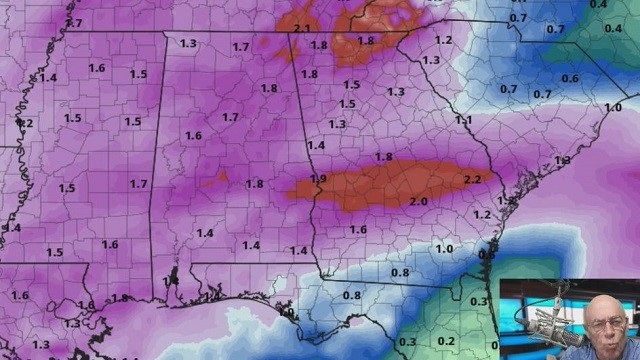
Displacement south from the main dynamics in tandem with marginal thermodynamics should limit the overall severe potential for Alabama with this system, but should instability values rise higher than forecast now, some risk of severe storms might have to be introduced. The main window for the heavier storms will come from about midnight Wednesday night through 9 a.m. Thursday. Rain amounts of around 1 inch are expected.
FRIDAY AND THE WEEKEND: Friday will be mostly sunny and cooler, with a high in the 50s over north Alabama and 60s to the south. Then the next weather system will bring more rain into Alabama over the weekend. Periods of rain are likely Saturday and Sunday with highs in the 50s. Some thunder is possible, but there is no risk of severe storms.
NEXT WEEK: Monday and Tuesday looks dry with seasonal temperatures, but more rain arrives on Wednesday. Highs will be in the 50s much of the week.
LAST THURSDAY: The National Weather Service has completed its survey work; a total of 14 tornadoes touched down across Alabama. The most significant was a long-track EF-3 that moved across parts of Autauga, Elmore, Coosa, Tallapoosa and Chambers counties. This tornado was responsible for seven deaths northwest of Prattville in Autauga County.
ON THIS DATE IN 2018: A winter storm brought snow to Alabama; the heaviest was along the I-85 corridor in the broad area from Montgomery to Opelika, where amounts of 2-4 inches were common.
BEACH FORECAST: Click here to see the AlabamaWx Beach Forecast Center page.
For more weather news and information from James Spann and his team, visit AlabamaWx.


