James Spann: Frigid March morning for Alabama; warming trend ahead

James Spann forecasts a big warm-up for Alabama this week from Alabama News Center on Vimeo.
MARCH FREEZE: Here are some temperatures across Alabama just before sunrise:
- Oneonta — 18
- Cullman — 19
- Gadsden — 20
- Fort Payne — 20
- Jasper — 21
- Haleyville — 23
- Scottsboro — 23
- Pell City — 23
- Huntsville — 24
- Birmingham — 25
- Muscle Shoals — 25
- Selma — 25
- Anniston — 27
- Evergreen — 28
- Tuscaloosa — 28
- Mobile — 30
- Dothan — 31
The only place above freezing is along the immediate Gulf Coast; Gulf Shores reported 34 degrees at 5 a.m. Farmers in Chilton County are using wind machines and helicopters in an effort to protect the peach crop there.
Today will be sunny with a high between 55 and 60 degrees, followed by another clear, cold night. Lows Tuesday morning will be between 27 and 37 degrees for most communities; colder spots will see yet another freeze.
WARMING TREND: Temperatures Tuesday rise well into the 60s with a partly sunny sky. The weather stays dry Wednesday and Thursday, and the warming trend continues. The high will be close to 70 Wednesday, and most places will see low 80s Thursday.
FRIDAY: The day Friday will be warm and dry with a high in the low 80s, but a cold front will push an organized band of showers and thunderstorms into the state Friday night and early Saturday morning. The Storm Prediction Center has areas north and west of Birmingham in a severe weather risk Friday night.
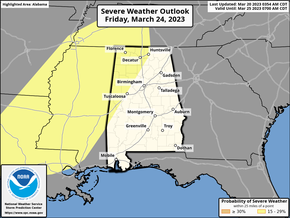
For now, it looks like the main risk of severe storms will come from 6 p.m. Friday through 6 a.m. Saturday. Most likely this will be a linear event with the main threat coming from strong winds, but an isolated tornado can’t be ruled out. The main limiting factor will be the lack of surface-based instability, but we really won’t know the magnitude of the threat until later this week.
THE ALABAMA WEEKEND: Rain ends early Saturday, and the sky will clear later in the day with a high in the low 70s. Sunday looks dry and mild, with a high in the 70s.
NEXT WEEK: A disturbance will bring the risk of showers Monday and Tuesday, followed by another risk of showers or storms later in the week. Highs will be mostly in the 70s.
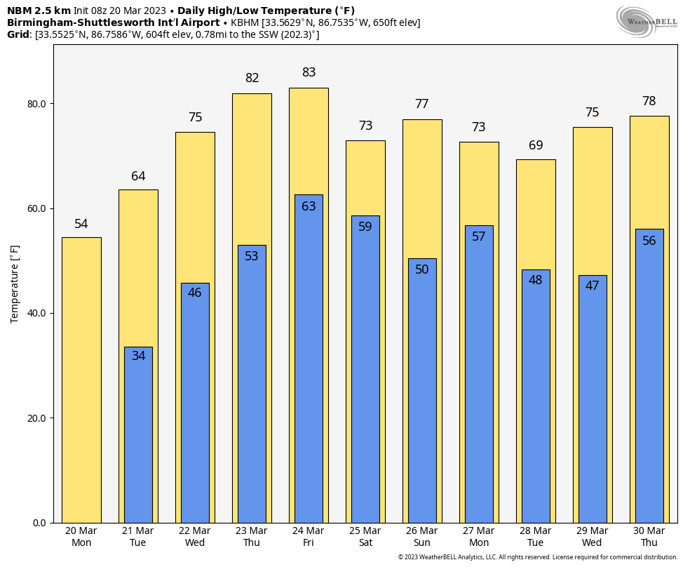
Many want to know if we are finished with freezing temperatures after Tuesday morning. We see no evidence of a freeze through the rest of March, but my advice remains the same every year: I would wait until April 15 to plant anything that might be harmed by a freeze. We usually have at least one significant cold snap during the first half of April.
ON THIS DATE IN 1905: A tornado estimated at F3 strength moved through parts of Chambers and Randolph counties in east Alabama; nine were killed.
ON THIS DATE IN 1998: A deadly tornado outbreak occurred over portions of the southeastern United States. Particularly hard hit were rural areas outside of Gainesville, Georgia, where at least 12 people were killed during the early morning. The entire outbreak killed 14 people and produced 12 tornadoes across three states. The town of Stoneville, North Carolina, was hard hit by the storms.
BEACH FORECAST: Click here to see the AlabamaWx Beach Forecast Center page.
For more weather news and information from James Spann and his team, visit AlabamaWx.


