James Spann: Alabama hits the low 80s by Thursday; severe storms possible Friday night
WARMING TREND BEGINS: Temperatures are between 57 and 65 degrees across much of Alabama this afternoon with a partly to mostly sunny sky; clouds are thicker across the Tennessee Valley, where a few sprinkles are showing up on radar. Rain will move across Tennessee this evening, staying generally north of Alabama. For a change, we stay above freezing tonight, with lows mostly in the 40s.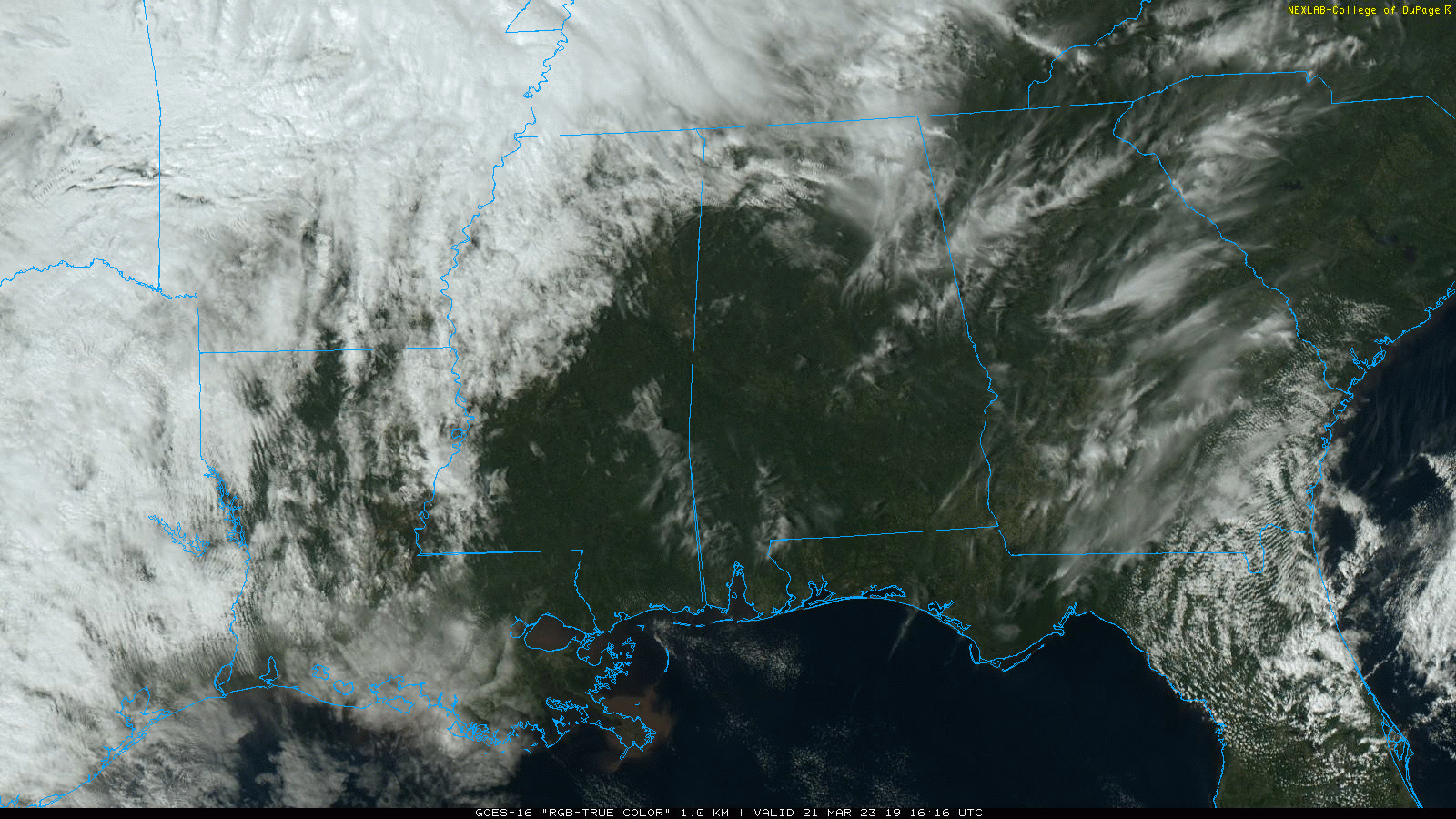 Wednesday will feature a mix of sun and clouds with a high in the low 70s; a few showers are possible over extreme north Alabama, mainly north of the Tennessee River. On Thursday, we rise into the low 80s with a good supply of sunshine.
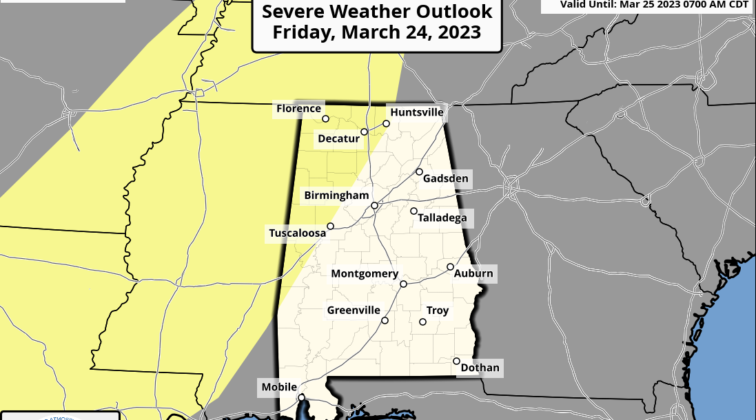
FRIDAY AND THE WEEKEND: The day Friday will be warm and breezy with a high back in the low 80s. Then a cold front will push an organized band of showers and thunderstorms into the state Friday into early Saturday morning. The Storm Prediction Center (SPC) maintains a risk of severe thunderstorms for northwest Alabama.
The National Weather Service office at Birmingham has all of its county warning area in a severe weather risk, and the SPC will most likely expand its risk area Wednesday. A line of severe storms will likely move through the state in the window from 10 p.m. Friday through 6 a.m. Saturday. Damaging straight-line winds will be the primary threat; however, forecast wind profiles suggest a few tornadoes are possible as well.
Rain ends early Saturday, followed by a clearing sky Saturday afternoon. Clouds return quickly Sunday, however, and new model data suggests rain could move back into the state as early as Sunday afternoon. The air will be unstable, and a few thunderstorms will be involved. If the sun can break out, the high will be close to 80 Saturday, followed by 70s Sunday.
NEXT WEEK: The weather stays unsettled Monday with a chance of showers and thunderstorms. New model data shows drier air moving into the state Tuesday. The latter half of the week looks dry and mild for now. Highs will remain in the 70s through the week for most of Alabama.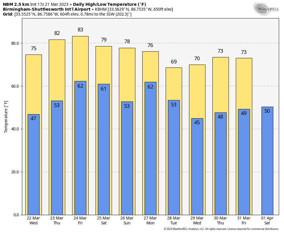 ON THIS DATE IN 1932: A generational tornado outbreak unfolded across Alabama. At least 36 tornadoes — including 27 killers and several long-lived tornado families — occurred across the Deep South, and Alabama was the hardest hit. The March 24 headline of The Tuscaloosa News stated that the death toll rose to 300, 32 of whom had died in Northport, and 2,500 were known to be injured. The Red Cross worked tirelessly to rehabilitate approximately “10,000 people left homeless in Alabama, Georgia and Tennessee.” According to The Tuscaloosa News, in Alabama alone, there were more than “8,000 whose domiciles were blown to the four winds.” To this day, we don’t know the exact number of people who died. Keep in mind there were no tornado warnings in 1932.
Chilton County was hit extremely hard, with 58 people killed. The Union Grove community near Jemison was laid to waste. Doctors and nurses from Montgomery and Birmingham worked all night by lantern and flashlight to relieve the widespead suffering. In Clay County, one of the tornadoes remained on the ground for 30 miles, cutting a path 400 yards wide. A new automobile became airborne and was carried through the air for a distance of 400 yards. Twelve people died in Clay County and 200 were injured. After the tornado, there were people living in the Clay County Courthouse. Sylacauga was hit by a violent tornado.
ON THIS DATE IN 1962: An estimated F3 tornado tore through the community of Weaver, in Calhoun County north of Anniston. This tornado occurred along the leading edge of a fast-moving squall line that produced peak wind gusts of 58 mph at Birmingham.
BEACH FORECAST: Click here to see the AlabamaWx Beach Forecast Center page.
For more weather news and information from James Spann and his team, visit AlabamaWx.


