James Spann: Scattered showers for Alabama today, Tuesday
James Spann forecasts summer-like weather for Alabama this week from Alabama News Center on Vimeo.
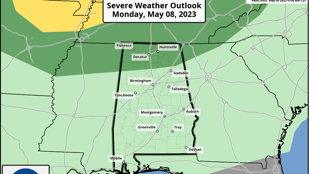
RADAR CHECK: Scattered showers are moving across Alabama early this morning; otherwise, the sky is mostly cloudy with temperatures generally between 65 and 72 degrees. We are forecasting a warm, humid day ahead with a mix of sun and clouds. A few additional showers or storms could form this afternoon, but they should be widely spaced. An organized mass of storms over Tennessee could slip into north Alabama tonight; the Storm Prediction Center has the Tennessee Valley in a marginal risk (level 1 out of 5) of severe thunderstorms for the potential for hail and strong, gusty winds.
The high today will be in the mid 80s; the average high for Birmingham on May 8 is 80.
REST OF THE WEEK: A summer-like pattern will continue for the rest of the week with partly sunny, warm, humid days along with some risk of widely scattered showers and storms daily. The better chance of seeing a shower each day will come during the afternoon and evening, and the chance of any one spot getting wet is near 35% Tuesday and 20-30% Wednesday through Friday. Highs will be in the mid to upper 80s; a few spots could touch 90 degrees.
THE ALABAMA WEEKEND: A broad upper ridge will keep the weather very warm, with highs between 86 and 90 degrees Saturday and Sunday. The sky will be partly to mostly sunny with only widely scattered afternoon and evening showers and storms.
NEXT WEEK: The overall pattern won’t change much, but some global models are hinting at higher shower coverage toward the middle of the week. Highs will hold in the 80s.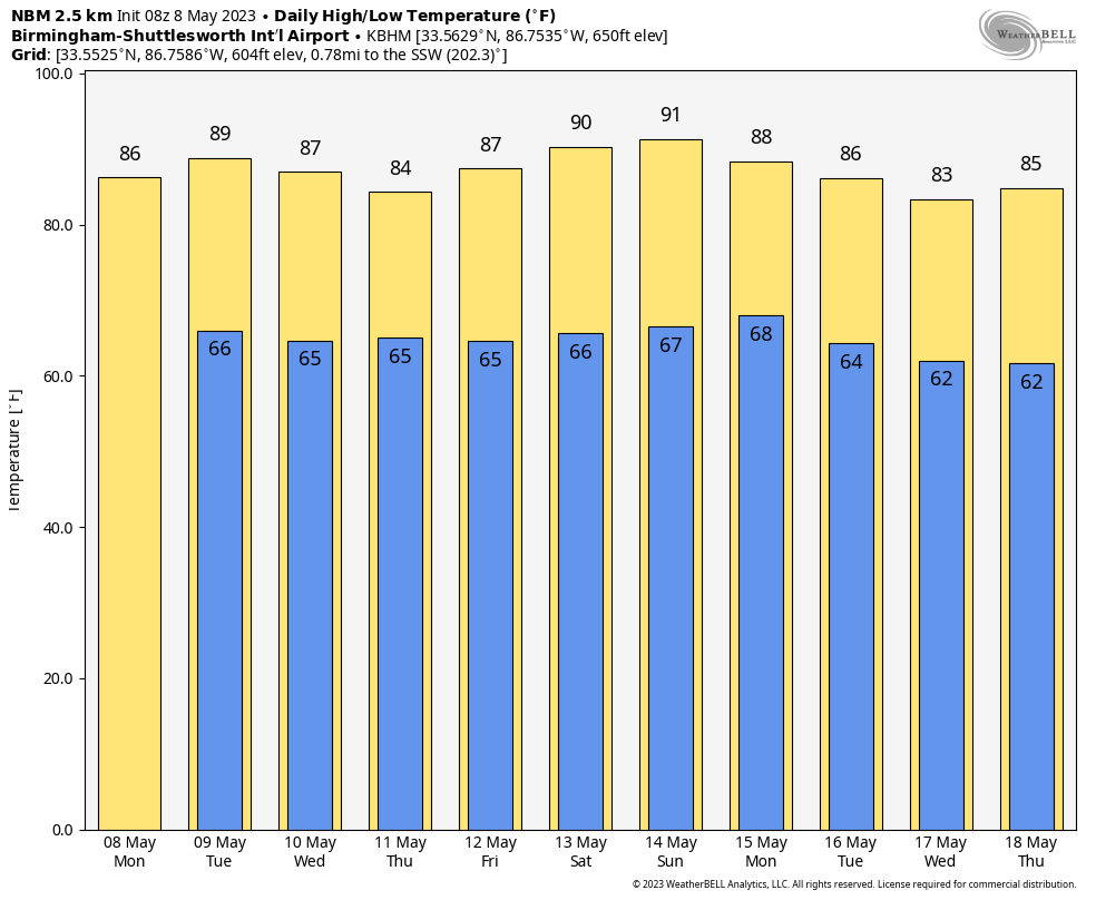 TORNADO SEASON DONE? The upper ridge that has formed across the Deep South means no tornado risk for Alabama for the next seven days. It’s too early to say for sure that our tornado season is done; technically it is in place through the end of May. There’s still some time for one more pattern change before the summer that would bring organized severe thunderstorms to the Deep South, but we aren’t seeing any sign of that for now.
ON THIS DATE IN 1979: Widespread damage occurred in the Tampa Bay area. The 19 tornadoes reported are the most in one day in Florida history. Three people drowned in Pinellas County, where flooding was most severe. Rainfall amounts of 18 inches in 24 hours were reported, with 12.73 inches falling at Tampa and 7.84 inches of that in just six hours. Worst hit was the Polk County community of Auburndale, where a tornado made a direct hit on the Auburndale School. Flying debris hurt eight students.
ON THIS DATE IN 2008: An EF-1 tornado moved across parts of Walker and Cullman counties, moving across Smith Lake along the way as a brief waterspout. The tornado blew down or snapped off hundreds of trees, damaged or destroyed at least five chicken houses and destroyed at least five boat houses at the Euskin Point Marina.
For more weather news and information from James Spann and his team, visit AlabamaWx.


