James Spann: Just a few isolated storms for Alabama today
James Spann has the midweek forecast for Alabama from Alabama News Center on Vimeo.
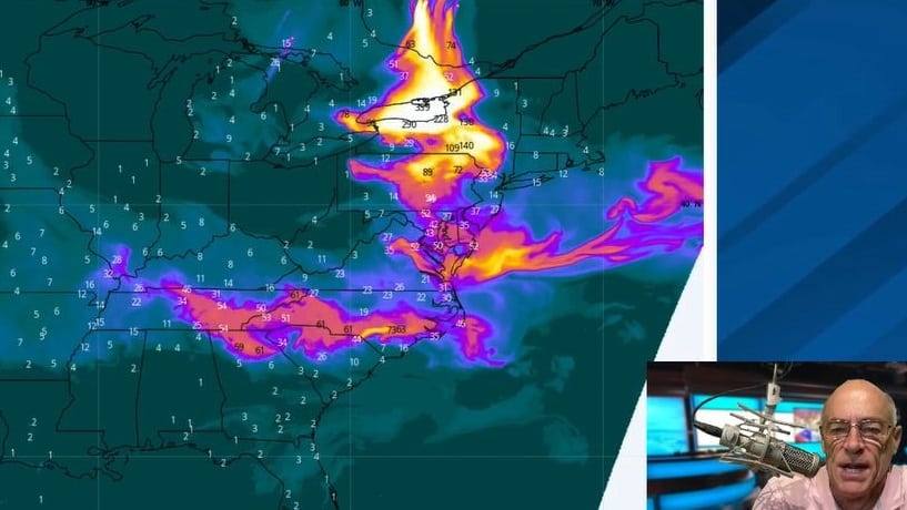
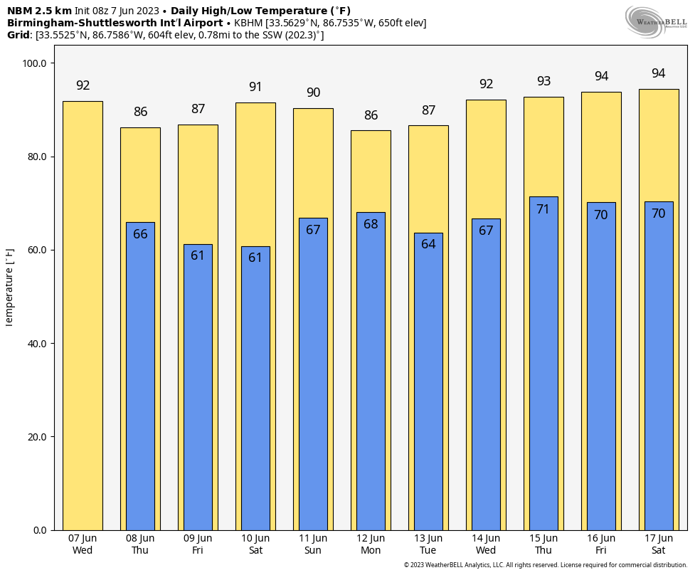
HOT JUNE DAY: Look for a high between 88 and 93 degrees across Alabama today with a partly to mostly sunny sky. It will be a hazy day for the northern third of the state, where some smoke in the upper atmosphere from the Canadian wildfires will persist. A few isolated storms will fire up this afternoon, generally in the window from 2 until 9 p.m.; the chance of any one spot getting wet is 10-20%.
Heat levels begin to come down Thursday as a surface front moves through the state, but storms remain isolated in coverage, with many places remaining dry. The high Thursday will be in the mid to upper 80s.
FRIDAY AND THE WEEKEND: An unusually dry air mass for June will drop into Alabama Friday and Saturday with lower humidity and cooler nights. Many places across the northern half of the state will dip into the 50s during the early morning hours. Moisture levels rise Sunday, and we will bring back the chance of scattered showers and thunderstorms. Highs will be in the 80s over the weekend.
NEXT WEEK: For now, the weather looks fairly typical for early summer, with partly sunny days and scattered, mostly afternoon and evening showers and thunderstorms. Heat levels will creep up, and some communities could reach the mid 90s toward the end of the week.
TROPICS: A non-tropical area of low pressure near the eastern Azores is producing disorganized showers and thunderstorms with winds to near gale force over the northeastern Atlantic Ocean. This system could acquire some subtropical characteristics while it moves to the east of the Azores. Later today, the system is forecast to turn northeastward over cooler waters, and further development is not expected. Regardless of development, heavy rains and gusty winds will continue across portions of the Canary Islands, Madeira Island and the Azores over the next day or so.
No tropical systems are expected near the U.S. for the next seven days.
WEATHER-RELATED INJURY: An isolated storm blew a tree down onto a golf cart at the Trussville Country Club Tuesday; one person suffered serious injuries. The same storm produced small hail and torrential rain.
ONE YEAR AGO TODAY: Several rounds of showers and thunderstorms occurred across central Alabama from the afternoon of June 7 through the evening of June 8, 2022. This led to flash flooding, which became significant in areas of Etowah County, such as Gadsden and Glencoe, on the evening of June 7. Additional flash flooding occurred across portions of Jefferson, Shelby and Talladega counties during the early morning of June 8. Slow-moving thunderstorms dumped upward of 6 inches of rain, which led to significant flash flooding in areas such as Birmingham and Sylacauga.
For more weather news and information from James Spann and his team, visit AlabamaWx.


