James Spann: More strong summer storms for Alabama today, tonight

James Spann forecasts more unsettled weather for Alabama from Alabama News Center on Vimeo.
MORE STORMS POSSIBLE: Alabama’s weather is rain-free at sunrise, but showers and storms will likely form later this afternoon and tonight. It won’t rain everywhere, but where storms form, they will be potentially strong to severe. The Storm Prediction Center has defined an enhanced risk (level 3 out of 5) of severe thunderstorms for the northwest corner of the state, including Florence and the Shoals. A slight risk (level 2) extends as far south as Fayette, Pelham and Heflin, and a marginal risk (level 1) covers much of the rest of central and south Alabama.
High-resolution models are not in very good agreement in terms of the timing and placement of thunderstorms, but the general window for the heavier storms will be noon to midnight. Like recent days, the main concern will come from strong, possibly damaging straight-line winds. Of course, all summer storms bring heavy rain and lots of lightning.
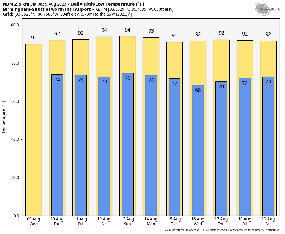
Highs today will range from the mid to upper 80s over the northern third of the state to the mid 90s for south Alabama. A heat advisory is in effect for the southern counties.
THURSDAY THROUGH THE WEEKEND: The overall pattern won’t change much. Each day we expect a mix of sun and clouds with the possibility of scattered showers and thunderstorms, most active during the afternoon and evening. The chance of any one spot getting wet daily is 45-55%, and highs will be between 92 and 96 degrees for most communities.
NEXT WEEK: Some global models are hinting at drier air entering Alabama by Tuesday, suggesting drier days, slightly lower humidity levels and cooler nights through midweek. But this doesn’t happen that often in August here, so we will believe it when we see it. Highs will remain mostly in the low to mid 90s.
 TROPICS: Very calm conditions persist across the Atlantic basin, and tropical storm formation is not expected through at least the next seven days.
ON THIS DATE IN 1935: The temperature at Birmingham reached 104 degrees as a blistering heat wave continued. Temperatures exceeded 100 degrees for five consecutive days.
ON THIS DATE IN 1969: An F3 tornado hit Cincinnati, killing four people and causing $15 million property damage. The tornado moved in a southeasterly direction at 40 to 50 mph.
For more weather news and information from James Spann and his team, visit AlabamaWx.


