James Spann: Mostly dry weekend for Alabama after Friday showers, storms
James Spann forecasts some rain for Alabama today, then a mostly dry weekend from Alabama News Center on Vimeo.
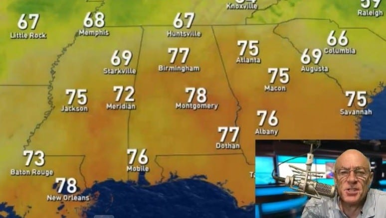
SOME RAIN TODAY: An upper low will bring showers and thunderstorms back to Alabama today. It won’t rain everywhere, and it won’t rain all day, but showers and storms will be around through early tonight. The chance of any one location seeing rain is 50-60%, and the high will be in the low to mid 80s for most communities. The average high for Birmingham on Sept. 1 is 89.
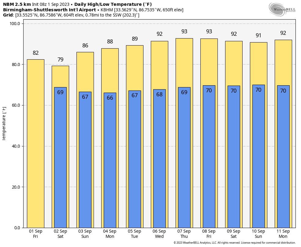
LABOR DAY WEEKEND: A few scattered showers or storms are possible Saturday over the southern half of the state, especially southwest Alabama. The sky will be mostly cloudy with highs ranging from the upper 70s over the northern counties to the upper 80s near the coast. Sunday and Monday will be dry with a partly to mostly sunny sky and a gradual warming trend; highs will be in the upper 80s and low 90s.
REST OF NEXT WEEK: Most of the week looks dry with mostly sunny days, fair nights and highs between 90 and 94 degrees. A few scattered showers could show up by Friday.
 FOOTBALL WEATHER: For the high school games across Alabama tonight, a few scattered showers are possible, but many stadiums will be dry. Temperatures will fall through the 70s.
On Saturday, Jacksonville State hosts East Tennessee State (1 p.m. kickoff). Expect a mostly cloudy sky with temperatures around 80 degrees through the game and just a slight risk of a shower.
Auburn will host UMass Saturday at Jordan-Hare Stadium (2:30 p.m. kickoff). The sky will be mostly cloudy; there is a small risk of a shower during the game. Expect a kickoff temperature near 83 degrees, falling to near 80 by the final whistle.
Alabama hosts Middle Tennessee State Saturday at Bryant-Denny Stadium (6:30 p.m. kickoff). Expect a clearing sky with temperatures falling from near 81 degrees at kickoff through the 70s during the game.
TROPICS: There is a cluster of tropical systems in the Atlantic, but none of them will affect the U.S. or the Gulf of Mexico for at least the next seven days.
- Idalia is now a post-tropical cyclone moving away from the United States. It is expected to become a tropical storm again over the weekend with some impact to Bermuda. From there it heads out to the North Atlantic.
- Franklin is still a hurricane with winds of 80 mph northeast of Bermuda. It becomes post-tropical over the weekend as it heads to the North Atlantic.
- Jose is a junk tropical storm that will be absorbed by Franklin by Saturday morning.
- Gert has regenerated; it is a tropical depression over the open Atlantic and will be absorbed by Idalia by Sunday far from land.
- Invest 94L in the eastern Atlantic will likely become a tropical storm over the weekend, but it will turn north and will remain far from land.
ON THIS DATE IN 1974: Lt. Judy Neuffer became the first woman to fly a Hurricane Hunter aircraft through the eye of a hurricane.
ON THIS DATE IN 2018: Hurricane Gustav made landfall over southeast Louisiana at Category 2 strength. Several parishes in the New Orleans area had announced plans for voluntary evacuations beginning Aug. 30. New Orleans Mayor Ray Nagin had ordered the mandatory evacuation of the whole of New Orleans commencing on the morning of Aug. 31.
For more weather news and information from James Spann and his team, visit AlabamaWx.


