Scott Martin: Alabama stays dry, warm through much of next week

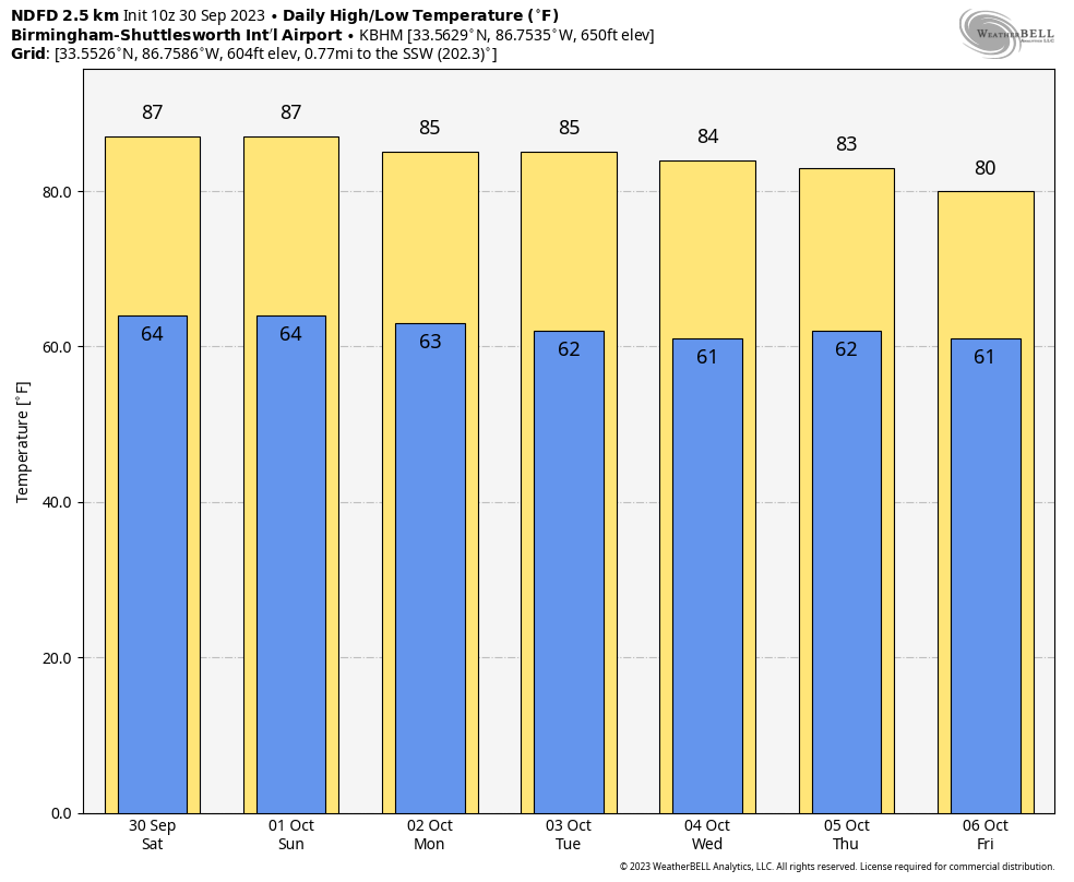
NOT MUCH CHANGE: I hope you are ready for a very repetitive forecast, as not much change is going to happen until we get to the end of next week. Ridging is in control of the eastern half of the country, and that will keep us warm and dry today with tons of sunshine. Highs will be in the upper 80s to the lower 90s.
Sunday will feature mainly sunny skies with highs in the mid 80s to the lower 90s.
We’ll have a bit of a wedging effect on Monday, and temperatures will be a little cooler. Skies will be sunny with highs ranging throughout the 80s. Tuesday and Wednesday will be much the same.
On Thursday we will start to see a little change, with a trough taking over for the ridge that had been over the eastern parts of the country. We’ll have a few more clouds and temperatures will start to be a touch cooler. Highs will range from the upper 70s to the upper 80s.
On Friday, the ridge will be completely replaced by the trough, and a cold front should move through the state. For now, it looks to be moisture-starved, and only a few showers will be possible. Highs will be in the mid 70s to the mid 80s.
TROPICS: The tropics continue to be active. We have Tropical Storms Philippe and Rina out there over the central Atlantic. Both are expected to curve northward and move away from land. The rest of the tropics are quiet, and no new systems are expected to develop within the next seven days.
For more weather news and information from James Spann, Scott Martin and other members of the James Spann team, visit AlabamaWx.


