James Spann: Freeze likely in Alabama Wednesday and Thursday mornings
James Spann forecasts Alabama’s coldest weather so far this season from Alabama News Center on Vimeo.
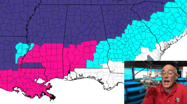
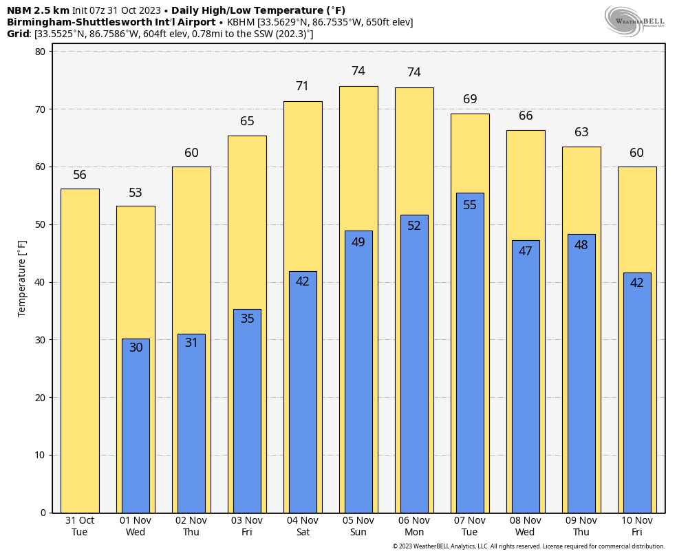
COLD BREEZE: Clouds linger across Alabama early this morning, and we note a few sprinkles on radar over the southern half of the state. We expect a clearing sky today with highs in the 50s over the northern counties and low to mid 60s to the south. A freeze warning is in effect for late tonight and early Wednesday over the northern half of the state, where temperatures will drop into the 27- to 32-degree range for most places. We expect upper 30s early Wednesday all the way down to I-10.
Wednesday will be sunny and cool, with a high in the 50s, and another freeze is likely early Thursday extending down into south Alabama, where a freeze watch is in effect. During the day Thursday the sky will be sunny with a high in the upper 50s and low 60s.
FRIDAY AND THE WEEKEND: Dry weather continues with a warming trend. Highs will be in the 60s Friday, followed by low to mid 70s over the weekend with mostly sunny days and fair nights. Clouds will increase late Sunday and Sunday night.
NEXT WEEK: Models suggest a disturbance will bring a chance of rain to Alabama and the Deep South Monday, but amounts will likely be less than one-quarter inch for most places. There is poor consistency in what happens over the latter half of the week; we will lean toward a dry forecast for now. Temperatures trend downward after Tuesday.
 FOOTBALL WEATHER: Expect a clear sky for the high school games across Alabama Friday night with temperatures falling through the 50s.
Saturday, UAB hosts Florida Atlantic at Protective Stadium in downtown Birmingham (2 p.m. kickoff). The sky will be sunny with temperatures in the low 70s.
Auburn travels to Nashville to take on Vanderbilt (3 p.m. CT kickoff). The sky will be clear with upper 60s at kickoff, dropping into the low 60s by the final whistle.
Alabama will host LSU at Bryant-Denny Stadium (6:45 p.m. kickoff). The sky will be clear with temperatures falling through the 60s. It will be a perfect night for football in Tuscaloosa.
TROPICS: A trough of low pressure over the eastern Caribbean Sea continues to produce a large area of showers and thunderstorms. Environmental conditions appear conducive for further development during the next several days while the system moves westward over the central and southwestern Caribbean Sea, and a tropical depression is likely to form by the latter part of this week. Regardless of development, this system has the potential to produce heavy rains over portions of Central America toward the end of this week. The National Hurricane Center gives it a 70% chance of development.
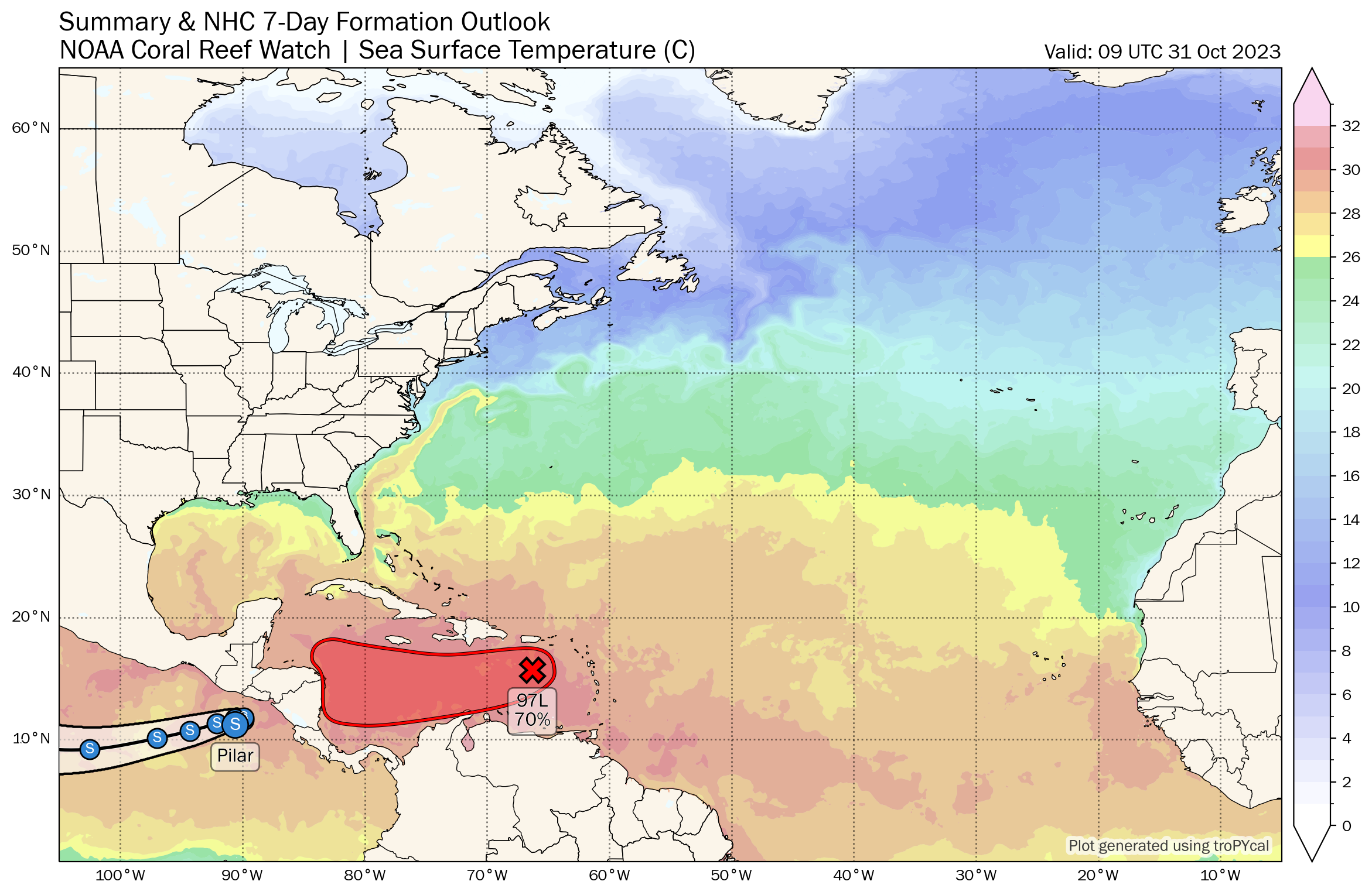
The rest of the Atlantic basin is quiet; no tropical systems will threaten the U.S. for at least the next seven days. Hurricane season ends in one month.
ON THIS DATE IN 1991: A severe winter storm, dubbed the Great Halloween Mega Storm, struck the upper Midwest. Minnesota bore the brunt of this storm. Blizzard conditions occurred, with winds gusting frequently to 40 and 50 mph. By the time it was all over on Nov. 2, Duluth recorded 37 inches, Minneapolis 28 inches, International Falls 18 inches and Sioux Falls, South Dakota, had 11.2 inches in 24 hours, its earliest snowfall of 6 inches or more and snowiest October on record. For Duluth and Minneapolis, the snow amounts set new all-time records for the greatest amount of snow in a single storm.
For more weather news and information from James Spann and his team, visit AlabamaWx.


