Bill Murray: Rain moves into Alabama later today, widespread tonight and Wednesday
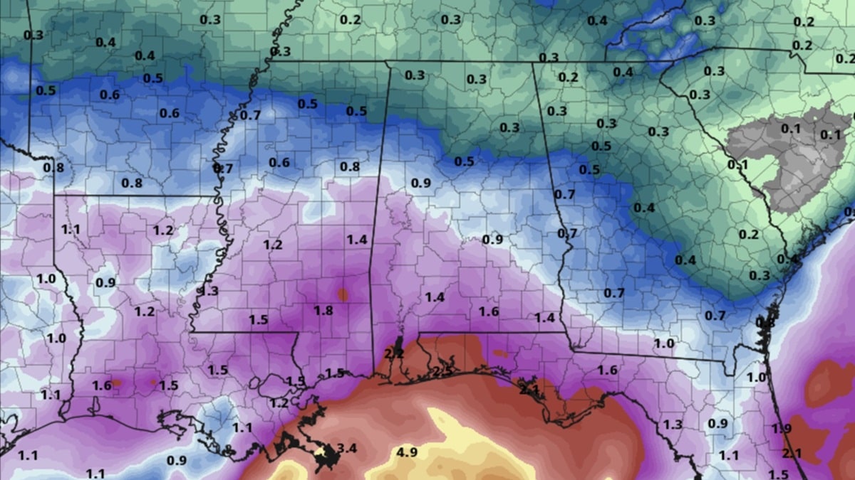
RAIN RETURNS: We’re getting off to a mostly cloudy start this morning as moisture streams across Alabama from the southwest. The rain has taken its time moving in due to a drier, low-level northeasterly flow. A surface low is organizing over the northwestern Gulf this morning. It will rotate toward the central Gulf Coast over the next 36 hours, and this will allow rain to spread into Alabama late this afternoon and tonight. Much of northwest, central and south Alabama will have high rain chances tonight. It appears that there will be a fairly significant gradient for rainfall amounts across the state, with around one-third inch over the Tennessee Valley, around one-half to 1 inch across north central Alabama, 1 to 1.5 inches across south central Alabama and more than 2 inches over south Alabama. Rainfall amounts could be excessive along the Gulf Coast.
END OF THE WEEK: As the surface low moves northward, it will run out of steam and weaken over the Southeast. This will allow the rain to diminish on Thursday and some clearing on Thursday night, but it won’t last long, and mostly cloudy skies will prevail on Friday. Meanwhile, with an upper low over Florida, another surface low will form off the coast of southeast Florida and move northeast. This will keep a few showers in the forecast on Friday, especially over eastern Alabama. A cold front will be pushing into Alabama on Friday, but rain chances will be low.
TEMPERATURES: Highs today will be in the upper 60s across north and central Alabama, with cooler temperatures over south Alabama, where the rain will be more widespread. Wednesday highs will be around 60 degrees with the clouds and rain. Highs Thursday and Friday will be in the middle and upper 60s. Lows will be in the 40s and lower 50s each morning through Friday.
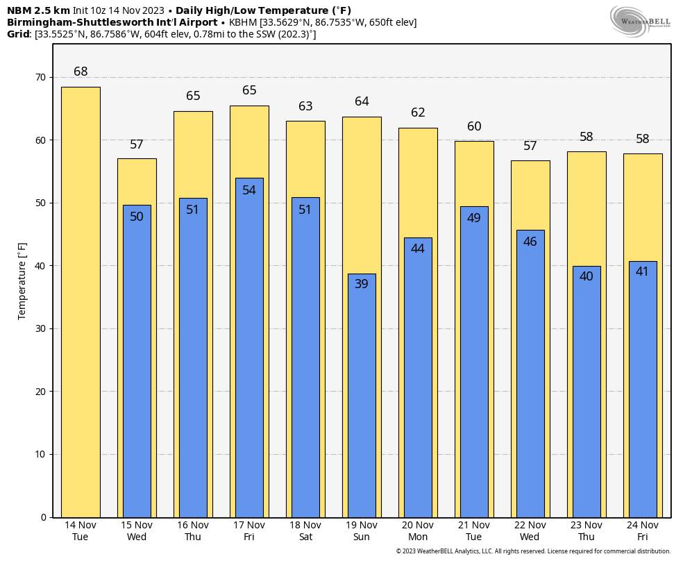
THE ALABAMA WEEKEND: Dry air moves into the Deep South, and the weekend will feature mostly sunny, pleasant days and fair, cool nights. Highs generally will be in the 60s, lows mostly in the 40s.
INTO NEXT WEEK: There is a lot of uncertainty around the forecast in the early part of next week. A storm system will be approaching from the west, but the latest runs of the Global Forecast System have hinted that it might stay west of Alabama through Tuesday and weaken before it moves into the state Wednesday. That same run indicates that a stronger system will roll through on Friday with rain and storms, moving out before the weekend. Either way, Thanksgiving looks dry now.
For more weather news and information from James Spann, Bill Murray and other members of the James Spann team, visit AlabamaWx.


