James Spann: Subfreezing nights ahead for Alabama
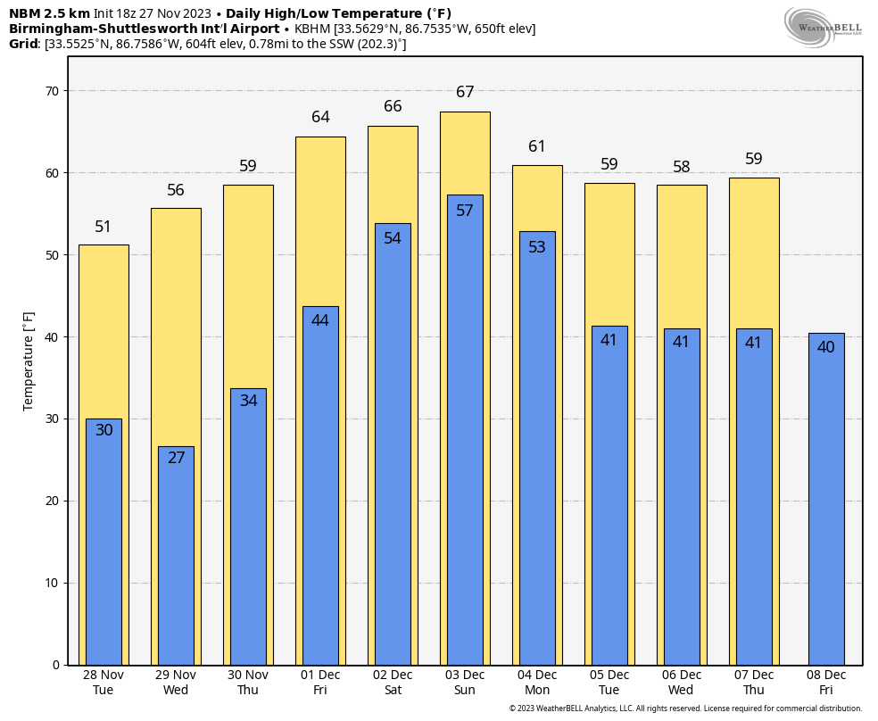
SUNNY, COOL NOVEMBER DAY: Temperatures are in the 40s over the northern half of the state this afternoon despite a sunny sky; low to mid 50s are observed over the southern counties. Tonight will be clear and cold, with a freeze for much of north and central Alabama; lows there will be between 25 and 32 degrees for most communities.
The coldest morning this week will come early Wednesday, with 20s over the northern half of the state and a potential freeze all the way down to I-10. Colder spots will see another freeze Thursday morning.
The weather will be dry through the daytime Thursday, and a warming trend begins Thursday afternoon with highs back in the 60s. An upper trough and surface front will bring rain into the state Thursday night.
FRIDAY AND THE WEEKEND: The weather will be unsettled, with several waves of rain and possible thunderstorms. At the moment it looks like rain on Friday is most likely during the morning, followed by a break late Friday afternoon and Friday night. The high will be in the 60s.
For the weekend, we will forecast periods of rain and a few thunderstorms Saturday and Sunday with highs holding in the 60s. A few strong storms can’t be ruled out Sunday, but for now the severe weather risk looks low. We do expect very beneficial rain Friday through Sunday, with amounts around 2 inches for north Alabama; the southern counties have potential for 2-4 inches — very good news for a state that still is experiencing drought.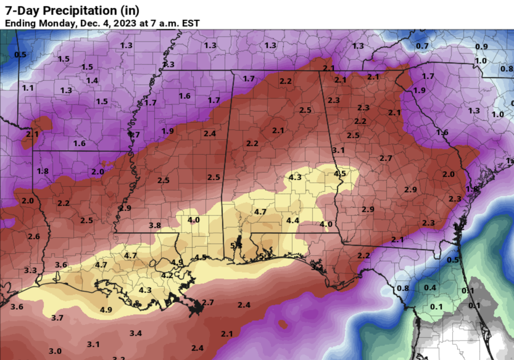 NEXT WEEK: The latest global model data suggests some lingering light rain is possible Monday; the rest of next week looks dry with seasonal temperatures.
 TROPICS: All is quiet across the Atlantic basin. Hurricane season ends Thursday.
ON THIS DATE IN 1701: Anders Celsius, the astronomer who invented the Celsius, often called the centigrade thermometer scale, was born.
ON THIS DATE IN 1898: A powerful storm known as the “Portland Gale” affected coastal New England on Nov. 26-27. The storm formed when two areas of low pressure merged off the coast of New Jersey and traveled up the east coast. This storm produced hurricane-force winds in Nantucket and sank more than 150 boats and ships.
For more weather news and information from James Spann and his team, visit AlabamaWx.


