Scott Martin: Storms for Alabama today; some may be strong to severe
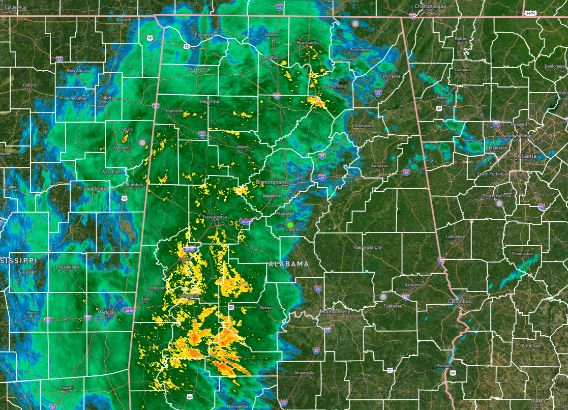
RADAR CHECK: Nearly everyone in the western half of north and central Alabama was getting light to moderate rain early this morning, and this batch will continue to push northeastward through the morning. Another round of rain and storms will push through the state during the afternoon that could contain strong to severe storms.
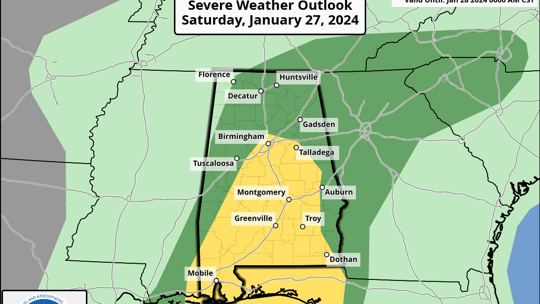
THE ALABAMA WEEKEND: Nearly the entire state is under a risk of severe storms today during the afternoon and evening, with the potential for brief tornadoes and damaging winds up to 60 mph. A slight risk is up for locations along and south of a line from Demopolis to Gardendale to Auburn, while the rest of Alabama is under a marginal risk except for the extreme northwest corner. For now, the main window for the threat of severe weather will be from 1 p.m. until around 8 p.m. Highs will be in the lower 60s to the lower 70s.
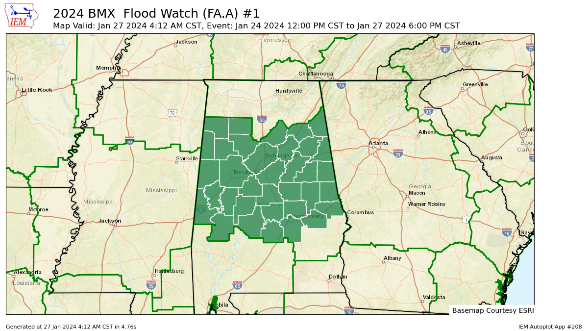
A flood watch continues until 6 p.m. for most of central Alabama.
After the cold front associated with today’s action moves out, Sunday will be much cooler. Some light rain may be possible over the northern half of the state, but expect skies to be mostly cloudy. Highs will be in the mid 40s to the mid 50s.
THE WORK WEEK: The week ahead looks dry with close to normal highs. Monday will feature mostly sunny skies with highs in the 50s. We go warmer on Tuesday, with sunny skies and highs in the upper 50s to the lower 60s. A trough will be working its way eastward just to our north on Wednesday that will briefly knock some highs back into the lower 50s, but we’ll continue to be dry with mostly sunny skies. Thursday will be sunny with highs in the mid 50s to the lower 60s. Friday will be a bit warmer, as highs make it into the upper 50s to the mid 60s underneath mostly sunny skies.
For more weather news and information from James Spann, Scott Martin and other members of the James Spann team, visit AlabamaWx.


