James Spann: Scattered showers, storms return to Alabama Wednesday
HOTTEST DAY SO FAR: Here are some temperatures around Alabama at 3 p.m.; for most places, today is the hottest day so far in 2024:
- Dothan — 101
- Ozark — 101
- Birmingham — 100
- Selma — 100
- Tuscaloosa — 99
- Huntsville — 99
- Muscle Shoals — 99
- Montgomery — 99
- Gadsden — 97
- Mobile — 97
- Anniston — 96
- Auburn — 95
- Cullman — 93
- Albertville — 93
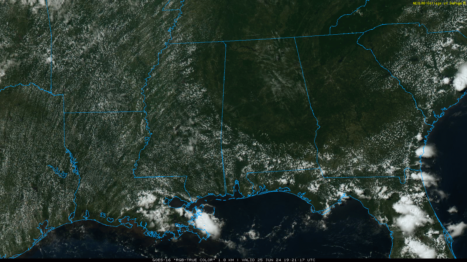
We note a few isolated showers over the southern third of the state, but most places are dry. Tonight will be fair with a low in the 70s.
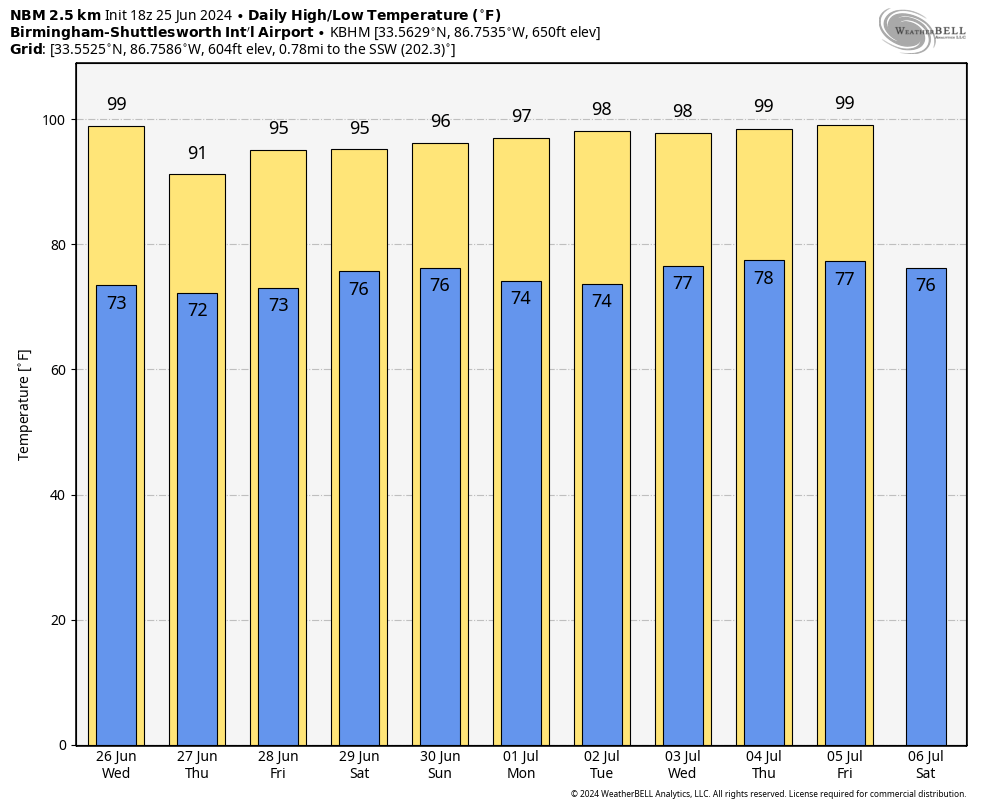
REST OF THE WEEK: The air aloft will be a little colder, and the air a little more unstable, and with rising moisture levels we will bring in the chance of a few scattered, random showers and thunderstorms daily Wednesday through Friday. Most, but not necessarily all, of the storms will come during the afternoons and evenings (around 2 to 10 p.m.), and the chance of any one spot seeing rain daily is 25-30%. Heat levels come down a bit, with highs in the low to mid 90s, but with higher dew points it will pretty much feel the same.
THE ALABAMA WEEKEND: Models are little more aggressive with shower and thunderstorm coverage Saturday and Sunday. Odds of any one community seeing rain bath days are now 40-50%. Otherwise, expect a mix of sun and clouds with highs in the mid 90s.
The classic summer weather pattern continues through much of next week: hot, humid days with scattered, mostly afternoon and evening showers and thunderstorms.
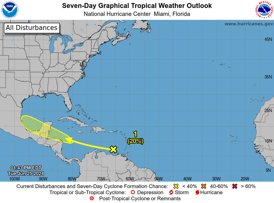
TROPICS: A tropical wave over the southeastern Caribbean Sea is producing disorganized showers and thunderstorms as it moves quickly westward at around 25 mph. Environmental conditions could support some gradual development once the wave reaches the western Caribbean Sea late this week, and some development is also possible over the southwestern Gulf of Mexico during the weekend. If anything develops, it will most likely head for Mexico; the National Hurricane Center gives it only a 20% chance of becoming a tropical storm for now.
No tropical systems are expected near the central Gulf Coast (Gulf Shores to Panama City Beach) through July 4.
ON THIS DATE IN 1957: Audrey reached hurricane strength and was moving northward through the Gulf of Mexico. It would make landfall two days later near Sabine Pass and would be one of the deadliest hurricanes in U.S. history.
ON THIS DATE IN 1967: Three F3 tornadoes crossed the Netherlands, killing seven people and producing widespread damage.
For more weather news and information from James Spann and his team, visit AlabamaWx.


