James Spann: A few strong storms possible across Alabama later today
James Spann forecasts another scorcher for Alabama, with scattered strong storms possible from Alabama News Center on Vimeo.
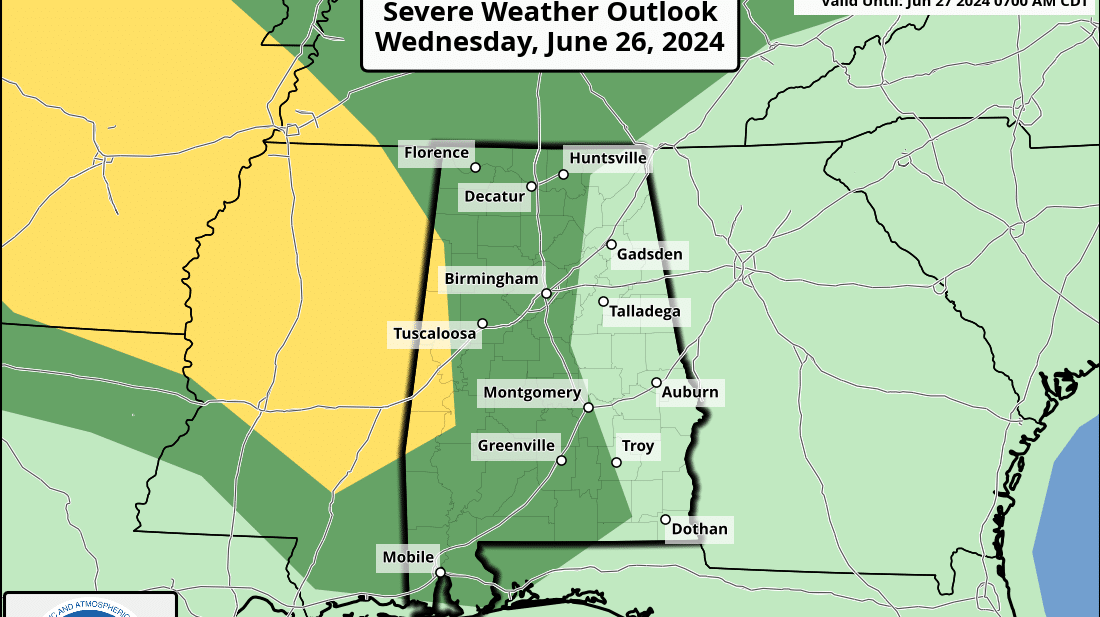
SHOWERS, STORMS RETURN: We can’t promise rain for everyone, but scattered showers and thunderstorms return to Alabama today. Where storms do form, they could be strong. The Storm Prediction Center has a slight risk (level 2 of 5) defined today for a few counties in west Alabama; otherwise, most of the western half of the state is in a marginal risk (level 1).
The main threat will come from strong straight-line winds and small hail; there is no tornado threat. While a few storms are possible across the Tennessee Valley this morning, most of the showers and stronger storms will come this afternoon and early tonight. The chance of any one spot getting wet is 40-50%.
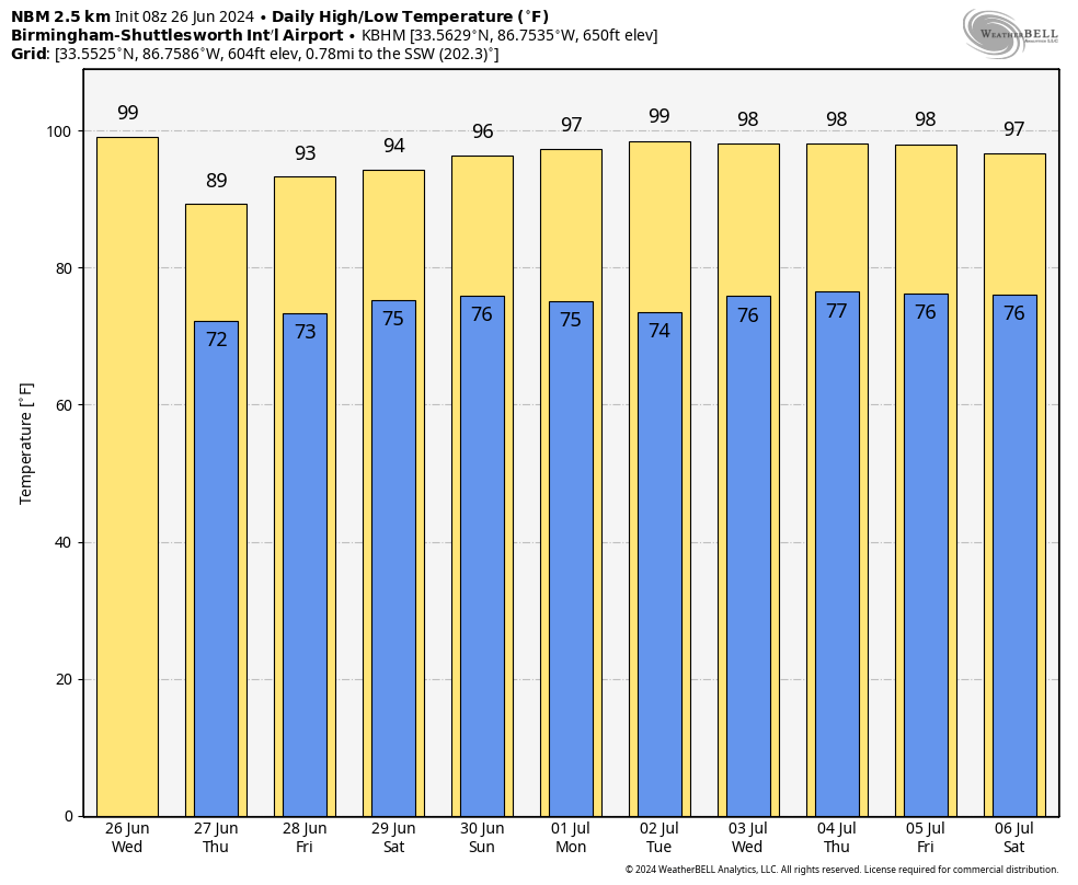
Otherwise, expect a mix of sun and clouds with a high generally in the upper 90s; a few spots could touch 100 degrees.
THURSDAY: Heat levels will come down, with a high between 89 and 94 degrees. The sky will be partly sunny with a few scattered showers and storms, mostly between 2 and 10 p.m.
FRIDAY AND THE WEEKEND: Routine summer weather continues — partly sunny, hot, humid days with the usual risk of scattered showers and storms daily, generally during the afternoons and evenings. Highs will be in the 90s, and the chance of any given community seeing rain will be 40-60%.
NEXT WEEK: There is evidence the upper ridge will strengthen, meaning hotter afternoons and fewer showers for the first half of the week. Highs return to the upper 90s. A few afternoon showers and storms are still possible, becoming a little more numerous by Independence Day and Friday (but no washout; the typical summer stuff).
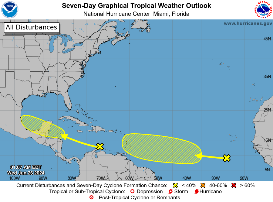
 TROPICS: A tropical wave moving into the central Caribbean Sea is producing limited shower activity as it moves quickly westward at around 25 mph. Environmental conditions could become more conducive for some gradual development over the western Caribbean Sea late this week or over the southwestern Gulf of Mexico during the weekend. If anything forms here, it will likely move into Mexico, and the National Hurricane Center gives it only a 20% chance of development over the next seven days.
Out in the far eastern Atlantic, a tropical wave is centered a few hundred miles south-southwest of the Cabo Verde Islands. It is producing disorganized showers and thunderstorms. Some slow development of this system is possible late this week into early next week while it moves generally westward across the central and western tropical Atlantic at 15 to 20 mph. The chance of development is 30%.
No tropical storms or hurricanes are expected near the central Gulf Coast (Gulf Shores to Panama City Beach) for the next 10 days.
 HEAT PARADE: Here are some of the official highs across Alabama yesterday; it was the hottest day so far this year.
- Dothan — 103
- Birmingham — 101
- Tuscaloosa — 101
- Montgomery — 101
- Muscle Shoals — 101
- Troy — 101
- Eufaula — 101
- Huntsville — 100
- Selma — 100
- Sylacauga — 100
- Anniston — 98
- Gadsden — 98
- Mobile — 98
ON THIS DATE IN 1986: Hurricane Bonnie made landfall on the upper Texas coast. A wind gust to 98 mph occurred at Sea Rim State Park. Ace, Texas, recorded 13 inches of rain.
For more weather news and information from James Spann and his team, visit AlabamaWx.


