James Spann: Showers, storms develop in Alabama later today; dry air arrives Wednesday
James Spann forecasts a wet day for many in Alabama, followed by a dry period from Alabama News Center on Vimeo.
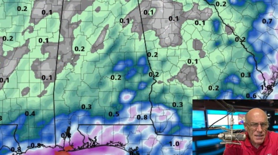
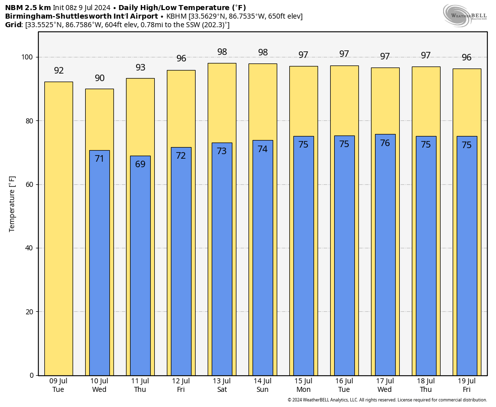
TROPICAL TUESDAY: The remnant circulation of Beryl will pass well to the north of Alabama today, but it will help to pull some deeper tropical moisture into the state, helping in the production of scattered to numerous showers and thunderstorms. The chance of any one spot seeing rain today is 60-70%, and, like Monday, the heavier storms will be very efficient rain producers. But, also like Monday, some places won’t see any rain at all. That is the way it works on summer days around here. The high will be in the low 90s, right at average for mid-July.
REST OF THE WEEK: A dry air mass moves in from the north late tonight, and most of Alabama will be rain-free Wednesday through Friday with sunny days, fair nights and lower humidity levels. Scattered showers and storms will be confined to the far southern part of the state (from Mobile to Dothan), and even there the rain won’t be too widespread. The Tennessee Valley will hold in the upper 80s Wednesday, with low 90s elsewhere. We expect mid 90s Thursday and Friday, but with lower humidity the heat will be tolerable.
THE ALABAMA WEEKEND: Dry air stays in place, and the weekend looks generally rain-free with a good supply of sunshine both days. We will mention just a small risk of a shower Sunday. Heat levels tick up, with highs in the upper 90s.
NEXT WEEK: Showers will likely remain few and far between Monday and Tuesday, then increase a bit over the latter half of the week as moisture levels rise and the air becomes a little more unstable. Highs will be in the 90s, with lows in the 70s.
 TROPICS: Beryl is now a post-tropical low over Arkansas; the remnant circulation will be in eastern Canada later in the week. The tropics are now very quiet, and tropical storm formation is not expected across the Atlantic basin at least for the next seven days.
ON THIS DATE IN 1979: Hurricane Bob was born in the Gulf of Mexico, becoming the first Atlantic hurricane to be given a male name.
ON THIS DATE IN 1980: Birmingham’s high was 98 degrees; it would be the last time below 100 until July 18. The great heat wave of 1980 brought triple-digit heat to the city for eight consecutive days, peaking at 106 on July 13. In July alone, there were an estimated 120 heat-related deaths along with the loss of more than 200,000 chickens and half the state’s corn crop.
For more weather news and information from James Spann and his team, visit AlabamaWx.


