James Spann: Elevated rain chances for Alabama through next week

James Spann forecasts rain for about 80% of Alabama today from Alabama News Center on Vimeo.
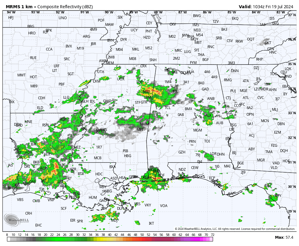
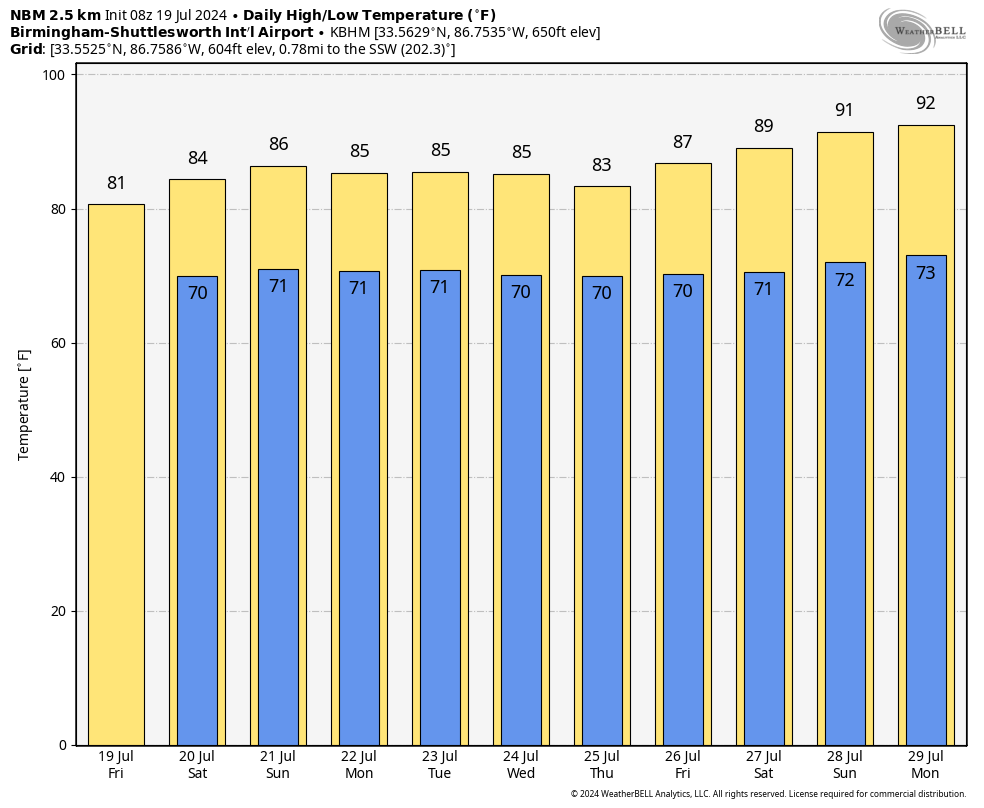
RADAR CHECK: Large areas of rain are moving through Alabama early this morning, and we continue to forecast occasional showers and thunderstorms today and tonight. With high precipitable water values, storms will be very efficient rain producers. Heavier storms will also be capable of producing strong, gusty winds and lots of lightning. Because of clouds and rain, highs today will be only in the 77- to 84-degree range, far below average for July 19.
The weather won’t change much over the weekend. This isn’t a total washout, but expect occasional showers and thunderstorms Saturday and Sunday. While most of the rain will come from noon to midnight, we expect a few morning showers as well. The amount of sun you see will be limited both days, and highs will be only in the low to mid 80s.
NEXT WEEK: Elevated rain chances will continue across the Deep South as an upper trough keeps the air unstable and moisture content remains very high. Scattered to numerous showers and storms are likely Monday through Friday, with highs holding in the 80s. There is a good chance much of north and central Alabama won’t see 90 degrees again until around July 28-29. Rain amounts over the next seven days will be 2-4 inches for most of the state.
TROPICS: All remains very quiet across the Atlantic basin, and tropical storm formation is not expected at least for the next seven days.
ON THIS DATE IN 1997: Hurricane Danny moved to the mouth of Mobile Bay near Fort Morgan just before dawn. The hurricane then drifted into southern Mobile Bay and stalled; it finally made landfall near Mullet Point midday as a Category 1 hurricane. Danny drifted across Baldwin County through the rest of the day and into the morning of July 20. The weakening cyclone finally turned north late in the day and moved over the extreme northwest Florida panhandle before proceeding to move north and northeast over Alabama for the next two days.
Radar estimated an incredible 43 inches of rain over the open water in Mobile Bay. Observing sites reported 30-40 inches across the area, with Dauphin Island reporting 36.71 inches. Numerous roads were inundated and impassable for days after Hurricane Danny. Record flooding caused major damage to homes along the Fowl River in Mobile County and the Fish River in Baldwin County.
For more weather news and information from James Spann and his team, visit AlabamaWx.


