James Spann: Sun, scattered storms for Alabama through Labor Day
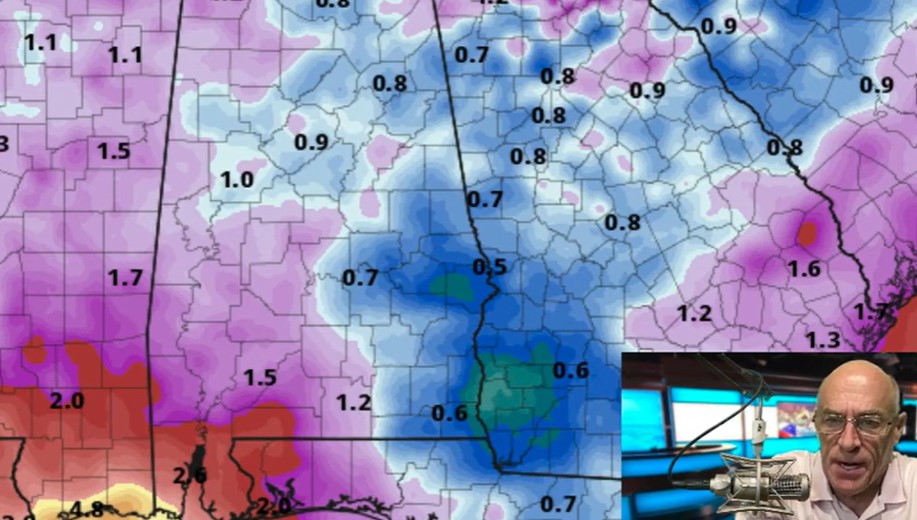
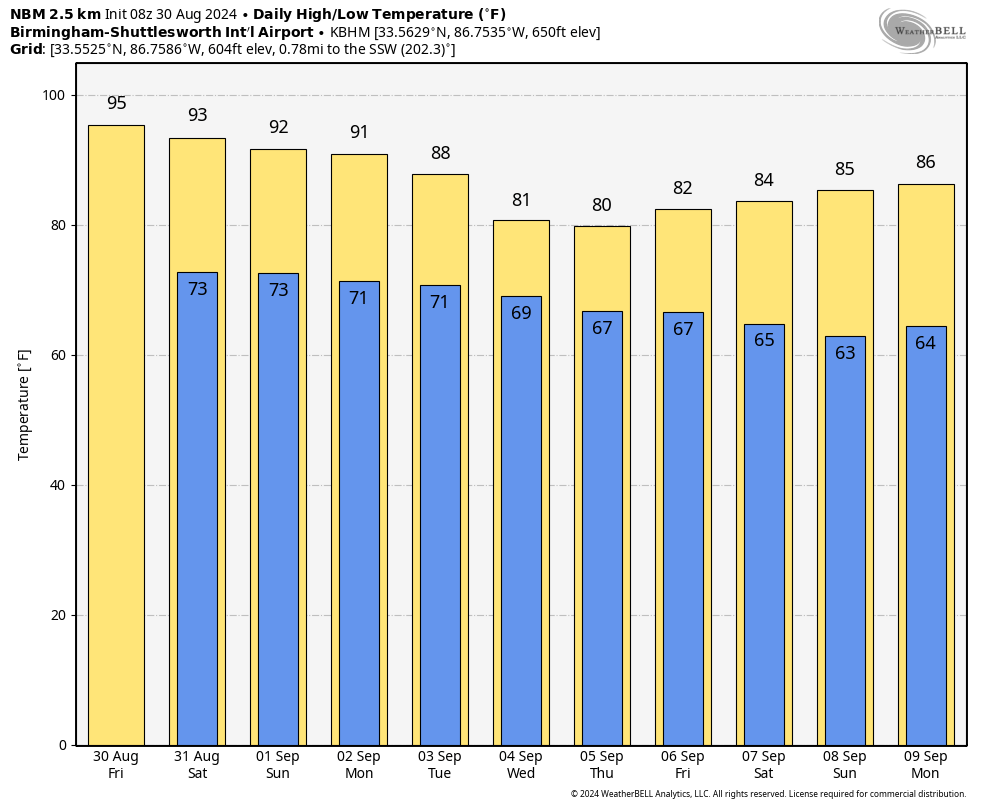
SCATTERED AFTERNOON STORMS: We have some pretty routine late summer weather for Alabama through the holiday weekend: partly sunny days with random, scattered, mostly afternoon and evening showers and thunderstorms. Most of the storms will come from about 1 until 10 p.m.; the chances of any spot seeing rain are 20-30% today and 40-50% Saturday through Monday. Expect a high in the mid 90s today, followed by low 90s over the weekend.
Where storms develop, they will produce lots of lightning, and some could produce strong winds. We had a few microbursts across the state Thursday, including one at Alexander City that took down a number of trees and caused some structural damage.
REST OF NEXT WEEK: Heat levels drop considerably; highs will be close to 80 over the northern half of the state by midweek, with lows in the 60s. We will maintain some risk of scattered showers and storms daily. Global models suggest rain coverage could be highest toward the end of the week with the approach of a surface front.
FOOTBALL WEATHER: Alabama hosts Western Kentucky Saturday at Bryant-Denny Stadium (6 p.m. kickoff). A brief shower or storm can’t be ruled out during the first half; otherwise, the sky will be mostly fair with temperatures falling from near 88 degrees at kickoff to near 80 by the final whistle. Auburn will host Alabama A&M at Jordan-Hare Stadium (6:30 p.m. kickoff). Again, a shower or storm is possible during the first half; otherwise, it will be mostly fair with temperatures falling through the 80s.
Troy will host Nevada Saturday (6 p.m. kickoff). There’s some risk of a shower or storm during the first half; otherwise, the weather will be fair with temperatures falling from around 87 degrees at kickoff to near 80 by the final whistle.
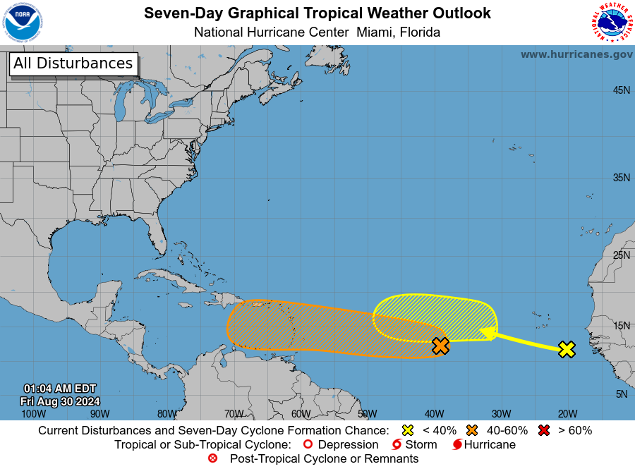
TROPICS: The National Hurricane Center is monitoring two tropical waves this morning — one just coming off the coast of Africa, and another one in the middle of the Atlantic between the Lesser Antilles and the coast of Africa.
The wave just off the African coast has only a 20% chance of development over the next seven days. The focus is on the lead wave over the central Tropical Atlantic; it continues to produce disorganized showers and thunderstorms that are a little more concentrated near its axis.
Environmental conditions appear conducive for gradual development of this system, and a tropical depression could form by early next week while it moves westward at 10 to 15 mph, approaching the Lesser Antilles. The system is then forecast to continue moving westward to west-northwestward across portions of the eastern and central Caribbean Sea by the middle of next week.
It is too early to know whether this develops into a tropical storm or hurricane, or whether it enters the Gulf of Mexico. We will keep a close eye on it.
ON THIS DATE IN 2023: Idalia made landfall in the Big Bend region of Florida as a low-end Category 3 hurricane.
Idalia’s primary impact was devastating storm surge across the coastal Big Bend in Levy, Dixie and Taylor counties. Storm-surge inundations of 7 to 12 feet along the coast were some of the highest recorded since the 1993 Storm of the Century. In some locations, according to local residents, the surge exceeded that observed in 1993. Idalia moved ashore during low tide; the storm surge could easily have been 3 to 4 feet higher had it moved onshore four to six hours later at high tide. In addition to surge, wind and flooding damage was recorded well inland into Georgia.
For more weather news and information from James Spann and his team, visit AlabamaWx.


