James Spann: Isolated showers over west Alabama this afternoon
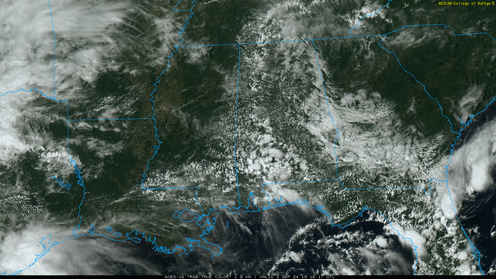
RADAR CHECK: We have a few isolated showers on radar over west and south Alabama this afternoon, nothing especially heavy or widespread. Otherwise, we have a mix of sun and clouds with temperatures ranging from the 80s over the eastern half of the state to the low 90s to the west. Isolated showers end this evening; tonight will be mostly fair with a low between 66 and 74 degrees.
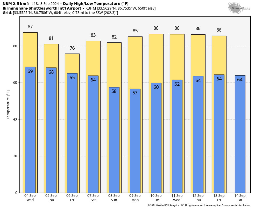
Much of Alabama will be dry Wednesday with only a small risk of a shower; expect a high between 86 and 91 degrees.
Rain coverage will increase Thursday with relatively widespread rain, especially over the southern two-thirds of the state. Periods of rain are likely statewide Friday with some thunder possible as well. The high Thursday will be in the low 80s, and on Friday much of Alabama will hold in the 70s all day because of clouds and rain. Amounts of 1-2 inches are likely for much of Alabama between now and Friday night.
THE ALABAMA WEEKEND: A cold front will push through on Saturday, and we will mention the risk of a few isolated showers along the front, but most of the day should be dry. A cooler, drier air mass will arrive Saturday night, setting the stage for a sunny Sunday with lower humidity. Highs over the weekend will be mostly in the low to mid 80s, with 50s likely for the northern counties of the state Sunday morning.
NEXT WEEK: For now, most of the week looks rain-free with highs in the 80s and lows in the upper 50s and 60s, very seasonal for early September.
 TROPICS: The National Hurricane Center (NHC) is monitoring several areas this afternoon, including two tropical waves in the central and eastern Atlantic basin. By the end of the week, environmental conditions are expected to become unfavorable for development for both systems.
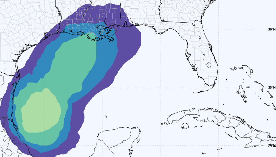
Also, a tropical wave is producing disorganized showers and thunderstorms over Hispaniola and portions of the central Caribbean Sea. As this system moves westward, some development is possible when it reaches the western Caribbean Sea and the southwestern Gulf of Mexico late this week or over the weekend. The NHC has dropped the chance of development over the next seven days to 30%.
Once the system reaches the Bay of Campeche this weekend, global models are suggesting some chance this will become a tropical depression or storm, then lift northward. Models are not especially bullish on intensification for now, and the system remains just something to watch. There’s no way of knowing the final track or intensity if it develops at all.
ON THIS DATE IN 1970: Amid a severe hailstorm at Coffeyville, Kansas, a stone 17.5 inches in circumference and nearly 2 pounds in weight was recovered. The average stone size from the storm was 5 inches in diameter, with another stone reportedly 8 inches in diameter.
ON THIS DATE IN 1979: Hurricane David made landfall in south Florida as a Category 2 storm. It caused 15 deaths in the United States. David was a Category 5 over the Dominican Republic, where more than 2,000 people died. On the same day, eyes were also on Tropical Storm Frederic in the open Atlantic; it would go on to strike the Alabama Gulf Coast on Sept. 12, 1979.
For more weather news and information from James Spann and his team, visit AlabamaWx.