Scott Martin: Mainly dry weekend ahead for Alabama; wet weather returns midweek

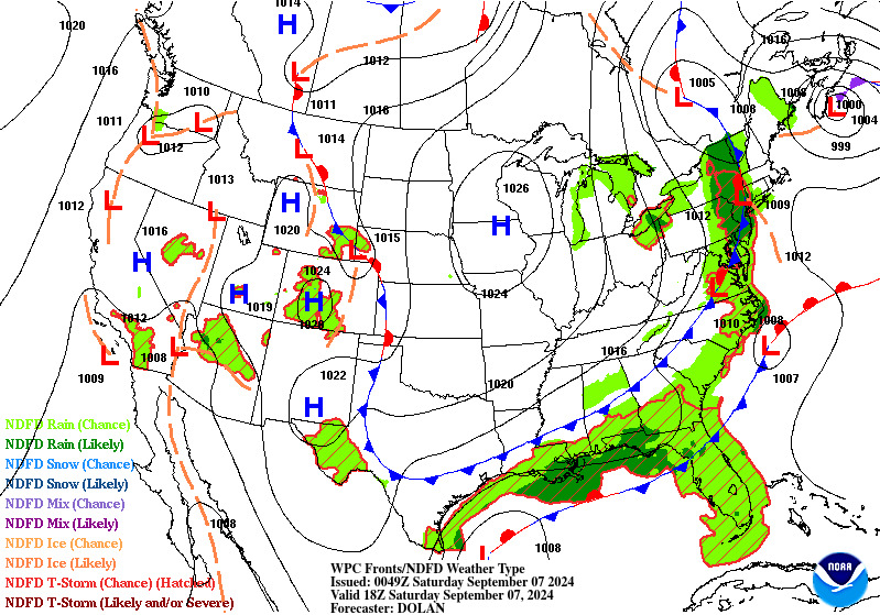
As we move into Sunday, high pressure will build to our north, keeping most of the showers and storms well to our south. There could be a stray shower in extreme southeastern Alabama, but that’s a long shot. The rest of the state will be dry, with highs in the lower to mid 80s.
THE WORK WEEK: By Monday, we’ll start to heat things up again as ridging builds over the state. Expect mostly sunny skies and highs climbing into the mid to upper 80s.
On Tuesday, moisture from a potential tropical system affecting the western and northwestern Gulf Coast will begin moving northeast toward Alabama. While much of the state will remain dry, a few showers might pop up in the extreme south. Highs will be in the 80s, with cooler temperatures in the south, where there could be more cloud cover.
On Wednesday, additional moisture will move in, increasing the chances of scattered showers across nearly all of central Alabama and a bit into the western part of north Alabama. Highs will be cooler due to the cloud cover and showers, reaching only the upper 70s to lower 80s.
Expect more scattered showers Thursday as the moisture continues its slow northeastward trek. The heavier showers should stay to our west and southwest. Highs will be in the upper 70s to lower 80s.
By Friday, we’re still looking at a decent chance for scattered showers across central Alabama. Heavier rainfall is likely along the northern Gulf Coast and offshore. Highs will range from the lower to mid 80s.
Rainfall totals by Friday evening could vary from as little as one-tenth of an inch to as much as 6.5 inches along the Alabama Gulf Coast. These numbers will adjust as we get updates and refine our forecasts with higher-resolution models throughout the week.
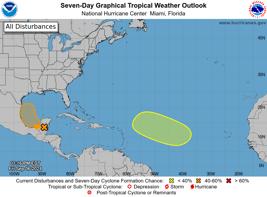
TROPICS: The first system we’re watching is over the southwestern Gulf of Mexico. A tropical wave is churning up disorganized showers and thunderstorms over Belize, Guatemala and the Yucatán Peninsula of Mexico. This wave is forecast to move over the Bay of Campeche today, where it will start interacting with a frontal boundary. A tropical depression could form in the early to middle part of next week as it moves slowly northwestward over the southwestern Gulf of Mexico. Formation chance through seven days is 50%.
The second system is over the eastern and central tropical Atlantic. An elongated trough of low pressure is producing broad shower and thunderstorm activity in this region. A more concentrated low-pressure area might form over the next couple of days. Any development is expected to be slow as the system drifts through the early part of next week and then begins moving west-northwestward across the central tropical Atlantic later next week. Formation chance through seven days is 20%.
For more weather news and information from James Spann, Scott Martin and other members of the James Spann team, visit AlabamaWx.


