James Spann: Freeze warning for north Alabama tonight; warmer weekend ahead

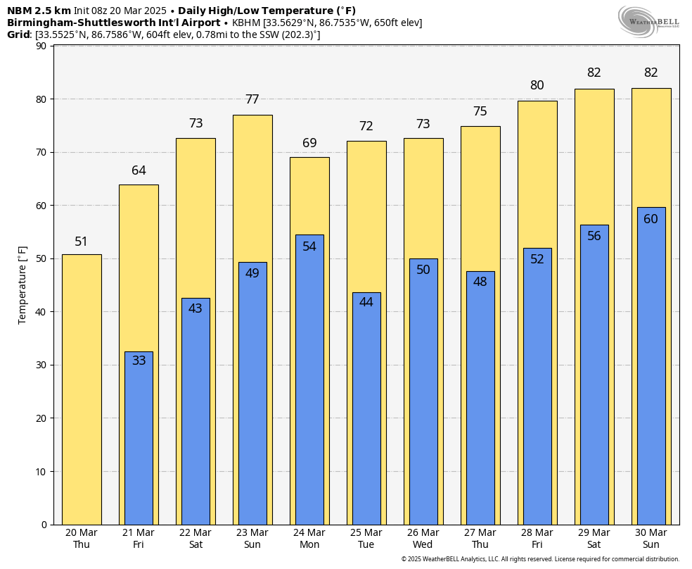
BREEZY AND MUCH COOLER: Alabama’s weather will be breezy and much cooler today; the sky will be occasionally cloudy over the northern half of the state with temperatures holding in the 40s and a few spotty showers. The sky becomes sunny over south Alabama with a high in the 50s. A brisk north wind will make it feel colder.
FREEZE WARNING: A freeze warning is in effect tonight for roughly the northern half of the state, where lows early Thursday will drop into the 28- to 34-degree range. Frost is likely deep into south Alabama with a clear sky and light wind. We warm into the 60s Friday afternoon with a sunny sky.
THE ALABAMA WEEKEND: Highs return to the 70s over the weekend; Saturday will be mostly sunny, followed by a partly sunny sky Sunday. A south wind will begin to increase Sunday afternoon ahead of a cold front that will bring showers and storms into the state late Sunday night, mainly after midnight. The Storm Prediction Center has defined a risk of severe thunderstorms for areas north of a line from Demopolis to Calera to Anniston.
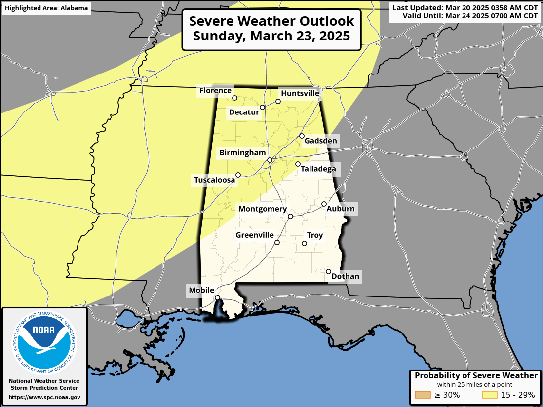
Models are suggesting only very limited instability, which will likely limit the threat, but we will watch model trends closely. For now, it looks like the best chance of heavier storms will come from midnight Sunday night through 8 a.m. Monday. By Monday afternoon, any lingering showers will be over the southern third of the state.
The rest of the week looks generally mild and dry, with highs in the 70s, but the European global models suggest a few showers Tuesday night.
SPRING IS HERE: Today is the first day of spring; the equinox was at 4:01 a.m., which means the sun is directly over the equator and day lengths are approximately 12 hours long everywhere on the planet. The amount of daylight will continue to increase until the summer solstice in June.
ON THIS DATE IN 1905: An estimated F3 tornado moved through Chambers and Randolph counties in east Alabama, killing nine and injuring more than 30. The damage was just south of Roanoke.
ON THIS DATE IN 1948: An F3 tornado tracked through Tinker Air Force Base in Oklahoma City just before 10 p.m., destroying 54 aircraft, including 17 transport planes valued at $500,000 apiece. The total damage amounted to more than $10 million, a record for the state that stood until the massive tornado outbreak of May 3, 1999. Maj. Ernest W. Fawbush and Capt. Robert C. Miller were ordered to see whether operationally forecasting tornadoes were possible. The tornado prompted the first attempt at tornado forecasting.
Forecasters at Tinker believed conditions were again favorable for tornadoes and issued the first recorded tornado forecast. On March 25 at 6 p.m., a forecast tornado occurred, crossing the prepared base, and the damage was minimized. The successful albeit somewhat lucky forecast paved the way for tornado forecasts to be issued by the U.S. Weather Bureau after a lengthy ban.
For more weather news and information from James Spann and his team, visit AlabamaWx.