James Spann: Alabama temperatures near record levels in coming days

SUNNY APRIL DAY: The sky is mostly sunny across Alabama this afternoon with temperatures mostly in the 70s. Tonight will be mostly fair with lows in the 50s and 60s.
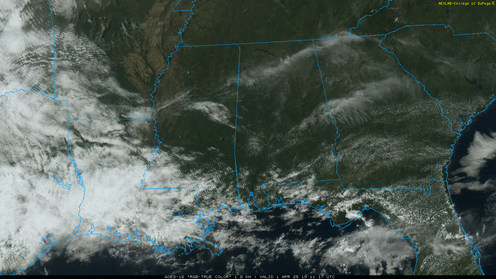
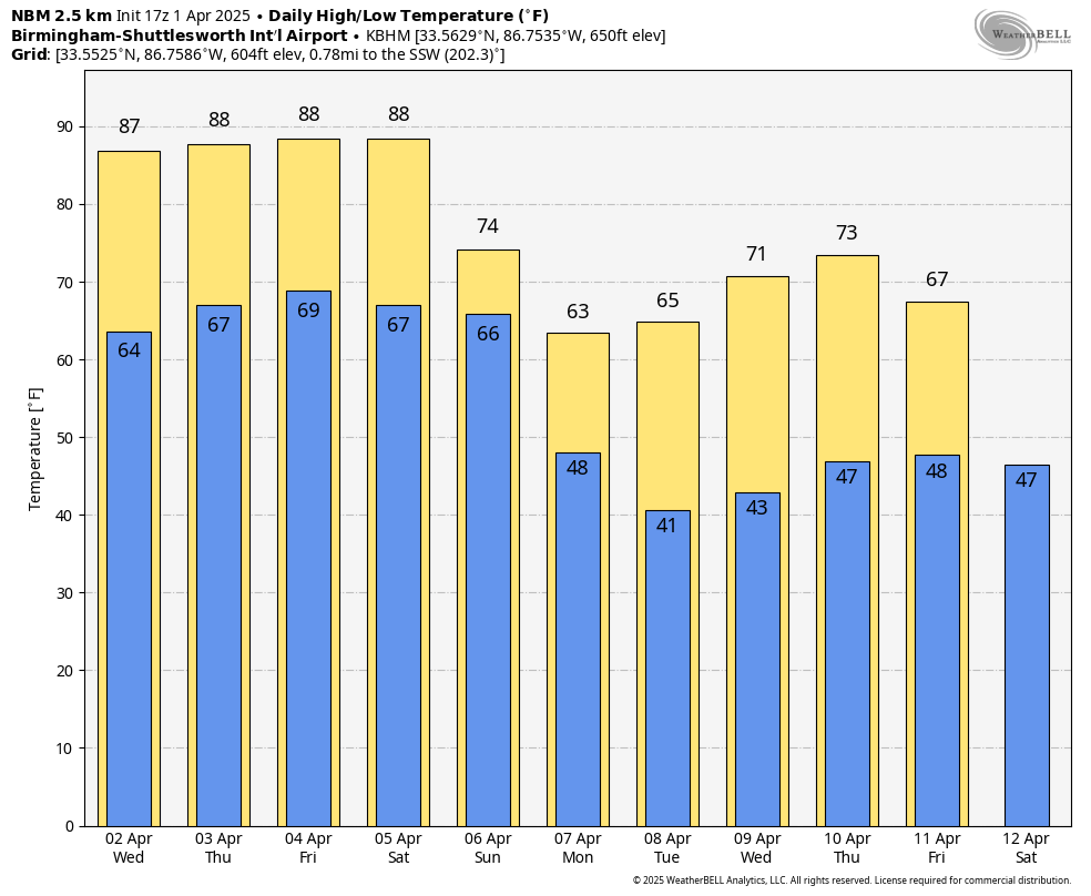
SUMMER PREVIEW: A strong upper ridge will build across the Gulf Coast region, setting the stage for the warmest weather so far this year over the latter half of the week. Highs rise into the 85- to 90-degree range, right at record levels for early April in Alabama. The ridge will also help to keep showers and thunderstorms north and west of Alabama, but a few isolated showers or storms could creep into the northwest counties Wednesday night.
Here are the daily record highs for Birmingham:
- April 3 — 87 (1999)
- April 4 — 88 (1934)
- April 5 — 88 (2010)
If we do reach 90 degrees on one of these days, it won’t be the earliest 90-degree temperature on record; that happened on March 21, 1907 (based on data at Birmingham).
THE ALABAMA WEEKEND: Saturday will be another summer-like day, with a partly sunny sky and a high in the upper 80s. Then the ridge breaks down, allowing showers and storms to move into the state Saturday night and Sunday. The Storm Prediction Center has defined a risk of severe storms late Saturday night over the northern and western counties.
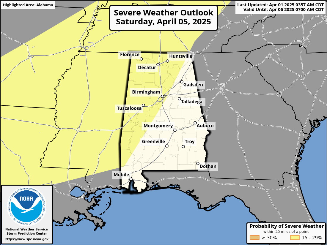
We will be much more specific about any threat of strong to severe storms later in the week; the risk will likely come late Saturday night into Sunday morning. Highs drop into the 70s Sunday with clouds and periods of rain.
SPRING CHILL: A pattern flip means much colder air for Alabama next week. Some north Alabama communities won’t get out of the 50s Monday, and lows will drop into the 30s Tuesday morning. Frost will be likely over at least the northern half of the state, with a freeze for colder spots. Most of the week will be dry.
ON THIS DATE IN 1960: The first weather satellite, TIROS 1 (Television and Infra Red Observation Satellite), began sending pictures back to earth. The TIROS series would have little benefit to operational weather forecasters because the image quality was low and inconsistent. The most important understanding achieved from the new technology was the discovery of the high degree of organization of large-scale weather systems, a fact never apparent from ground and aircraft observations.
For more weather news and information from James Spann and his team, visit AlabamaWx.


