James Spann: Nice warm-up for Alabama today; a few storms late Thursday

COLD START: Here are some temperatures across Alabama just before sunrise this morning:
- Cullman — 30
- Fort Payne — 30
- Haleyville — 30
- Gadsden — 31
- Chelsea — 31
- Morris — 31
- Margaret — 31
- Hueytown — 32
- Jasper — 34
- Decatur — 36
- Birmingham — 37
- Muscle Shoals — 37
- Anniston — 37
- Huntsville — 38
- Tuscaloosa — 38
- Montgomery — 43
- Mobile — 45
- Dothan — 46
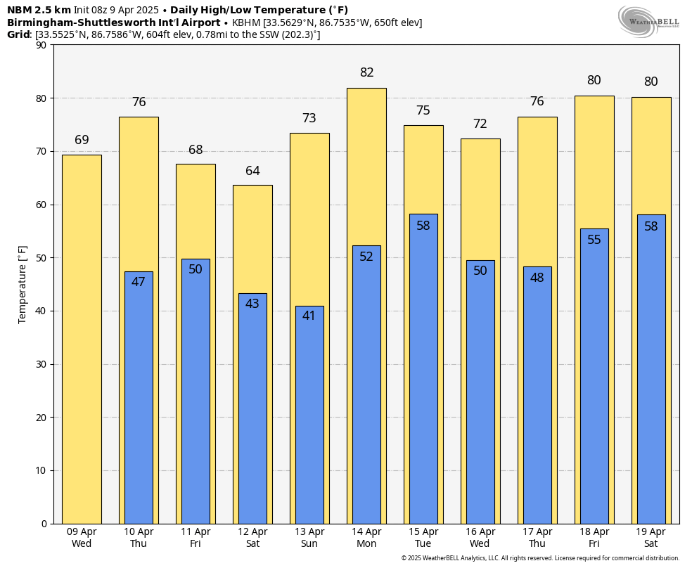
With a sunny sky, temperatures will rise into the 67- to 73-degree range across Alabama this afternoon.
STORMS RETURN: While most of the day Thursday will be dry with a high in the 70s, a cold front will bring a few showers and storms to the state late in the day and Thursday evening. The Storm Prediction Center has defined a slight risk (level 2 out of 5) of severe thunderstorms for north Alabama.
This is a low-end severe weather threat as wind fields will be weak, but a few storms could produce small hail and gusty winds Thursday evening over the northern half of the state.
Friday will be cooler, with highs in the 60s. A passing upper trough could bring a few showers to the northern third of the state during the afternoon and evening, but rain amounts should be light.
THE ALABAMA WEEKEND: Expect a sun-filled sky over the weekend; the high will be in the 60s Saturday, followed by 70s Sunday. Mornings will be cool, with lows in the low to mid 40s; some colder spots over north Alabama could reach the upper 30s.
The weather next week looks relatively tame; we will mention the chance of a few showers Tuesday and Friday, but much of the week will be dry with seasonal temperatures.
ON THIS DATE IN 1947: An estimated F5 tornado struck Woodward, Oklahoma, during the late evening, killing 95 people and causing $6 million damage. The tornado, one to two miles in width and traveling at a speed of 50 mph, killed a total of 167 people along its 221-mile path from Texas into Kansas.
For more weather news and information from James Spann and his team, visit AlabamaWx.


