James Spann: Scattered storms for Alabama Friday; fewer on Saturday, Sunday

RADAR CHECK: Showers and storms are widely scattered across Alabama this afternoon, but a few spots are seeing heavy rain and frequent lightning. A decent part of the state is dry with temperatures mostly in the upper 70s and low 80s. Showers will fade after sunset.
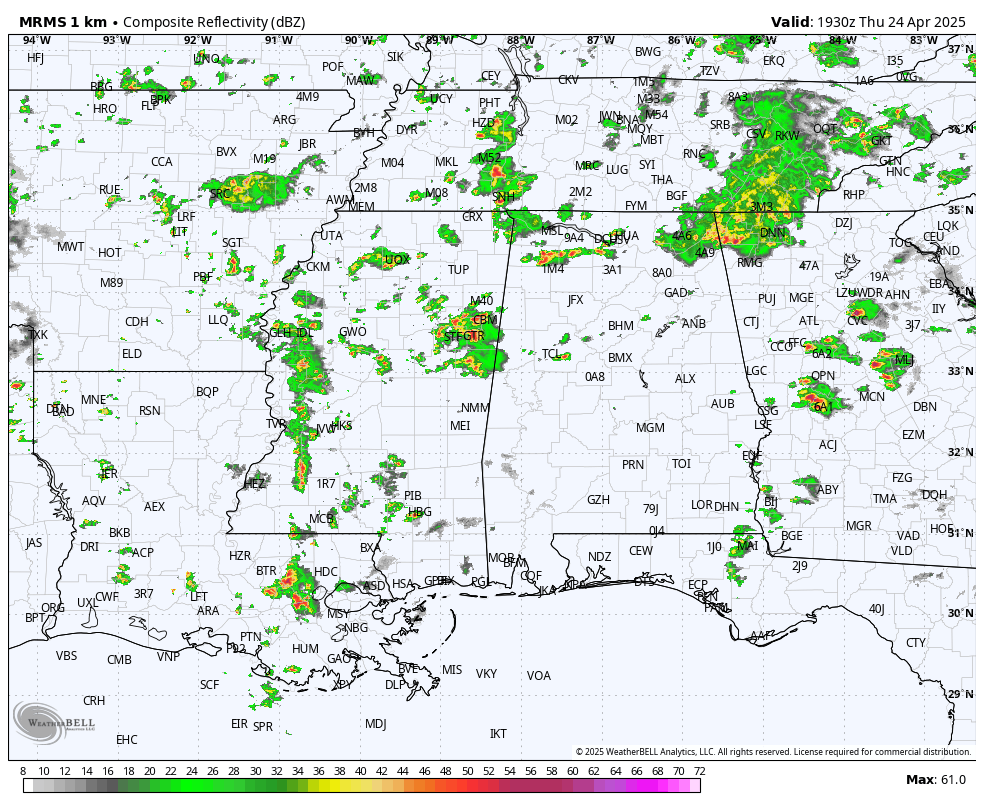
FRIDAY AND THE WEEKEND: A weak disturbance will bring scattered showers and storms to Alabama Friday, mainly over the northern half of the state and mostly during the afternoon and evening. Most communities will see a high in the low 80s with a mix of sun and clouds.
Over the weekend the air aloft will be a little warmer, meaning a slightly more stable air mass. Accordingly, we should see fewer scattered showers and storms. Most of south Alabama will stay dry; for the northern half of the state, the risk of any one spot seeing rain over the weekend is 20-30%. Most of the scattered showers will come during the afternoons and evenings; highs will be between 80 and 85 degrees.
NEXT WEEK: We won’t see much change through the first half of the week, with only isolated showers and highs in the 80s. An approaching upper trough has potential to bring higher rain chances late Thursday and Friday.
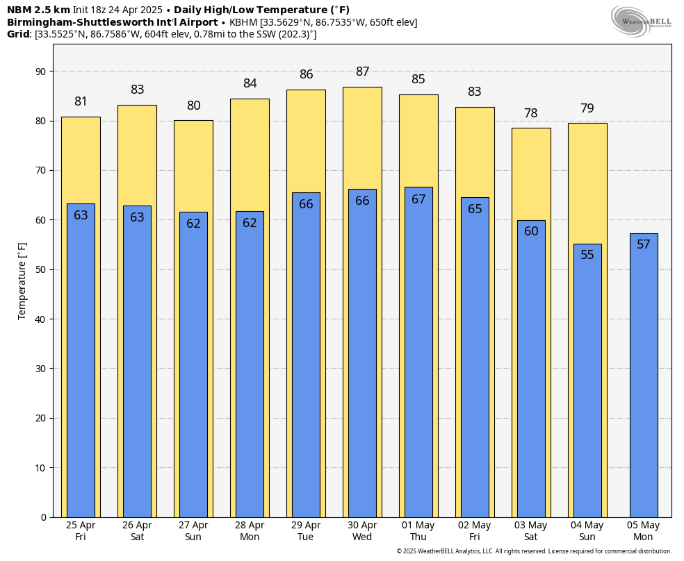
RACE WEEKEND: The weather looks generally favorable for race weekend at Talladega: highs in the low 80s, lows in the 60s and just a few widely scattered showers during the afternoons and evenings. There’s no risk of severe storms.
ON THIS DATE IN 1908: A long-track tornado, estimated at F4 strength, moved from near Dora in Walker County to near Sylvania in DeKalb County around 4:10 p.m. This tornado may have been associated with a family of tornadoes or was a single path. The estimated single-tornado damage path would be at least 100 miles long. Thirty-five people were killed along the path; the hardest-hit communities were Dora, Warrior and Albertville. A nine-ton oil tank was reportedly carried around one-half mile near Albertville.
ON THIS DATE IN 2010: Nine tornadoes touched down across Alabama, including an EF-3 that tore through Parrish and Cordova in Walker County. Along the path, 70-80 homes and other buildings were damaged, including one home that was destroyed. Between 800 and 1,000 trees were snapped or uprooted. One year later, on April 27, 2011, two more tornadoes would move through Cordova, including an EF-4.
Another EF-3 tore through Albertville in Marshall County.
This was part of a regional severe thunderstorm outbreak that produced 142 tornadoes. A long-lived twister left a trail of destruction extending more than 149 miles from Louisiana through Mississippi, resulting in 10 deaths and 75 injuries. This EF4 storm, which grew to a width of 1.75 miles, sported the fourth-longest track in Mississippi history. The storm destroyed part of Yazoo City.
For more weather news and information from James Spann and his team, visit AlabamaWx.


