Brian Peters: Gorgeous weekend weather for Alabama
THE ALABAMA WEEKEND: A clear sky covers all of the Southeast this morning with sunrise temperatures generally around the 50-degree mark. A cold front is poised to move into and across central Alabama later today, but thanks to a very dry atmosphere, there will be no showers or storms accompanying the front, just a few clouds. Highs today should reach the middle and upper 70s across the northern half of Alabama.
The upper flow tonight and Sunday will become northwesterly, so look for a chilly morning Sunday, with lows in the 40s. It is possible that some of the normally colder, sheltered locations may dip into the upper 30s, but I do not expect to see frost. The latest spring freezing temperature recorded at the Birmingham Shuttlesworth International Airport occurred on April 26, 1986.
RACE WEEKEND: The weather could not get much better this weekend for the races at Talladega. The weekend forecast is for sunshine with highs in the middle 70s today and near 70 on Sunday for the Geico 500.
ELSEWHERE: Looking to the other side of the world, Tropical Cyclone 21 is roaming south of the equator in the Indian Ocean. It is forecast to become a hurricane by Sunday before gradually weakening after Tuesday.
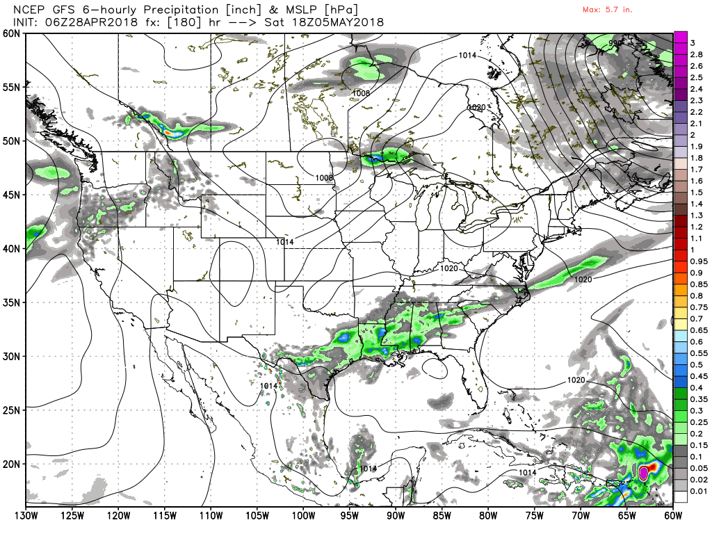
THE WEEK AHEAD: By Monday, an upper ridge becomes established over the eastern half of the country, and it basically stays put until Friday. At the surface, a large high-pressure system will move across the Southeast through the week. This will essentially keep us warm and dry for the work week ahead, with highs reaching the lower half of the 80s through Friday. The QPF graphic below shows the absence of rain for the next five days.

Friday into Saturday, a strong upper trough will slide across Canada, dampening the ridge over the eastern portion of the country. At the surface, a cold front will be dragged into the Southeast Friday afternoon, but thanks to the front becoming parallel to the upper flow, it is likely to stall out across the area on Saturday, bringing a chance for showers into the forecast that will probably remain with us into Sunday.
 LONG TERM: Looking into voodoo country, the Global Forecast System has a rather interesting upper air pattern that will spell a good deal of wet weather for the Southeast if it verifies. An upper trough moves into the Oklahoma Panhandle around May 7 and closes off as a closed low over northeast Texas by May 9. It becomes detached from the westerlies and slowly moves eastward into east Tennessee by May 13. So we could be looking at an extended period of unsettled weather for Alabama.
BEACH FORECAST: Click here to see the AlabamaWx Beach Forecast Center page.
WEATHERBRAINS: You can listen to our weekly 90-minute netcast any time on the web, or on iTunes. This is the show all about weather featuring many familiar voices, including meteorologists at ABC 33/40.

Enjoy this beautiful weekend and Godspeed.
For more weather news and information from Brian Peters, James Spann and other members of the James Spann team, visit AlabamaWx.


