James Spann: Mix of sun, storms will continue for Alabama
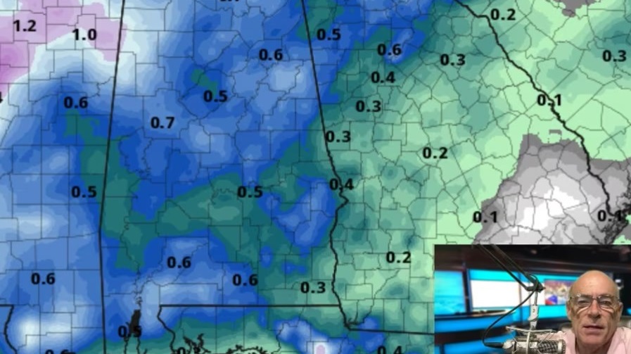
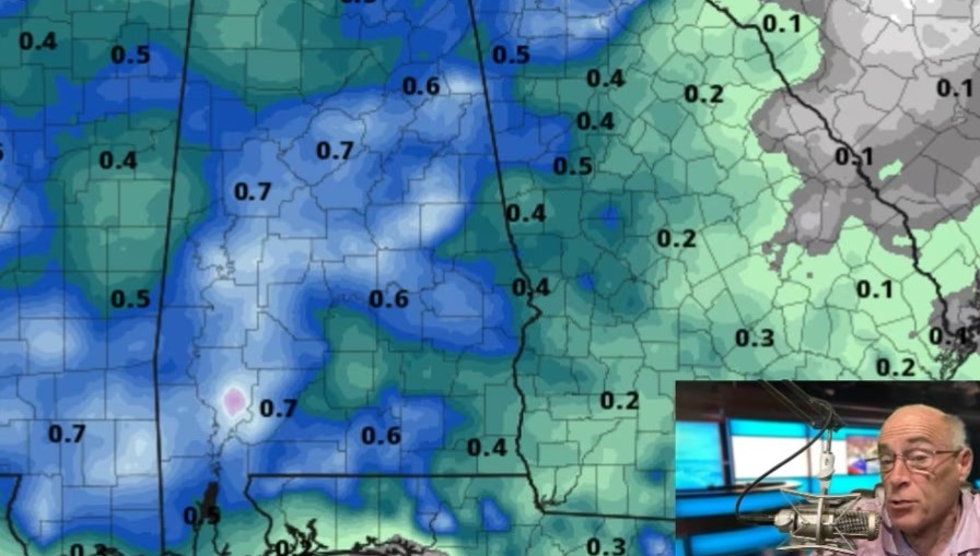
RADAR CHECK: Like recent days, we have your classic case of random, scattered showers and thunderstorms across Alabama this afternoon. Heavier storms are producing frequent lightning, gusty winds and small hail. They are moving very little and some neighborhoods are getting drenched, but other places are bone dry. So it goes on summer days in Alabama. Storms will settle down after sunset.
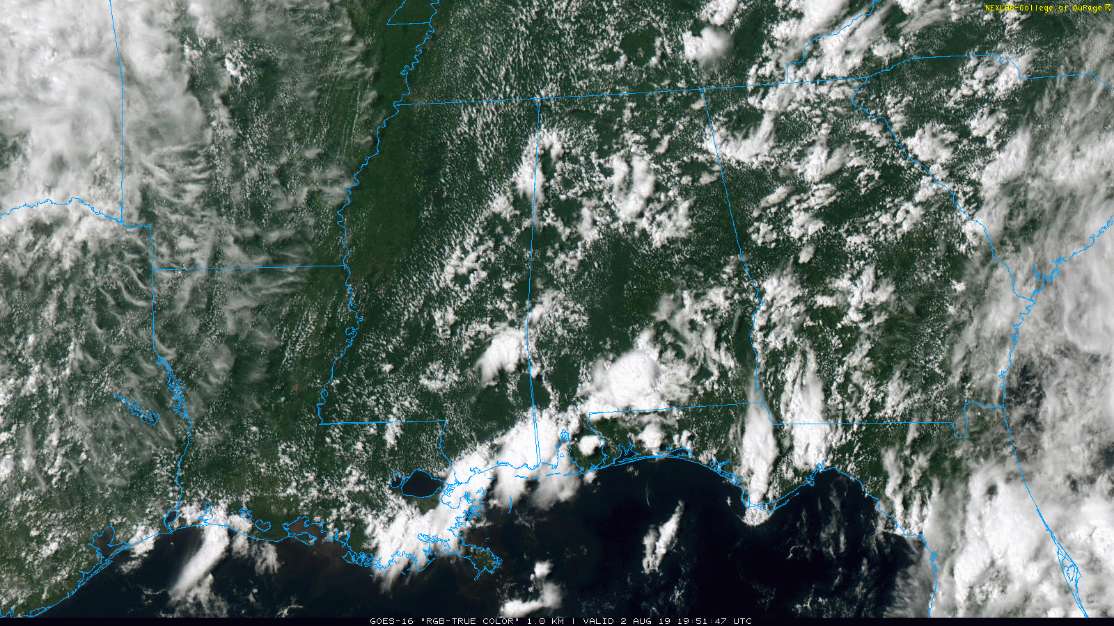
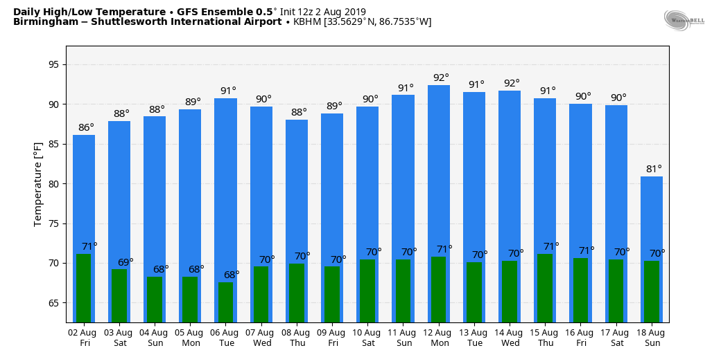
THE ALABAMA WEEKEND: Unstable air will remain in place across Alabama, meaning the weather won’t change much Saturday and Sunday. Look for a mix of sun and clouds both days with scattered to numerous showers and thunderstorms, mostly between noon and 8 p.m. The chance of any one spot getting wet both days is 60% to 70%. But that doesn’t mean a washout, and not everyone will see rain. Afternoon highs will remain in the 86- to 89-degree range, which is below average for early August, typically the hottest part of summer in Alabama.
NEXT WEEK: Don’t expect much change Monday, but global models continue to suggest showers and storms will become fewer in number Tuesday and Wednesday as the air will be a little drier by then. But they will probably increase again by Thursday and Friday. Highs will be in the 88- to 92-degree range for much of the week.
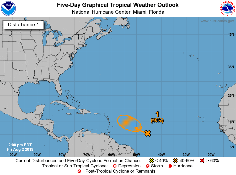
TROPICS: Odds continue to drop concerning potential development of Invest 96L in the Atlantic. The wave could briefly become a tropical depression over the weekend, but strong upper-air winds early next week should prevent it from becoming any stronger. If anything does form in that region, most likely it will recurve and not affect the U.S. There are no systems anywhere near the Gulf of Mexico.
LONG TIME SINCE TRIPLE DIGITS: The last time Birmingham reached 100 degrees was June 26, 2016, a total of 1,132 consecutive days below 100 degrees. There’s no sign of any excessive heat for the next 15 days (upper 90s or higher).
ON THIS DATE IN 1985: Delta Air Lines Flight 191, which originated at Fort Lauderdale, Florida, encountered a microburst while on approach to land at Dallas/Fort Worth. The aircraft struck the ground more than a mile short of the runway, struck a car near the airport and then collided with two water tanks and disintegrated. The crash killed 137 people and injured 28 others. The National Transportation Safety Board determined that the crash resulted from the flight crew’s decision to fly through a thunderstorm, the lack of procedures or training to avoid or escape microbursts, and the lack of hazard information on wind shear.
BEACH FORECAST CENTER: Get the latest weather and rip current forecasts for the beaches from Fort Morgan to Panama City on our Beach Forecast Center page.
WEATHERBRAINS: You can listen to our weekly 90-minute netcast any time on the web at WeatherBrains.com or on iTunes, Stitcher or Spotify. This is the show all about weather featuring many familiar voices, including the meteorologists at ABC 33/40.
CONNECT: You can find me on all of the major social networks:
Facebook
Twitter
Instagram
Pinterest
Snapchat: spannwx
For more weather news and information from James Spann and his team, visit AlabamaWx.