James Spann: Marco brings rain to south Alabama this morning
James Spann forecasts main impact of tropical storms west of Alabama from Alabama NewsCenter on Vimeo.
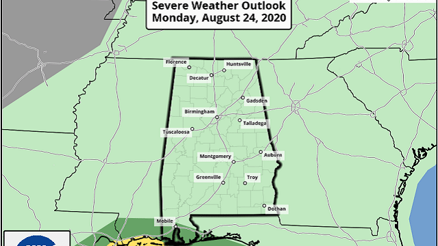
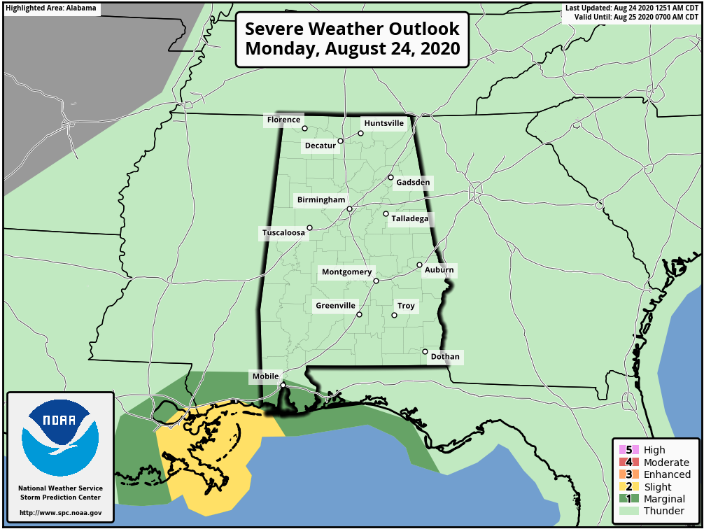
RADAR CHECK: Rain is fairly widespread this morning south of a line from Mobile to Montgomery to Roanoke as deeper moisture from Tropical Storm Marco in the Gulf of Mexico has moved into the southern half of Alabama. Showers are possible statewide today; the heaviest rain will come over southwest Alabama, where a flash flood watch is in effect for the southern half of Mobile and Baldwin counties. There is also a marginal risk (level 1 out of 5) of severe storms for that same area, as there is a low-end chance of a waterspout or a brief tornado with Marco passing just to the west.
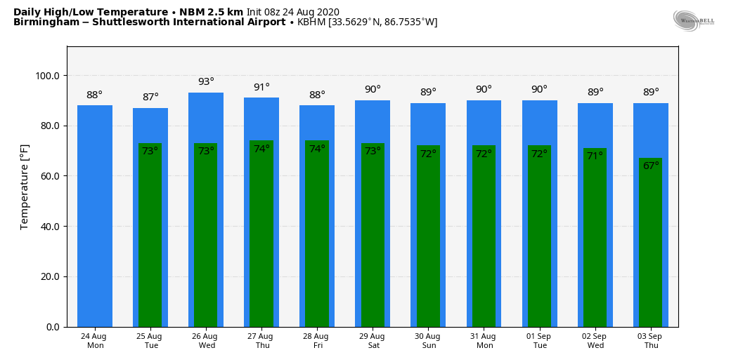
There’s no risk of flooding or tornadoes for the rest of Alabama today, and the high this afternoon will be in the low to mid 80s; the average high for Birmingham on Aug. 24 is 90.
REST OF THE WEEK: Widely scattered showers and thunderstorms are possible Tuesday and Wednesday with a mix of sun and clouds each day. Sinking air on the far periphery of Laura, which should be a hurricane in the Gulf Tuesday, could keep a decent part of the state dry Wednesday. Deeper moisture will be pulled into the state Thursday and Friday as Laura passes well to the west, but the heaviest rain and main direct impact, most likely, will remain west of our state. We will gradually increase the chance of rain Thursday and Friday as precipitable water values rise, but neither day will be a washout. Any tornado threat from Laura will most likely remain west of Alabama based on the current forecast track.
THE ALABAMA WEEKEND: We expect partly sunny days over the weekend with the usual chance of random, scattered, mostly afternoon and evening showers and thunderstorms. The high both days will be between 87 and 90 degrees, very close to seasonal averages for the end of August.
NEXT WEEK: We will keep the persistence forecast going — partly sunny days, fair nights and a few pop-up afternoon and evening showers and storms on most days. Highs will be generally in the upper 80s.
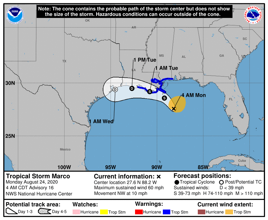
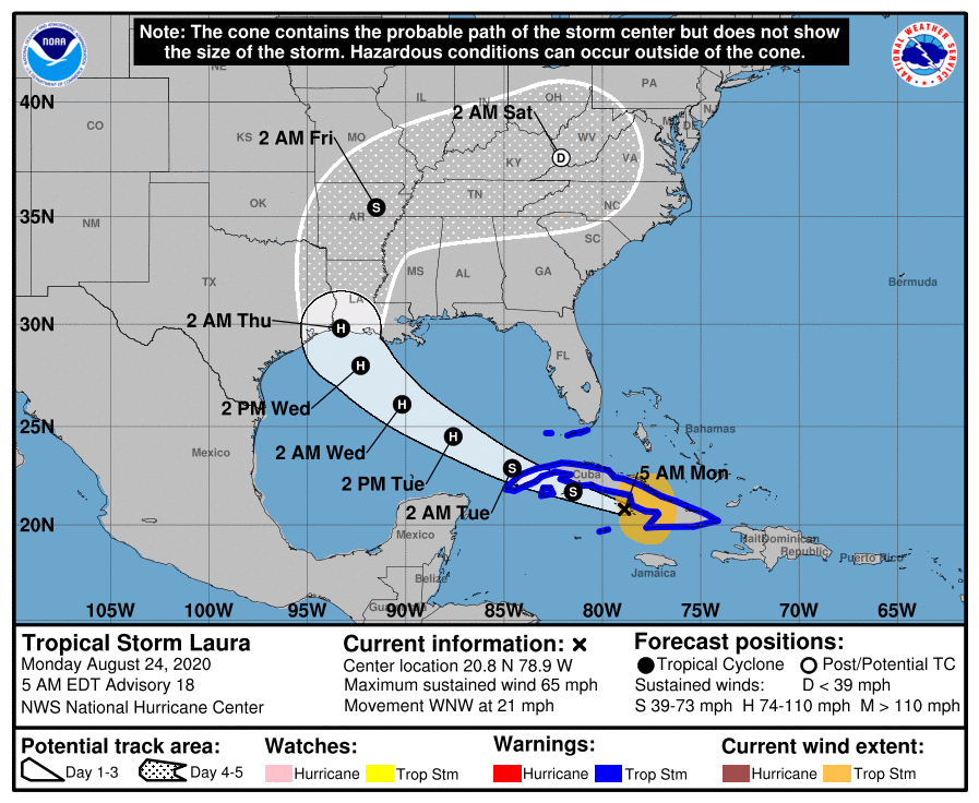
TROPICS: Marco and Laura, our tropical twins, are both tropical storms this morning. Marco is in the Gulf of Mexico; Laura is over Cuba.
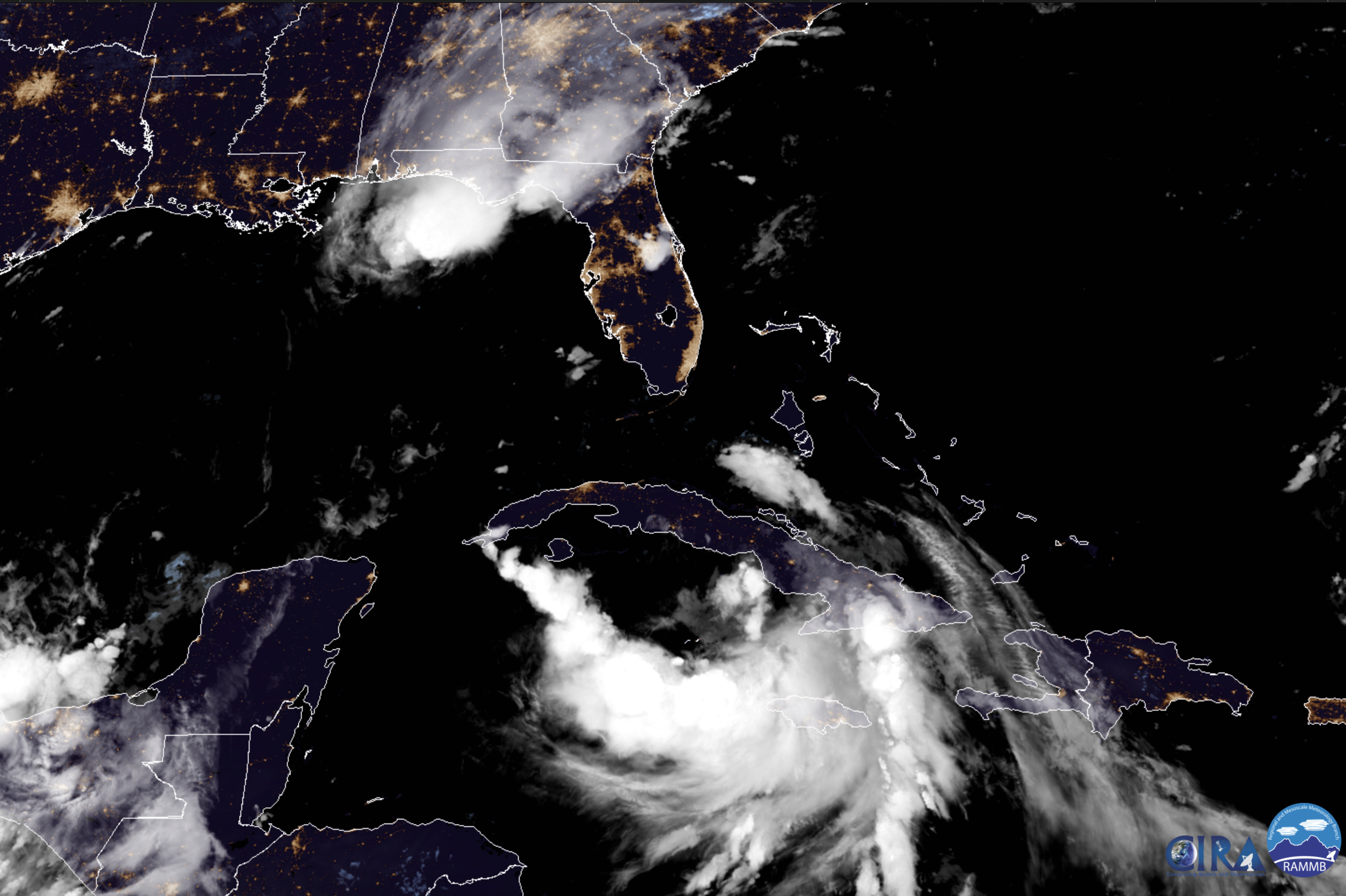
MARCO: Tropical Storm Marco has been highly sheared in the Gulf overnight, and winds have decreased to 60 mph. It will turn westward, and move along the Louisiana coast later today and tonight. The system will dissipate near the upper Texas coast Tuesday night. The main impact will be rain and flooding potential, but a few isolated waterspouts or brief tornadoes are possible.
LAURA: Laura features sustained winds of 65 mph and is on the southern coast of Cuba this morning. It is expected to strengthen into a hurricane once it gets into the open waters of the Gulf of Mexico; the National Hurricane Center is forecasting landfall near the Sabine Pass (the Texas/Louisiana border) Wednesday night at Category 2 strength. Confidence is fairly high this morning with good model agreement.
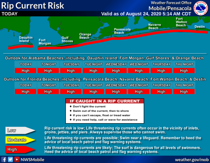
CENTRAL GULF COAST: The main impact for the central Gulf Coast from these systems is rip current danger (Gulf Shores to Panama City Beach) through Thursday. Expect red or double red flags. The surf should settle down by Friday.
The main threat of flooding and high-gradient wind will be far to the west.
ON THIS DATE IN 1992: Hurricane Andrew made landfall in southern Florida at 4:30 a.m. The high winds caused catastrophic damage in Florida, with the Miami-Dade County cities of Florida City, Homestead and Cutler Ridge receiving the brunt of the storm. About 63,000 homes were destroyed, and more than 101,000 others were damaged. This storm left roughly 175,000 people homeless. As many as 1.4 million people were left without electricity at the height of the storm. In the Everglades, 70,000 acres of trees were knocked down. Additionally, rainfall in Florida was substantial, peaking at 13.98 in in western Miami-Dade County. About $25 billion in damage and 44 fatalities were reported in Florida.
Andrew is one of only four hurricanes to be at Category 5 strength at the time of landfall in the U.S. The others are the Labor Day hurricane of 1935, Camille in 1969 and Michael in 2018.
BEACH FORECAST: Click here to see the AlabamaWx Beach Forecast Center page.
WEATHER BRAINS: You can listen to our weekly 90-minute show anytime on your favorite podcast app. This is the show all about weather featuring many familiar voices, including the meteorologists at ABC 33/40.
CONNECT: You can find me on the major social networks:
Facebook
Twitter
Instagram
Pinterest
Snapchat: spannwx
For more weather news and information from James Spann and his team, visit AlabamaWx.


