James Spann: Warm, humid day ahead for Alabama
James Spann forecasts a quiet, mostly dry weather week for Alabama from Alabama NewsCenter on Vimeo.
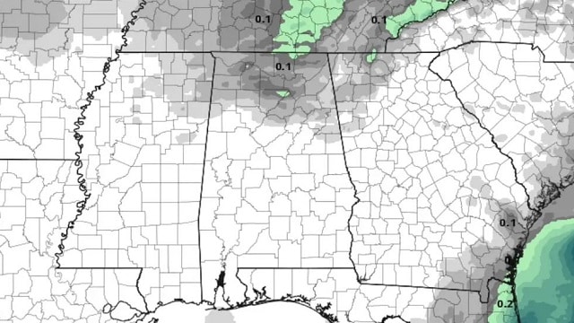
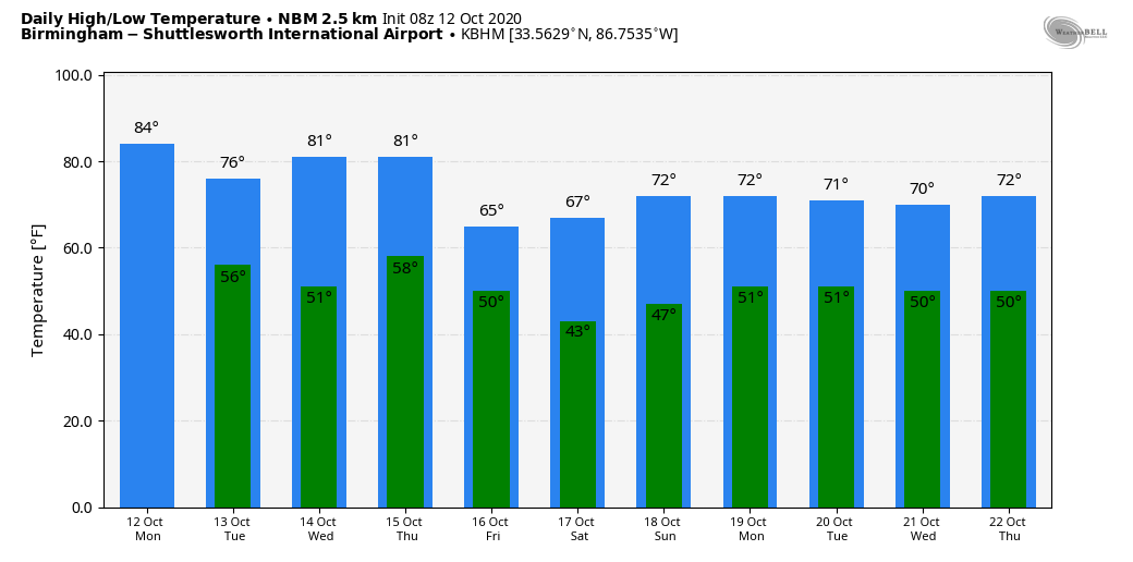
WARM AND HUMID: Morning clouds will give way to a partly sunny afternoon across Alabama today, and we project a high in the low to mid 80s for most communities. The average high for Birmingham on Oct. 12 is 76. A cold front will pass through the state tonight; it will have potential to bring a few isolated showers to the northern third of the state, but most places will be dry due to very shallow moisture.
Tuesday will be sunny, less humid and cooler, with a high in the mid 70s. The weather will stay dry through Thursday with sunny, warm days and clear, pleasant nights. Another cold front passes through Thursday night in dry fashion.
FRIDAY AND THE WEEKEND: Much cooler air arrives Friday; the day will be sunny with a high in the mid 60s along with a cool north breeze. Saturday morning will most likely be the coldest morning so far this season, with lows between 35 and 42 degrees. Many of the colder valleys and protected areas will have frost. Then, Saturday will be a glorious fall day, with ample sunshine and highs between 65 and 70 degrees. Sunday will be sunny with a high close to 70.
NEXT WEEK: The dry weather pattern continues. A new surge of cooler, drier air arrives Monday, and for now the week looks rain-free with pleasant days and cool nights.
TROPICS: The National Hurricane Center is monitoring a tropical wave about 900 miles east of the Windward Islands. It has shown signs of organization during the past few hours. Some slight additional development is possible during the next day or so while the disturbance moves generally westward near 15 mph. Strong upper-level winds are expected to limit further development by midweek. The rest of the Atlantic basin is quiet.
DELTA RAIN TOTALS: Here are some storm totals from the ABC 33/40 Skywatchers (Friday through Sunday):
- Dunnavant (Shelby County) — 5.07 inches
- Grayson Valley — 4.04
- Margaret — 3.4
- Remlap — 3.2
- Mount Olive — 3.05
- Black Creek — 2.85
- West Blocton — 2.72
- Hueytown — 2.6
- Arley — 2.58
- Jacksonville — 1.91
- Weaver — 1.83
- Coker — 1.46
ON THIS DATE IN 1979: The lowest barometric pressure ever recorded occurred in the center of Typhoon Tip. A fly reconnaissance mission recorded the low pressure of 870 millibars. Tip was the largest tropical cyclone on record, with a wind diameter of 1,380 miles.
BEACH FORECAST: Click here to see the AlabamaWx Beach Forecast Center page.
WEATHER BRAINS: You can listen to our weekly 90-minute show anytime on your favorite podcast app. This is the show all about weather featuring many familiar voices, including the meteorologists at ABC 33/40.
CONNECT: You can find me on the major social networks:
Facebook
Twitter
Instagram
Pinterest
Snapchat: spannwx
For more weather news and information from James Spann and his team, visit AlabamaWx.


