James Spann: Slow warming trend ahead for Alabama; strong storms just before Thanksgiving
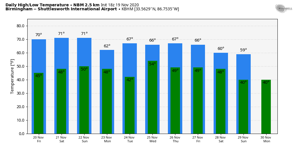
ANOTHER FINE FALL DAY: With sunshine in full supply, temperatures are in the 60s across the northern half of Alabama today, with low 70s to the south. Tonight will be clear and not as cold as recent nights, with lows generally in the 40s.
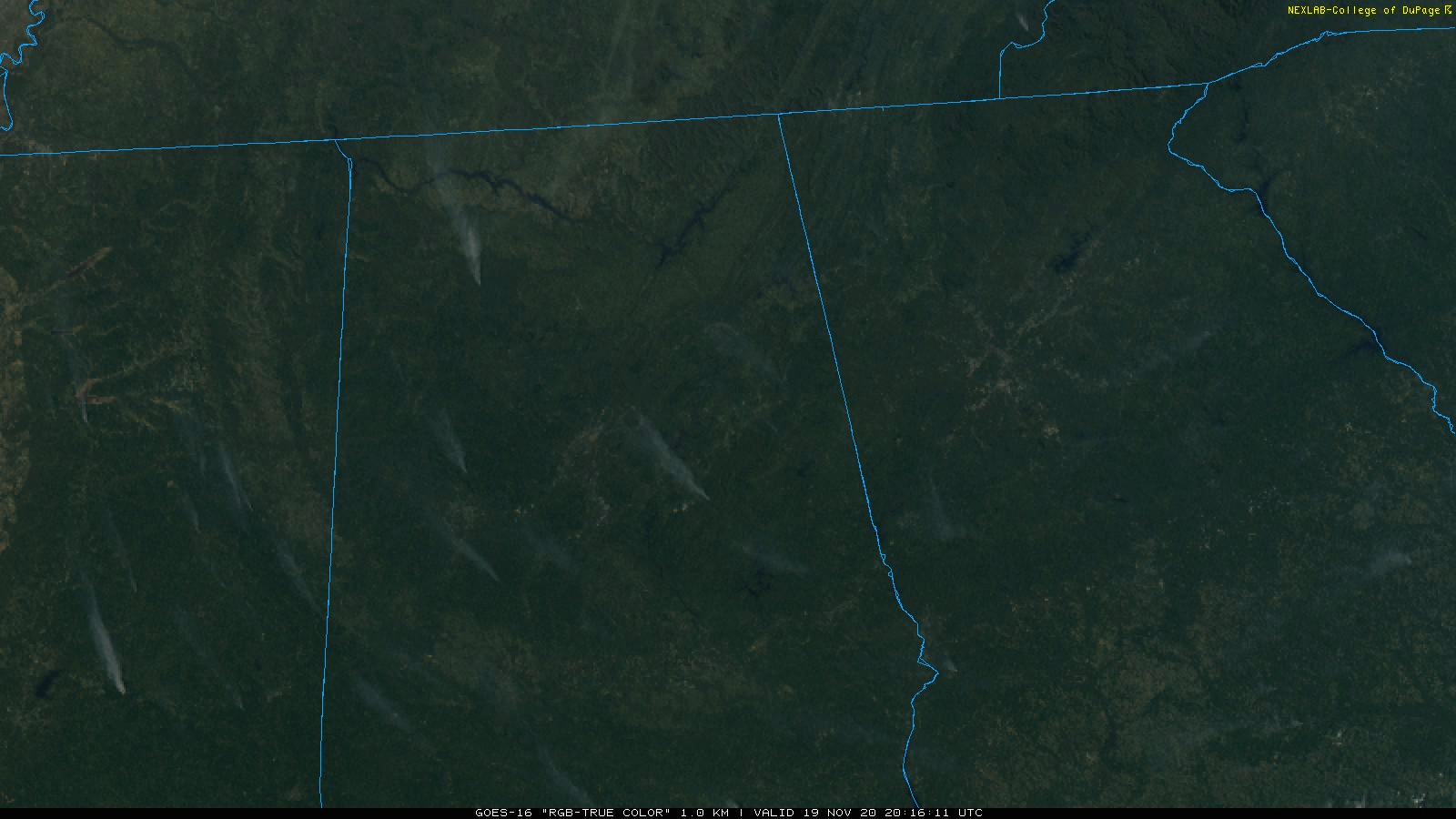
We note a number of smoke plumes over Alabama this afternoon on visible satellite imagery; I imagine most of those are prescribed burns.
Sunny weather continues Friday with a high close to 70 degrees.
THE ALABAMA WEEKEND: Saturday will be mostly sunny with a high in the low 70s, and for now Sunday looks dry during the day despite a slow increase in moisture with a partly sunny sky. Sunday’s high will be between 72 and 75 degrees. A cold front could trigger a few isolated showers over the northern quarter of the state Sunday night, but amounts should be light and spotty.
THANKSGIVING WEEK: Monday will be mostly sunny with a high in the 60s; Tuesday looks dry as well, with sunshine through scattered clouds and a high in the low 70s. A storm system will bring a batch of rain and thunderstorms to the state Wednesday. There are still model differences involving timing, but there is some chance strong storms could be involved. It’s too early to know whether there will be a severe weather risk; we will have much better clarity over the weekend.
Dry air returns in time for Thanksgiving Day and Friday, with lots of sunshine both days and highs in the 60s.
FOOTBALL WEATHER: For the high school playoff games Friday night, the sky will be clear with temperatures falling through the 50s.
Saturday, Alabama hosts Kentucky (3 p.m. kickoff at Bryant-Denny Stadium). The sky will be sunny with temperatures in the low 70s at kickoff, falling back into the 60s during the second half.
Auburn hosts Tennessee Saturday (6 p.m. kickoff at Jordan-Hare Stadium). It will be a great night for football with a clear sky. Temperatures will fall from the low 60s at kickoff into the upper 50s by the final whistle.
TROPICS: A disturbance over the southwest Caribbean is moving into southern Central America with no development. Another broad area of low pressure is northeast of the Bahamas in the Atlantic; the National Hurricane Center gives it only a low chance of development as it moves northeast. The Gulf of Mexico remains quiet.
ON THIS DATE IN 1930: An estimated F4 tornado struck the town of Bethany, Oklahoma. Between 9:30 a.m. and 9:58 a.m., it moved north-northeast from 3 miles west of the Oklahoma City limits and hit the eastern part of Bethany. About 110 homes and 700 other buildings, a fourth of the town, were damaged or destroyed. Near the end of the damage path, 3.5 miles northeast of Wiley Post Airfield, the tornado hit the Camel Creek School. Buildings blew apart just as the students were falling to the floor and looking for shelter, and five students and a teacher were killed. A total of 23 people were killed and another 150 injured, 77 seriously.
BEACH FORECAST: Click here to see the AlabamaWx Beach Forecast Center page.
WEATHER BRAINS: You can listen to our weekly 90-minute show anytime on your favorite podcast app. This is the show all about weather featuring many familiar voices, including the meteorologists at ABC 33/40.
CONNECT: You can find me on the major social networks:
For more weather news and information from James Spann and his team, visit AlabamaWx.


