James Spann: Rain returns to Alabama tonight
James Spann forecasts a rainy night for Alabama from Alabama NewsCenter on Vimeo.
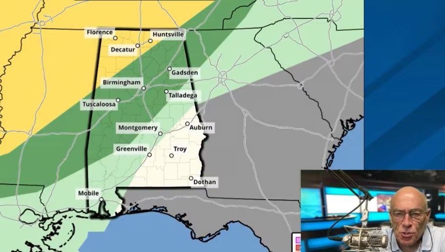
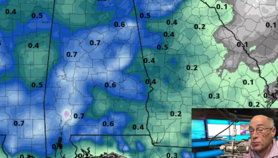
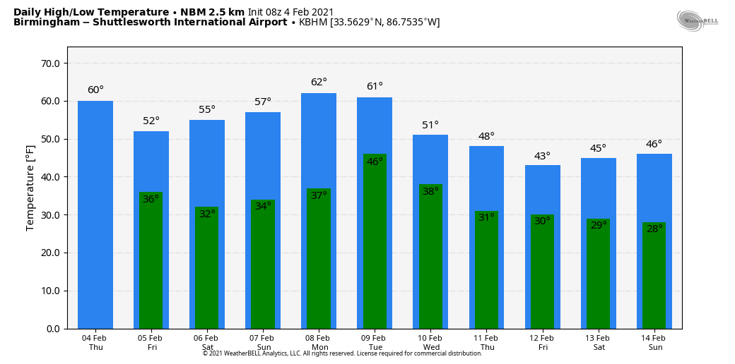
NICE WARM-UP TODAY: Temperatures are below freezing again this morning for much of Alabama, but look for a nice warm-up today, with many communities reaching the low 60s by afternoon. Clouds will increase ahead of a cold front, and rain is likely statewide tonight with no risk of severe storms and probably no thunder. Rain amounts will be one-half inch or less, and for the northern half of the state the best chance of rain comes from about 6 p.m. through 3 a.m.
The front will stall out Friday morning, and rain remains a possibility over the southern third of the state during the day. But for north and central Alabama, Friday will be dry with potential for a little sun at times. The day will be cooler, with a high in the low 50s.
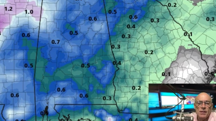
THE ALABAMA WEEKEND: A wave forms on the front and some rain is possible Saturday and Saturday night. During the day the best chance of rain will remain over the southern half of Alabama; then rain is likely statewide late in the day into Saturday night. Moisture will be limited and amounts should be one-half inch or less.
There is some chance a few snowflakes could mix in with the rain over far north Alabama after midnight Saturday night, but no impact is expected if that happens, with surface temperatures above freezing. On Sunday, the sky becomes partly sunny as drier air works into the state. Highs over the weekend will be in the mid to upper 50s.
NEXT WEEK: Monday will be dry and mild, with a high in the 60s. The next wave/cold front will bring a chance of some scattered light rain Tuesday and Tuesday night, followed by colder air Wednesday.
WINTER MISCHIEF? Global models are now showing signals for winter weather problems for Alabama at the end of next week, Thursday into Friday. Very cold air (but shallow) will creep into the state from the north, and the southern branch of the jet will push another wave into the region, pushing moist air from the Gulf over the shallow layer of cold air near the surface.
With this kind of scenario, the biggest problem is usually freezing rain instead of snow. Freezing rain is simply rain that falls in liquid form when surface temperatures are below 32 degrees. This in turn opens the door for ice accumulation on exposed objects. It is very important here to note that there is absolutely no skill in forecasting a winter storm seven to eight days in advance. This idea could totally go off the table in a few days; it is simply something to watch for now.
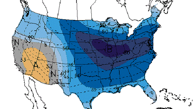
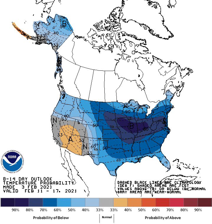
The Climate Prediction Center is forecasting below-average temperatures for the Deep South (and much of the nation) Feb. 11-17.
ON THIS DATE IN 1995: A massive nor’easter pounded areas from the southern Mid-Atlantic to northern New England. It would be the only significant storm in the 1994-95 winter season. More than 20 inches of snow buried parts of upstate New York. Wind chills dropped as cold as 40 degrees below zero. Behind the storm, Arctic air crossing the relatively warm waters of the Great Lakes produced intense lake effect squalls for nearly two weeks from Feb. 4 through Feb. 14. Snowfall totals for the storm ranged from near 2 to 7 feet. At one point during the storm east of Lake Ontario, snow was falling at the incredible rate of 5 inches an hour.
BEACH FORECAST: Click here to see the AlabamaWx Beach Forecast Center page.
WEATHER BRAINS: You can listen to our weekly 90-minute show anytime on your favorite podcast app. This is the show all about weather featuring many familiar voices, including the meteorologists at ABC 33/40.
CONNECT: You can find me on all of the major social networks:
For more weather news and information from James Spann and his team, visit AlabamaWx.