James Spann: Alabama heat levels slowly come down later this week
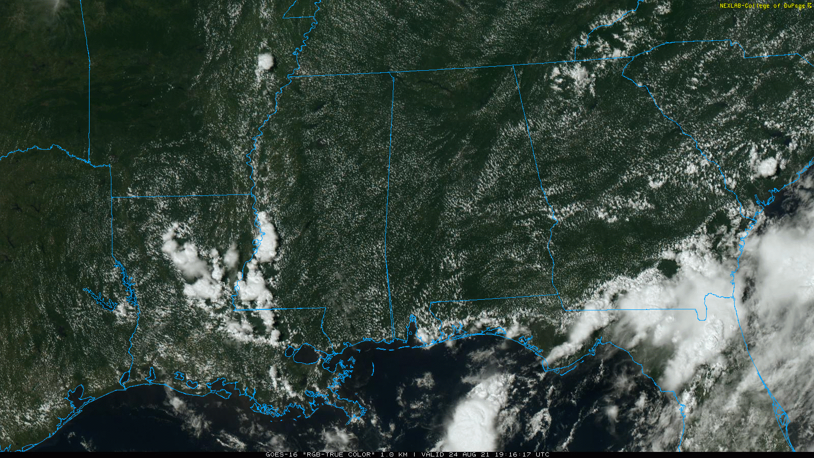
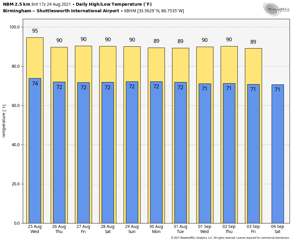
HOT SUMMER AFTERNOON: Temperatures across Alabama are mostly between 92 and 95 degrees this afternoon with a mostly sunny sky. There are a few isolated showers over Mobile and Baldwin counties; otherwise the state is rain-free. Tonight will be mostly fair with a low in the 70s.
REST OF THE WEEK: The weather won’t change too much Wednesday; afternoon showers or storms could form, but they should be few and far between. The sky will be partly to mostly sunny with a high between 91 and 94 degrees. Then, the upper ridge weakens Thursday and Friday, meaning an increase in the number of scattered showers and storms both days with lower heat levels. Highs on these two days will be in the upper 80s and low 90s with a mix of sun and clouds.
THE ALABAMA WEEKEND: Look for pretty routine weather for the end of August — partly sunny both days with scattered showers and thunderstorms, most active from noon to midnight. Highs will be between 87 and 91 degrees for most communities.
NEXT WEEK: For now we will continue to forecast typical weather for late August and early September. Highs will be mostly in the upper 80s, with partly sunny days and the daily round of scattered showers and thunderstorms, mostly during the afternoon and evening hours.
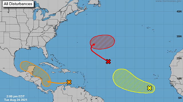
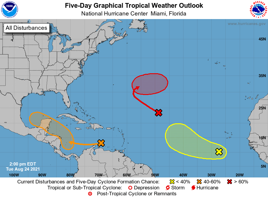
TROPICS: The National Hurricane Center is monitoring two waves in the Atlantic. The one halfway between the Lesser Antilles and the coast of Africa now has a high chance of becoming a tropical depression or storm over the next five days, but it will likely curve harmlessly into the open Atlantic and is no threat to land.
The wave in the eastern Atlantic south of the Cabo Verde Islands has a 30% chance of development over the next five days; if anything forms here it will likely not affect the U.S.
The one to watch is a wave in the southern Caribbean; there is a 60% chance that this becomes a depression or storm by the weekend. It will likely move across the Yucatan peninsula, then emerge into the Bay of Campeche in the far southwest Gulf of Mexico. Models shifted to the right this morning, suggesting a landfall potentially on the Texas or even the Louisiana coast in a week or so. It is too early to know the ultimate track or intensity at this point.
ON THIS DATE IN 1992: Hurricane Andrew made landfall in southern Florida at 4:30 a.m. Andrew is one of only four hurricanes to make landfall in the United States as a Category 5, alongside the 1935 Labor Day hurricane, 1969’s Camille and 2018’s Michael.
The high winds caused catastrophic damage in Florida, with the Miami-Dade County cities of Florida City, Homestead and Cutler Ridge receiving the brunt of the storm. About 63,000 homes were destroyed and more than 101,000 others were damaged. This storm left roughly 175,000 people homeless. As many as 1.4 million people were left without electricity at the height of the storm. In the Everglades, 70,000 acres of trees were knocked down. Rainfall in Florida was substantial, peaking at 13.98 inches in western Miami-Dade County. About $25 billion in damage and 44 fatalities were reported in Florida.
After moving across southern Florida, the hurricane emerged over the Gulf of Mexico at Category 4 strength, with the Gulf Coast of the United States in its dangerous path. After turning northwestward and weakening further, Andrew moved ashore near Morgan City, Louisiana, as a low-end Category 3 storm.
BEACH FORECAST: Click here to see the AlabamaWx Beach Forecast Center page.
WEATHER BRAINS: You can listen to our weekly 90-minute show any time on your favorite podcast app. This is the show all about weather featuring many familiar voices, including the meteorologists at ABC 33/40.
CONNECT: You can find me on the major social networks:
For more weather news and information from James Spann and his team, visit AlabamaWx.


