James Spann: Cooling trend ahead for Alabama, with frost by the weekend
James Spann forecasts calm weather for Alabama through the weekend from Alabama NewsCenter on Vimeo.
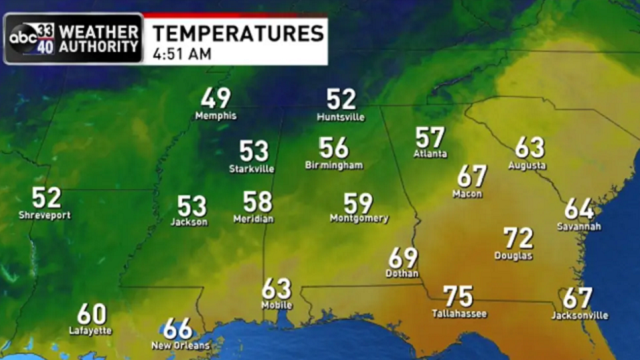
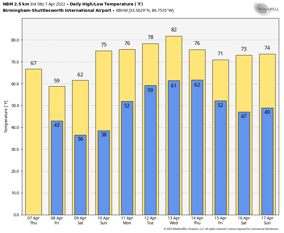
CALMER DAY: The cold front that brought showers and storms to Alabama Wednesday has moved out of the state, and today will be drier and cooler. With a partly to mostly sunny sky, we project a high between 65 and 70 degrees this afternoon. The average high for Birmingham on April 7 is 73.
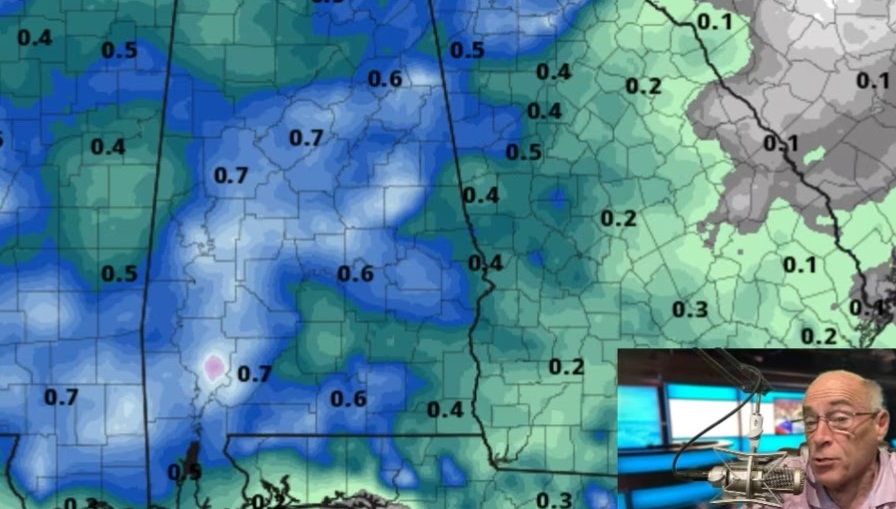
Friday will be windy and cooler, with cloudy periods and a chance of widely scattered showers over the northern third of the state. The high will be between 56 and 62 degrees, and a brisk west wind of 12-25 mph will make it feel cooler.
FROST/FREEZE THREAT OVER THE WEEKEND: Temperatures will drop well down in the 30s early Saturday and Sunday mornings, with potential for widespread frost over the northern third of the state. Colder pockets will see a freeze as they drop into the 26- to 32-degree range. Growers will need to monitor temperature forecasts and take needed precautions to protect plants and tender vegetation.
Otherwise, the weekend will feature a good supply of sunshine as dry air covers the state. The high will be around 60 degrees Saturday, followed by low to mid 70s Sunday as a warming trend begins.
NEXT WEEK: The main risk of severe storms for the first half of next week will be west of Alabama; the Storm Prediction Center has defined a severe weather risk for parts of Texas, Oklahoma, Kansas, Arkansas and Louisiana. Around here, moisture levels will rise and a few showers and storms are possible daily Monday through Wednesday. A cold front will bring a more organized band of rain and storms in here Thursday; it’s too early to know whether severe thunderstorms will be an issue.
RAIN UPDATE: Here are rain totals since the first of the year, and the departure from average:
- Huntsville — 23.88 inches (7.41 inches above average)
- Birmingham — 23.86 (7.16 above average)
- Tuscaloosa — 20.97 (4.81 above average)
- Muscle Shoals — 20.87 (5.23 above average)
- Anniston — 19.5 (3.26 above average)
- Montgomery — 17.59 (1.98 above average)
- Mobile — 13.31 (3.41 below average)
- Dothan — 13.29 (2.05 below average)
ON THIS DATE IN 1980: Severe thunderstorms spawned tornadoes that ripped through central Arkansas. The storms also produced high winds and baseball-sized hail. Five counties were declared disaster areas by President Jimmy Carter. A tornado causing F3 damage also affected St. Louis and St. Charles counties in Missouri, producing $2.5 million in damage.
BEACH FORECAST: Click here to see the AlabamaWx Beach Forecast Center page.
WEATHER BRAINS: You can listen to our weekly 90-minute show any time on your favorite podcast app. This is the show all about weather featuring many familiar voices, including the meteorologists at ABC 33/40.
CONNECT: You can find me on the major social networks:
For more weather news and information from James Spann and his team, visit AlabamaWx.