James Spann: Wet, unsettled weather for Alabama through Thursday
James Spann forecasts more rain for Alabama with some strong storm potential from Alabama NewsCenter on Vimeo.
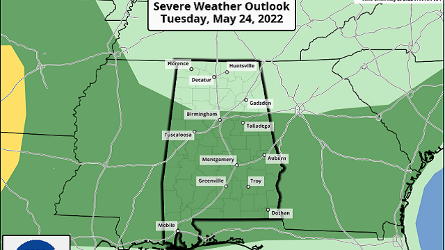
RADAR CHECK: A large mass of rain is moving northward through the western half of Alabama early this morning; otherwise it is a cloudy, humid morning with temperatures between 65 and 70 degrees. A very moist, tropical air mass continues to cover the Deep South today, and we expect occasional showers and thunderstorms with a high between 77 and 82 degrees. Stronger storms this afternoon could produce some hail and gusty winds; the Storm Prediction Center maintains a marginal risk (level 1 out of 5) of severe thunderstorms for the southern two-thirds of the state.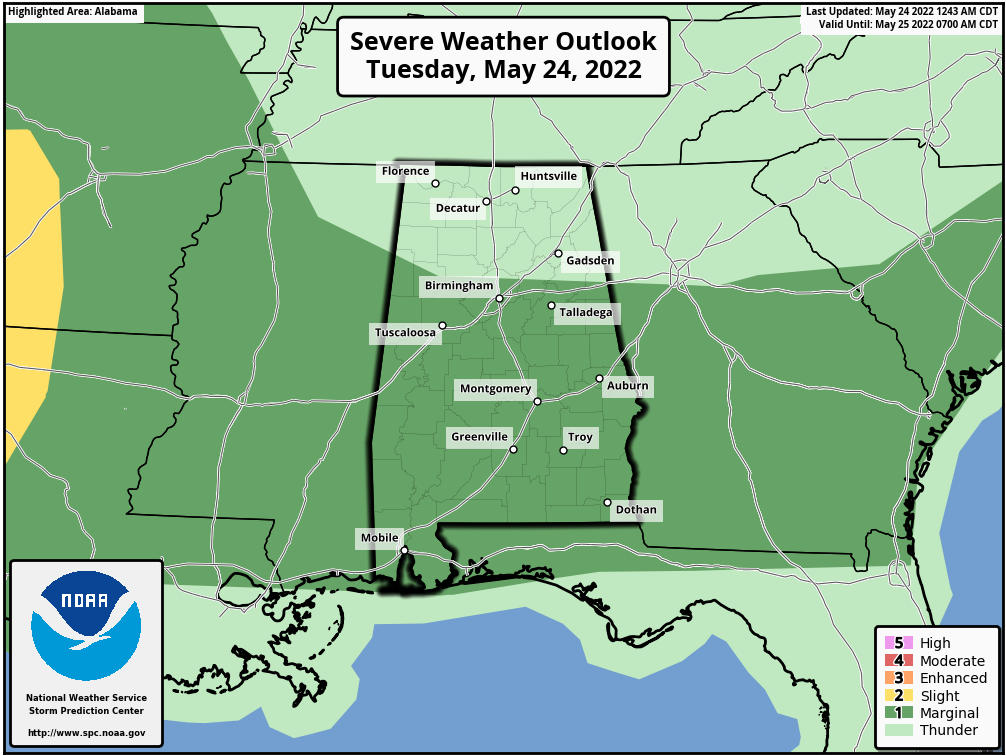 The unsettled pattern continues Wednesday and Thursday. Look for numerous showers and thunderstorms both days. There will be breaks in the rain, and the sun could pop out at times, but this will be a wet two-day period. The potential for hail and gusty winds will persist with heavier thunderstorms; the SPC has areas from Birmingham north and west in a marginal risk Wednesday and basically all of the state in a marginal risk Thursday. There will be some shear involved Thursday, so the chance of a tornado is not zero, but still very low.
On the positive side, more beneficial rain is likely, with additional amounts of 1-3 inches statewide. The rain will end at some point Thursday night.
FRIDAY AND THE HOLIDAY WEEKEND: A slot of dry air works into the state Friday; the sky becomes partly to mostly sunny with a high in the mid to upper 70s, almost 10 degrees below average for late May. The only risk of a shower Friday will be over the Tennessee Valley of far north Alabama, and even there most places will be dry.
The three-day weekend looks excellent, with mostly sunny, warm days and fair, pleasant nights. Highs will be in the 80s Saturday and Sunday, and close to 90 Monday. Lows will be in the 60s, but cooler spots will dip into the 50s early Saturday morning.
REST OF NEXT WEEK: An upper ridge will build across the Gulf Coast region, meaning mostly hot, dry weather with highs in the low 90s. However, a few spotty showers could show up late in the week.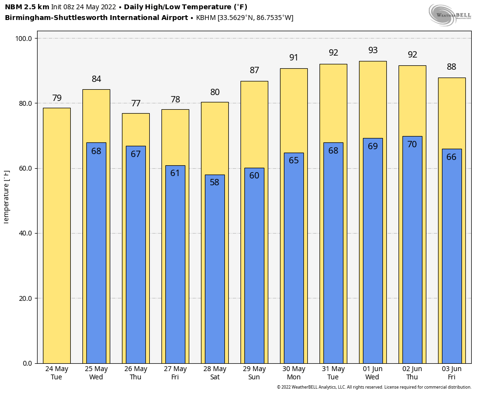 ON THIS DATE IN 1973: An F4 tornado tore through the small town of Union City, Oklahoma, killing two and injuring four others. This tornado was the first storm to be studied in detail by the National Severe Storms Laboratory Doppler Radar Unit at Norman, Oklahoma, and an armada of researchers in the field. Research of the radar data from the storm would lead to the discovery of a tornado vortex signature (TVS). The presence of a TVS on Doppler radar data is a very strong indication of tornadic potential in a severe thunderstorm.
BEACH FORECAST: Click here to see the AlabamaWx Beach Forecast Center page.
WEATHER BRAINS: You can listen to our weekly show all about weather any time on your favorite podcast app. James Spann and a team of meteorologists from around the nation bring on interesting guests; it’s a great podcast for weather geeks.
CONNECT: You can find me on the major social networks:
For more weather news and information from James Spann and his team, visit AlabamaWx.


