James Spann: Rain for Alabama at times today, with a few strong thunderstorms
James Spann forecasts an active weather day for Alabama from Alabama News Center on Vimeo.
RADAR CHECK: Rain is widespread over the northern third of Alabama early this morning. We also note strong to severe thunderstorms over parts of south Mississippi and Louisiana; those will be moving over the southern quarter of the state through the morning.
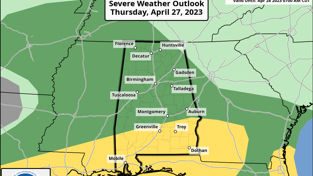
The Storm Prediction Center (SPC) maintains a slight risk (level 2 out of 5) of severe thunderstorms today south of a line from Grove Hill to Fort Deposit to Phenix City. A marginal risk (level 1) covers the rest of the state.
The core threat of strong to severe thunderstorms will come this morning into the early afternoon across the southern quarter of Alabama. The main threats will come from hail and strong winds, although an isolated tornado can’t be ruled out.
Additional scattered showers and storms will form late this afternoon and tonight over the northern half of the state, and those could be strong, with gusty winds and small hail. But the overall severe risk will be low, as the organized shear in the atmosphere will be east of here by then. Highs today will range from the upper 60s across the Tennessee Valley to the low 80s near the coast.
Any lingering showers will end early Friday, and the sky becomes partly sunny by afternoon as drier air returns. The high will be in the 70s.
THE ALABAMA WEEKEND: Another batch of showers and thunderstorms will move through south Alabama during the day Saturday; the SPC has defined a marginal risk (level 1) for areas south of a line from Linden to Prattville to Phenix City.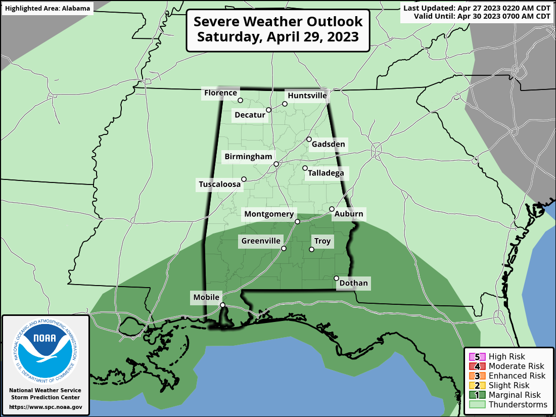 While the northern half of the state is expected to be dry, showers and storms are possible across south Alabama during the day Saturday, and stronger storms could produce hail and strong winds. Showers are possible statewide Saturday into Sunday morning, but a decent part of Sunday afternoon should be dry. The high will be close to 80 degrees Saturday, followed by low to mid 70s Sunday.
NEXT WEEK: For now, most of the week looks dry and mild, with highs generally in the 70s.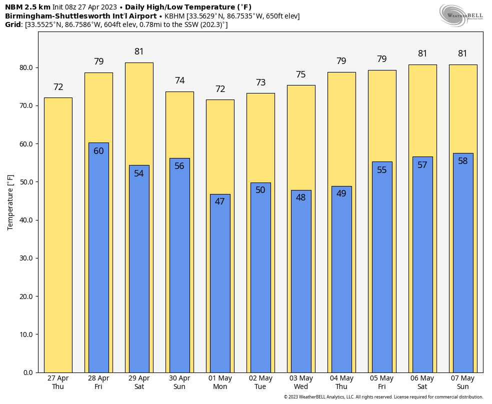 ON THIS DATE IN 2011: A generational severe weather outbreak in Alabama produced 62 tornadoes, killing 252 people. There were two distinct waves of widespread severe weather; the first wave of severe storms moved through during the early morning. This intense line of thunderstorms produced not only widespread damaging straight-line winds in the areas of Moody, Pell City and Riverside, but numerous strong tornadoes.
The second wave, which began with the Cullman EF-4 and Hackleburg/Phil Campbell EF-5 tornadoes, involved numerous supercell thunderstorms that produced deadly long-lived, strong to violent tornadoes. Widespread and catastrophic damage occurred in several locations. The deadliest tornado of the event was the one that moved through Tuscaloosa and the northern and western suburbs of Birmingham; it killed 65 people and injured more than 1,500.
For more weather news and information from James Spann and his team, visit AlabamaWx.


