James Spann: Severe storms possible across Alabama Wednesday
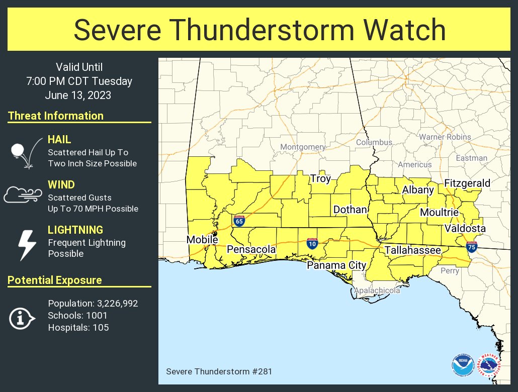
RADAR CHECK: Showers and storms persist across the southern half of Alabama this afternoon, and a severe thunderstorm watch is in effect until 7 p.m. for a number of south Alabama counties.
 Storms over south Alabama will weaken and fade after sunset.
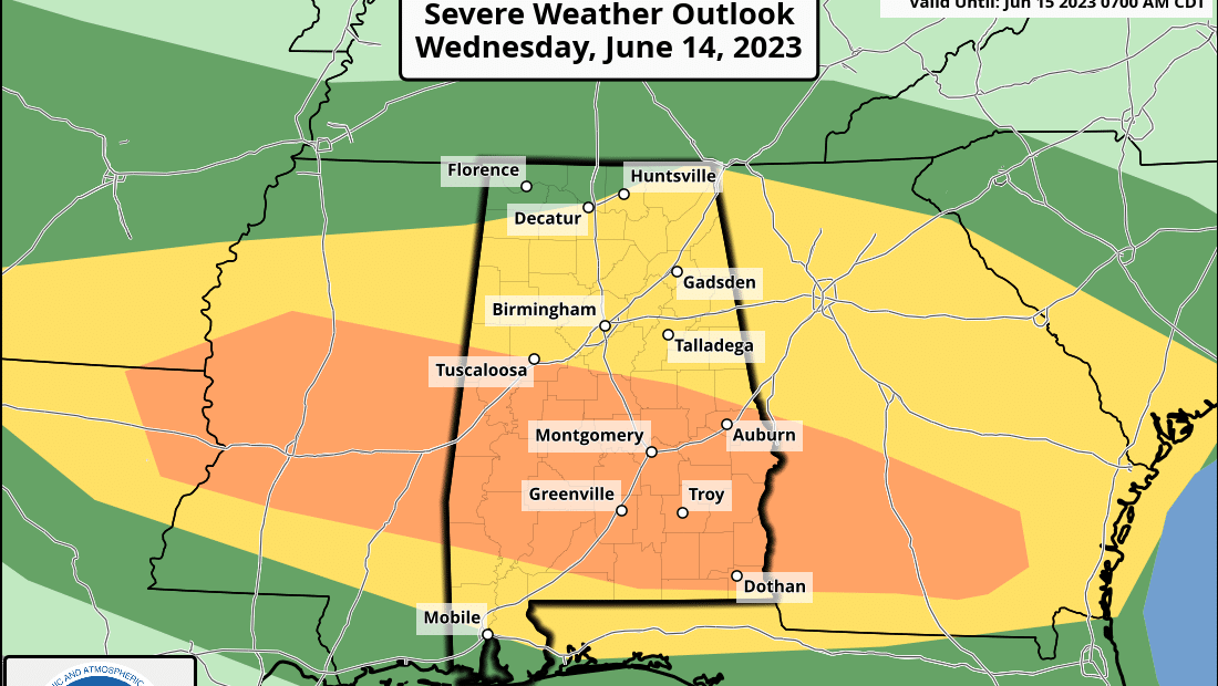
WEDNESDAY: The Storm Prediction Center (SPC) maintains an enhanced risk (level 3 out of 5) for parts of central and south Alabama, including cities like Eutaw, Greensboro, Brent, Demopolis, Selma, Montgomery, Greenville, Monroeville, Troy and Eufaula. Slight (level 2) and marginal (level 1) risks surround the enhanced risk area to cover the entire state.
Large hail and strong winds remain possible with the heavier thunderstorms Wednesday, and with unusually strong wind fields for June, an isolated tornado or two can’t be totally ruled out, mainly in the enhanced risk area. This is very unusual for Alabama since typically we don’t see any chance of tornadoes here with thunderstorms in June (and the rest of summer) due to weak winds aloft. The SPC also suggests some of the storms could produce hail to 2 inches in diameter.
Be sure and pay attention to severe weather warnings if they are needed Wednesday. Highs will remain in the 80s for most places.
THURSDAY THROUGH THE WEEKEND: Scattered to numerous showers and storms are likely Thursday, but showers should thin out greatly Friday. We bring back scattered showers and storms into the forecast Friday night and through the weekend. The weekend won’t be a washout, but from time to time expect a passing shower or thunderstorm. Highs will be between 85 and 91 degrees Saturday and Sunday for most communities, with some sun at times.
NEXT WEEK: A heat bubble will be focused to the west over Texas, and an upper low is forecast to be east of Alabama. This will bring some fairly typical summer weather to the state for much of the week, with partly sunny days and scattered, mostly afternoon and evening showers and thunderstorms. Highs will be close to 90 on most days.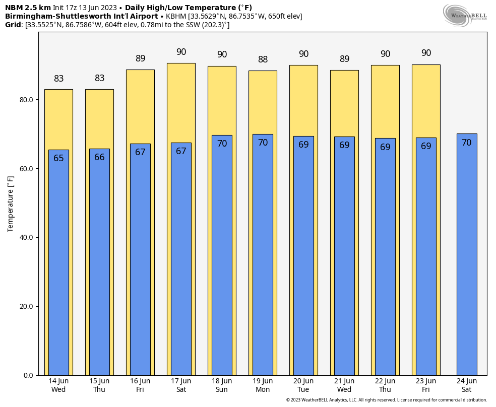 FLOODING? NOAA’s Weather Prediction Center is forecasting rain amounts of 3-5 inches for much of Alabama over the next seven days, and some flooding could develop with the heavier downpours.
TROPICS: All remains quiet across the vast Atlantic basin, and tropical storm formation is not expected through the weekend.
ON THIS DATE IN 1972: Severe weather conditions over the Yucatan peninsula in Mexico began to converge and form a tropical depression that would become Hurricane Agnes over the next two weeks. This hurricane affected most of the eastern United States, with the Northeast being the hardest-hit area with heavy rainfall.
ON THIS DATE IN 1976: A deadly tornado moved across parts of the southwestern Chicago suburbs, killing three people and injuring 23 others. The tornado, with winds over 200 mph, moved from Lemont to Downers Grove, causing $13 million in damage when 87 homes were destroyed and another 90 were damaged. The tornado passed over the Argonne National Laboratory, peeling part of the roof off a building housing a nuclear reactor.
For more weather news and information from James Spann and his team, visit AlabamaWx.


