James Spann: Summer storms rumbling over north Alabama this morning
James Spann forecasts more storms for Alabama today from Alabama News Center on Vimeo.
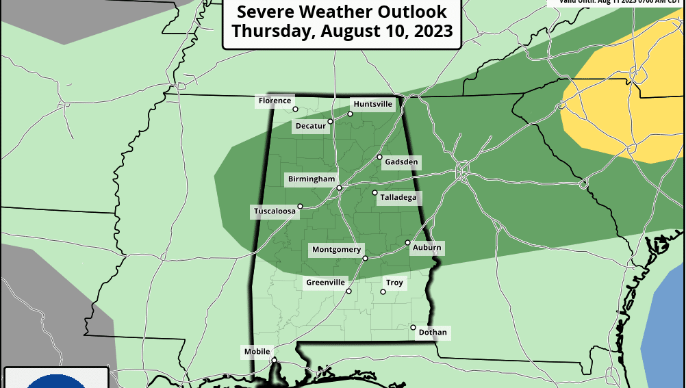
RADAR CHECK: At sunrise showers and thunderstorms are active over the northern half of the state. All are under severe limits, but they are producing heavy rain, gusty winds and lots of lightning. The Storm Prediction Center (SPC) has defined a marginal risk (level 1 out of 5) of severe thunderstorms for roughly the northern two-thirds of Alabama today.
The best chance of showers and storms for the northern half of the state will come this morning; scattered storms will develop into south Alabama this afternoon. It won’t rain everywhere, and it won’t rain all day, but where storms develop, they will be strong, with potential for small hail and gusty winds. The high today will be between 85 and 89 degrees for north Alabama, with mid 90s to the south.
FRIDAY AND THE WEEKEND: Scattered storms will develop again Friday, and the SPC has the southern two-thirds of the state in a marginal risk (level 1) due to the potential for gusty winds and small hail. Thunderstorms should be fewer with a partly sunny sky Saturday and Sunday. The weather will be hot and humid, with highs in the mid 90s.
NEXT WEEK: Thunderstorms are possible Monday ahead of a surface front, and we continue to see evidence of drier air pushing into the state temporarily on Tuesday and Wednesday. Scattered, mostly afternoon and evening showers and storms return Thursday and Friday; highs will be in the low 90s much of the week.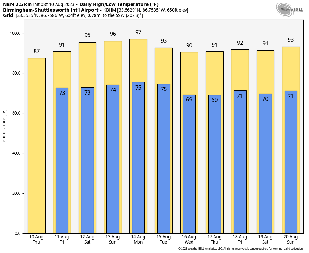 TROPICS: Another August day with very quiet conditions across the Atlantic basin; tropical storm formation is not expected through at least the next seven days.
ON THIS DATE IN 1856: A hurricane destroyed Isle Dernieres or Last Island, a pleasure resort south-southwest of New Orleans. The highest points of the island were under 5 feet of water. The resort hotel was destroyed, along with the island’s gambling establishments. More than 200 people perished, and the island lost all its vegetation and split in half. Only one cow remained on the island after the catastrophe. The Last Island is now just a haven for pelicans and other seabirds.
ON THIS DATE IN 1980: Hurricane Allen made landfall on South Padre Island near Port Isabel, Texas, as a Category 3 storm with maximum sustained winds of 115 mph. Earlier it was a Category 5 storm; Allen is the only hurricane in the recorded history of the Atlantic basin to achieve sustained winds of 190 mph, making it the strongest Atlantic hurricane by wind speed. Until Hurricane Patricia in 2015, these were also the highest sustained winds in the Western Hemisphere.
For more weather news and information from James Spann and his team, visit AlabamaWx.


