James Spann: Warming trend ahead for Alabama; rain, storms by the weekend
COOL DECEMBER DAY: Temperatures are in the 50s across most of Alabama this afternoon with sunshine through high, thin cirrus clouds. Tonight will be mostly fair with lows between 35 and 45 degrees. Colder spots across north Alabama could see a light freeze.
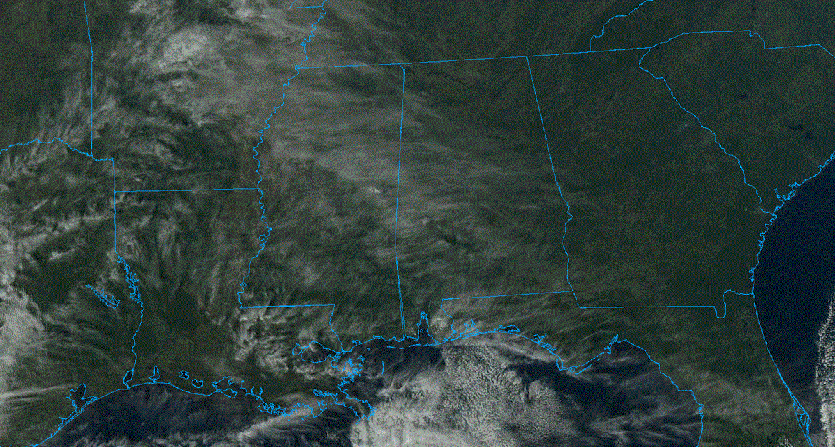
We will introduce the chance of a few showers near the Gulf Coast during the day Friday, and scattered showers are possible across all of Alabama Friday night as moisture begins to move northward. Otherwise, expect a mix of sun and clouds with a high in the 60s.
WET, STORMY WEEKEND: Showers are possible statewide during the day Saturday with the approach of a storm system, but it won’t rain all day. The day will be breezy with a high between 68 and 74 degrees, about 10 degrees above average for early December in Alabama.
An organized batch of rain and thunderstorms will arrive Saturday night into early Sunday morning. The Storm Prediction Center has introduced a marginal risk of severe thunderstorms for the western half of Alabama.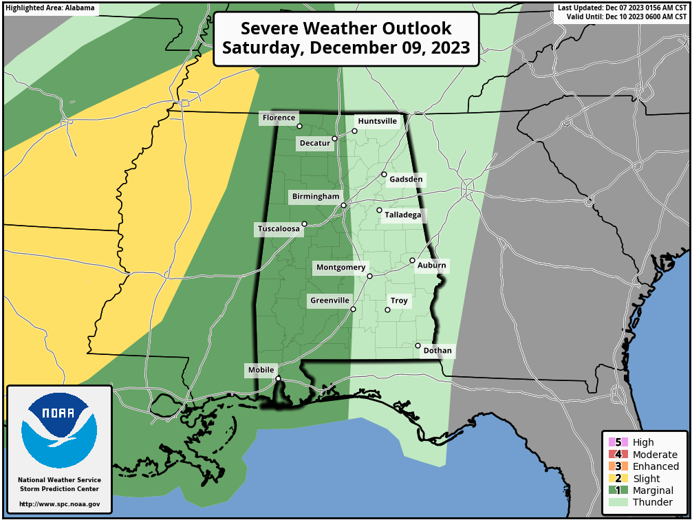 The storm system will feature a positive-tilt upper trough, limited surface-based instability and generally unidirectional wind profiles. This means a fairly low-end severe weather threat; heavier storms could produce gusty winds before dawn Sunday morning. A brief, isolated tornado can’t be ruled out but isn’t likely. The window for the heavier storms will come from about 9 Saturday night through 6 a.m. Sunday.
On the positive side, rain amounts of 1-2 inches are expected for most of Alabama. The rain will end from west to east during the day Sunday as colder air rolls into the state. Temperatures will hold in the 40s over north Alabama and the 50s for south Alabama. The sky will begin to clear by late afternoon.
NEXT WEEK: For now, the week looks cool and dry, with highs mostly in the 50s and lows in the 30s. Many north Alabama communities will experience a freeze Monday, Tuesday and Wednesday mornings.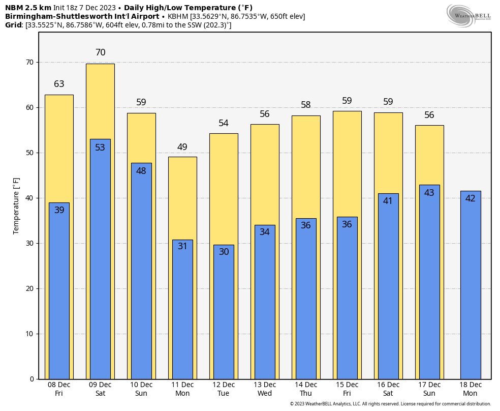
FOOTBALL WEATHER: For the Super 7 high school championship games in Tuscaloosa at Bryant-Denny Stadium, dry weather continues through Friday. Temperatures will fall into the 40s for the game tonight. The high Friday will be in the mid 60s with a partly sunny sky. We will mention the chance of a few isolated showers Friday night during the 6A game between Clay-Chalkville and Saraland, but nothing heavy or widespread. Temperatures will be in the 50s Friday night.
ON THIS DATE IN 2004: An F2 tornado moved through parts of Lowndes County, Mississippi, and Lamar County, Alabama. The most significant damage was at Steens, Mississippi, where several homes were destroyed.
ON THIS DATE IN 2006: A rare tornado tore through Kensal Rise in London. This T4 on the TORRO scale, equivalent to an F2 on the Fujita scale, injured six people and damaged 150 homes. According to the BBC, the last tornado that had caused significant damage in London was in December 1954, in west London.
For more weather news and information from James Spann and his team, visit AlabamaWx.


