James Spann: Colder air rolls into Alabama tonight
James Spann forecasts a dry, mostly cool week for Alabama from Alabama News Center on Vimeo.
DRY THIS WEEK: Today will be mostly sunny, breezy and cool across Alabama, with a high in the 50s. North winds will average 10-20 mph this afternoon as a surge of colder air rolls in. A freeze is likely over the northern two-thirds of the state Tuesday morning, with lows between 24 and 32 degrees. Wind-chill indices will dip into the upper teens in some places over north Alabama.
Tuesday will be sunny with temperatures below average; highs will be in the 40s over the northern half of the state, with low to mid 50s to the south. The weather will stay dry for the rest of the week. Freezing temperatures are likely over north and central Alabama again Wednesday and Thursday mornings. A warming trend begins later this week, and by Friday many places will see highs between 58 and 65 degrees.
CHRISTMAS WEEKEND: At this point Saturday looks dry with highs similar to those on Friday, but clouds will likely increase during the day ahead of a weather system to the west. We will bring in a chance of rain Sunday and Christmas Day, but it is just too early to be specific about timing, rain amounts, chance of thunder, etc., with considerable model differences. Highs will likely be in the upper 50s and low 60s both days, a little above average for late December in Alabama. For now, the chance of severe thunderstorms looks low with no surface-based instability.
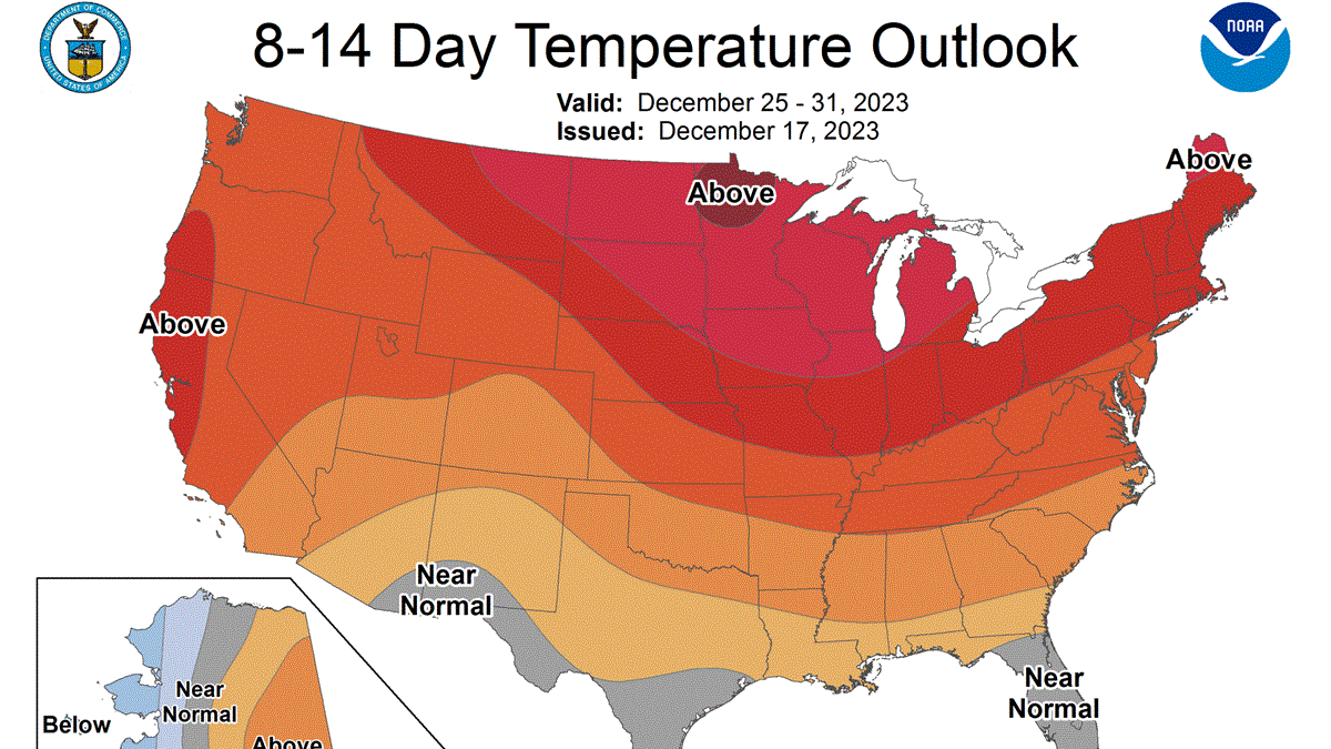
There’s still no sign of Arctic air for the rest of December, as temperatures are expected to remain a little above average through next week.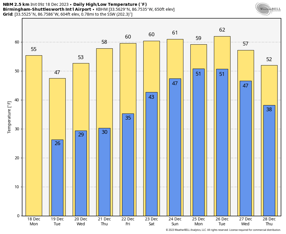 ON THIS DATE IN 1944: Typhoon Cobra, also known as the Typhoon of 1944 or Halsey’s Typhoon (named after Admiral William “Bull” Halsey), was the United States Navy designation for a tropical cyclone that struck the Task Force 38 during World War II in the Pacific Ocean. The typhoon was first observed Dec. 17 as it surprised a fleet of ships in the open waters of the western Pacific. Sustained winds associated with the storm were up to 100 mph with gusts to 140 mph. On Dec. 18, the small but violent typhoon hit the Task Force while many of the ships were attempting to refuel. Due to the extreme seas and winds, three destroyers capsized and went down with practically all hands, while a cruiser, five aircraft carriers and three destroyers sustained serious damage. Approximately 790 men were lost or killed, with another 80 injured.
ON THIS DATE IN 1986: A strong winter storm, which developed off the coast of New Jersey and moved out to sea, lashed the northeastern U.S. with high winds, heavy rain and heavy snow. The storm left snowfall amounts of up to 30 inches in Vermont, 24 inches in Massachusetts and 20 inches in New Hampshire. The highest rainfall amounts approached 4 inches in southern New England, where winds gusted to 70 mph.
For more weather news and information from James Spann and his team, visit AlabamaWx.


