James Spann: Clouds return to Alabama Friday, rain by Friday night
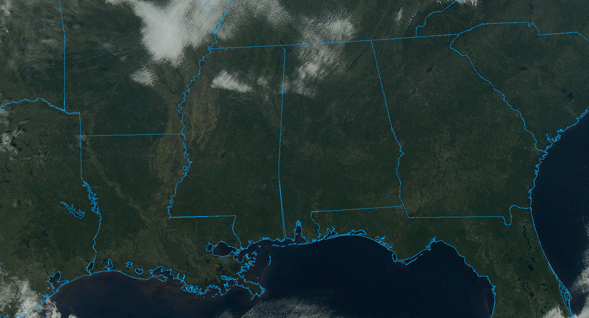
COOL JANUARY DAY: Temperatures across Alabama range from the low 40s across the Tennessee Valley to the upper 50s near the Gulf Coast. Clouds that hovered over north Alabama earlier today are dissipating, and tonight will be mostly fair and cold, with a low between 25 and 35 degrees for most communities.
RAIN RETURNS: Clouds will increase Friday ahead of a weather system that will bring rain to the state Friday night. The Storm Prediction Center (SPC) maintains a low-end marginal risk (level 1 out of 5) of severe thunderstorms for the Gulf Coast; the main threat will come from strong, gusty winds, although a brief, isolated tornado can’t be totally ruled out.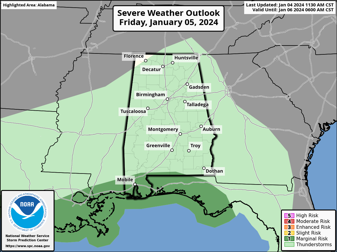 Most of the rain will come from about 6 Friday night through 6 Saturday morning. Amounts of around 1 inch are likely statewide; some spots could see more.
THE ALABAMA WEEKEND: Clouds will likely linger through much of the day Saturday, although there could be some clearing by mid to late afternoon in spots. Sunday will be dry with a partly sunny sky. Highs over the weekend will be in the 50s, right at seasonal averages for January in Alabama.
NEXT WEEK: Another system will bring clouds back into Alabama Monday and more rain Monday night into Tuesday. The SPC has defined a severe-weather threat for about the southern quarter of Alabama with this system.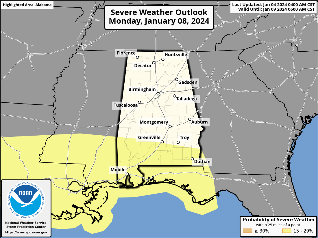 At the moment it looks like most of the rain will come from about midnight Monday through noon Tuesday; amounts of 1-2 inches are likely statewide. Gradient winds (not related to thunderstorms) will be strong, possibly gusting to 40 mph in spots. For south Alabama the main threat from heavier storms will come from strong winds, but again a brief tornado or two will be possible.
The latter half of the week looks dry with seasonal temperatures — highs mostly in the 50s, lows mostly in the 30s. There’s still no sign of any high-impact winter weather event for Alabama for the next seven to 10 days.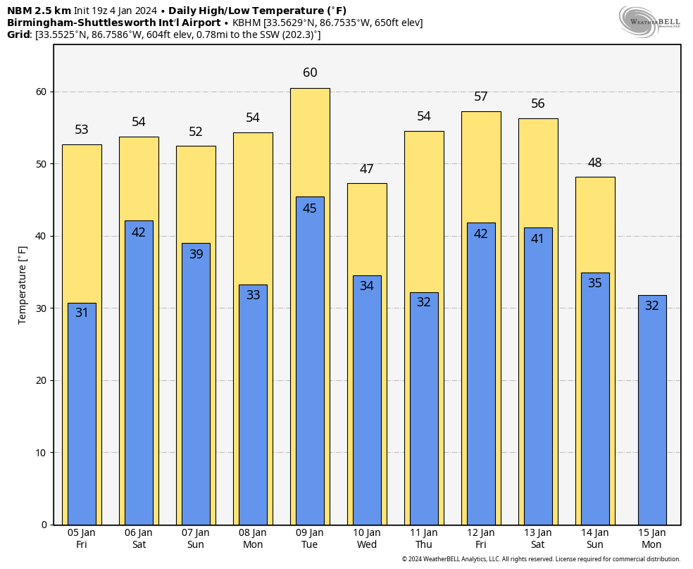 ON THIS DATE IN 1917: A tornado with estimated F3 damage cut a 15-mile path and struck a school at Vireton in Pittsburg County, Oklahoma, killing 16 people. It ranks as the fourth-worst school tornado disaster in U.S. history.
For more weather news and information from James Spann and his team, visit AlabamaWx.


