James Spann: Periods of rain for Alabama through Saturday, with a few strong storms
James Spann forecasts more rain for Alabama, sometimes heavy, with strong winds possible from Alabama News Center on Vimeo.
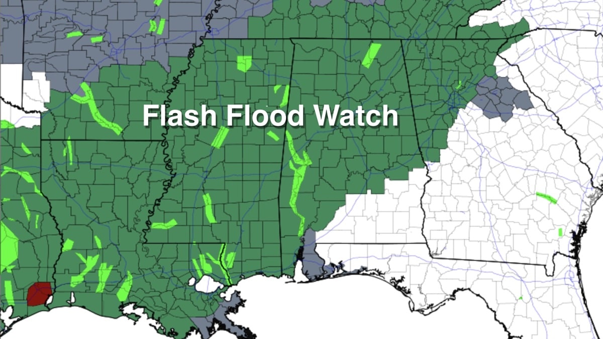
WET WEATHER CONTINUES: Rain is fairly widespread across Alabama early this morning, and periods of rain will continue through tonight. A flash flood watch remains in effect for areas north of a line from Mobile to Montgomery to Opelika.
A few strong thunderstorms are also possible today. The Storm Prediction Center (SPC) maintains a marginal risk (level 1 out of 5) of severe thunderstorms for basically all of Alabama through tonight.
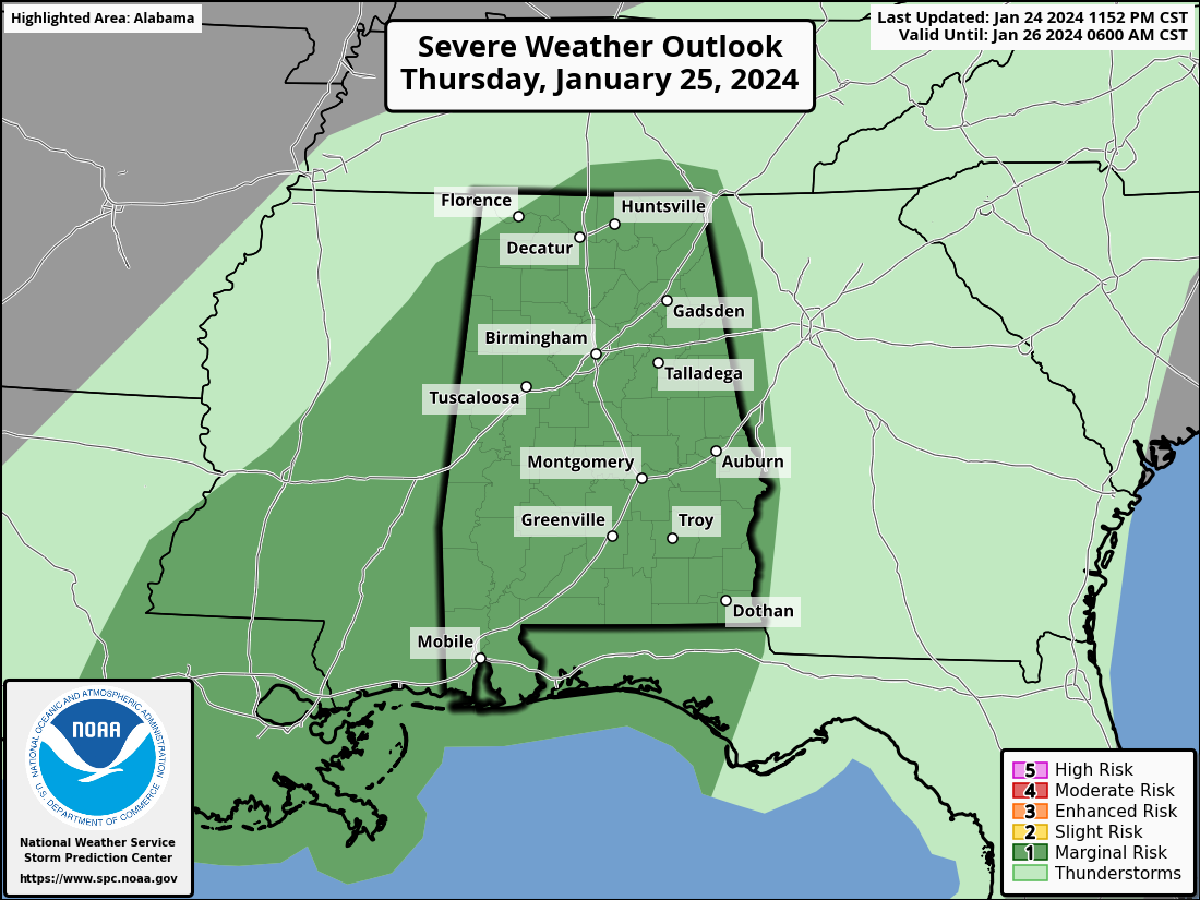
Heavier storms will be capable of producing strong, gusty winds. The chance of an isolated tornado is low but not zero. The main window for stronger thunderstorms will come during the afternoon and evening.
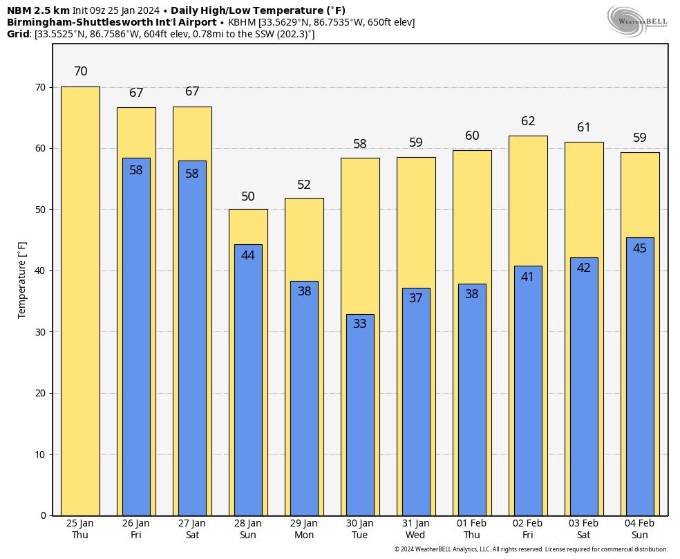
Occasional rain is likely again Friday, mainly over the southern two-thirds of the state. Temperatures will stay mild today and Friday, with highs between 67 and 73 degrees.
THE ALABAMA WEEKEND: Yet another batch of showers and storms will move through on Saturday. The SPC has defined a slight risk (level 2 out of 5) of severe thunderstorms for parts of east and south Alabama, in a broad zone from Anniston to Evergreen. A marginal risk (level 1) runs in the general area from Fort Payne to Mobile.
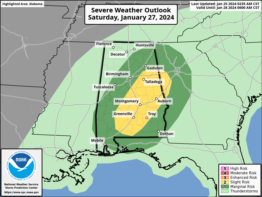
An organized line of strong thunderstorms could form over east and south Alabama; wind damage would be possible along the leading edge of this line, mainly during the mid to late afternoon. Like today, the risk of a tornado is low but not zero. The main limiting factor in the severe weather threat Saturday is the lack of surface-based instability. The high Saturday will be between 65 and 70 degrees.
Additional rain amounts between now and Saturday evening across Alabama will be 2-4 inches.
Cooler air rolls into the Deep South Sunday, with highs dropping into the 50s. Parts of the Tennessee Valley could hold in the 40s all day. The sky will stay mostly cloudy, and a bit of patchy, light rain can’t be ruled out over the northern half of the state.
NEXT WEEK: The weather will be dry Monday through Thursday with highs in the upper 50s and low 60s. A few showers could show up by the end of the week.
 RAIN SO FAR: Rain amounts of 2-4 inches were common over north and central Alabama Wednesday. Coker in Tuscaloosa County received 3.65 inches; Chelsea in Shelby County had 3.02 inches.
ON THIS DATE IN 1949: Las Vegas recorded 4.7 inches of snow. This brought the monthly snowfall total to 16.7 inches, still the city’s snowiest month on record.
ON THIS DATE IN 2021: An EF-3 tornado tore through Fultondale, killing a 14-year-old boy and injuring more than 10 people. It was down for 10 miles, first touching down near I-65 and Walker Chapel Road. Fultondale High School had significant damage.
For more weather news and information from James Spann and his team, visit AlabamaWx.


