James Spann: Summer-like week ahead for Alabama; a few showers, storms possible

RADAR CHECK: This morning, we are watching a band of showers and storms lined up ahead of a surface front from near Nashville to Oxford, Mississippi, to Monroe, Louisiana. This front will stall out later today near the northwest corner of Alabama; it will bring some rain to mainly the northern half of the state. It won’t rain everywhere, and most of south Alabama will stay dry. Some thunder is possible, but I don’t expect any severe storms, with weak wind fields and dynamic support. Highs remain in the 80s.
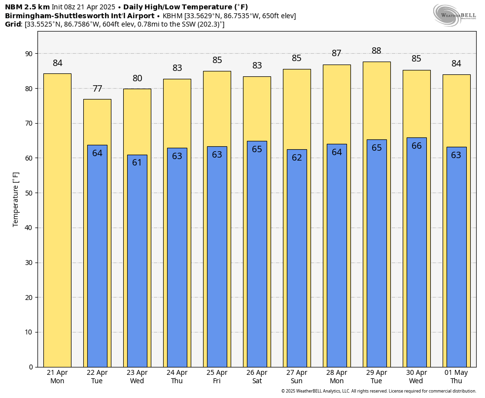
REST OF THE WEEK: We will mention the chance of showers and thunderstorms statewide Tuesday as the stalled front stays in place. Higher rain coverage will remain over the northern counties, and some spots will miss the rain completely due to the scattered nature of the showers. Highs drop into the 70s due to cloud cover.
Showers become fewer over the latter half of the week as the front lifts northward and dissipates. By the time we get to Friday and the weekend, most of Alabama will be simply warm and dry, with only isolated afternoon showers over the northern third of the state. Temperatures will stay above average, with highs in the 80s; lows will be in the 60s.
LONG RANGE: The ridge will likely hold into early May, meaning little if any chance of organized severe storms, and highs holding in the 80s. But Alabama’s tornado season runs through May, and there is still time for the pattern to break down. We typically get one last set of cool mornings before the long, hot, humid summer settles over us like a damp dish rag. Old timers call it “blackberry winter.”
RACE WEEKEND: The weather will be warm and mostly dry at Talladega Friday through Sunday. The chance of an afternoon shower is 20% or less, and highs will be in the 80s.
ON THIS DATE IN 2004: Oklahoma City residents are accustomed to walking outside to find a blanket of white covering the ground. But not in late April on a day that started out with temperatures in the upper 70s. The layer of white was not snow, but rather hail, which fell in prodigious amounts as massive supercell thunderstorms pounded the Oklahoma City metro area. Traffic was snarled on area highways, including I-44, as cars could not drive on roads slick with the ice.
For more weather news and information from James Spann and his team, visit AlabamaWx.


