James Spann: Cold air on its way to Alabama, but will winter mischief follow?
THIS AFTERNOON: Temperatures are mostly in the 60s across Alabama this afternoon, and we are seeing some sun breaking through the overcast.
COLDER DAYS AHEAD: Colder air begins to roll into Alabama tonight; many communities across North Alabama will hold in the 40s tomorrow with a chilly north wind, and, like today, the sky will feature more clouds than sun. Thursday will be cool and dry with a partly sunny sky; the high Thursday afternoon will be in the low 50s.
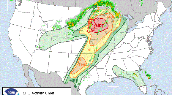
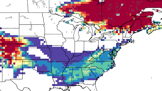
ARCTIC AIR ARRIVES FRIDAY: The next phase of the big chill arrives at the end of the week; most North/Central Alabama communities will hold in the 30s all day with a cloudy sky. And, with an approaching upper trough and developing low in the northern Gulf, the stage is set for some winter weather issues for the Deep South.

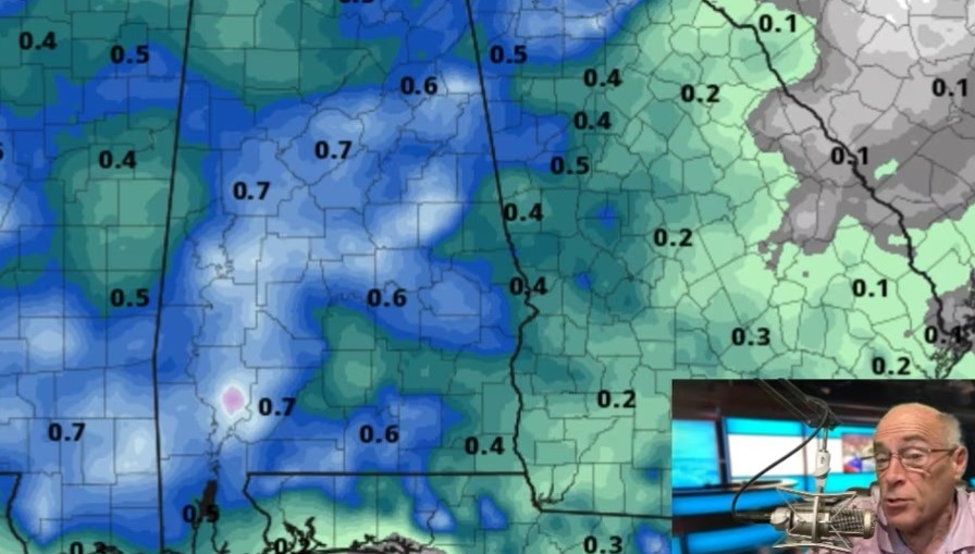
New global model data remains inconsistent; the American global model paints a strip of heavier snow across Central Alabama, while the European shows lighter snow mainly over North Alabama. The new 18Z North American Mesoscale model tends to support the European idea.
Forecast model soundings show the atmosphere certainly will be cold enough for snow over the northern third of the state, with rain for the southern counties. A mix of rain, sleet and snow is possible in the middle of the state.
Understand we are dealing with an event several days away, and it is simply too early to draw conclusions about accumulation potential and the placement of snow. Just be aware that some accumulating snow is possible for the northern half of Alabama Friday, Friday night and early Saturday, and there could be some travel impact.
With each day the forecast will be more certain and more specific. Be sure and check AlabamaWX often for updates; you won’t want to have old information if you need to travel across Alabama or the Deep South late this week.

THE WEEKEND: Cold air will stay in place after the departing storm system; expect a clearing sky Saturday with a high only in the mid to upper 30s; Sunday will be sunny with a high between 40 and 44. Early morning lows will be close to 20 degrees, with teens likely for colder spots early Sunday.
NEXT WEEK: The Global Forecast System is printing a low of 19 degrees for Birmingham early Monday; then we start to warm up, and mid 50s are possible by Tuesday afternoon. For now the first half of the week will be dry.
WEATHER BRAINS: You can listen to our weekly 90-minute netcast anytime on the web, or on iTunes. This is the show all about weather featuring many familiar voices, including meteorologists at ABC 33/40. We will produce this week’s episode tonight at 8:30. You can watch it live here.
CONNECT: You can find me on all of the major social networks:
Facebook
Twitter
Google Plus
Instagram
For more news and information, visit AlabamaWX.