James Spann: Windy day in Alabama, with showers/storms still possible
James Spann: Wet and windy today, wintry tomorrow in Alabama from Alabama NewsCenter on Vimeo.
STRONG PRE-DAWN WINDS: A wake low on the back side of the departing rain mass across Alabama is producing strong winds early this morning, gusting to 45 mph at times. This wind is not related to thunderstorms, but a very sharp, small-scale pressure rise/fall couplet. We have many reports of downed trees and power lines; the wake low wind will calm down soon, but winds will stay up in the 15-25 mph range through the day because of a tight larger-scale pressure gradient.
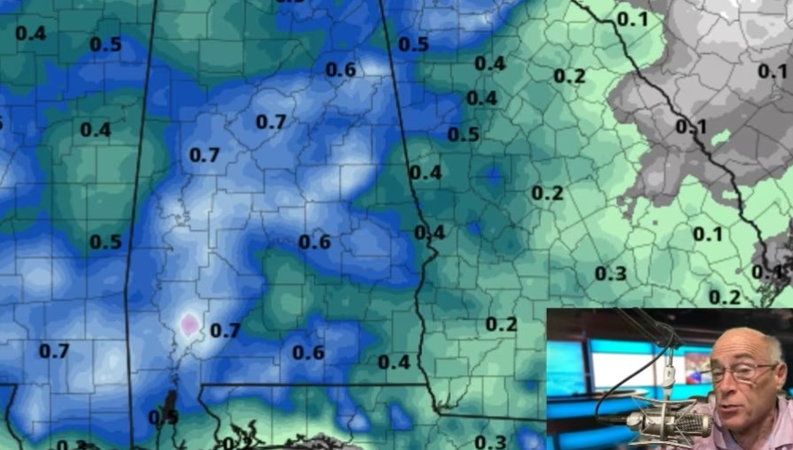
Radar shows the big mass of overnight rain moving out of the state early this morning, but additional showers and thunderstorms will form today ahead of a surface cold front moving in from the west. We note the Storm Prediction Center has a “marginal risk” of severe storms defined for about the eastern half of Alabama.

With only a very limited amount of surface-based instability, the overall threat is pretty low, but a few storms could produce small hail and gusty winds today. Additional rain amounts of one-half inch are possible. Temperatures won’t get out of the 60s with a cloudy sky.
WINTRY DAY TOMORROW: Tomorrow will feel more like January. Moisture wrapping around the back side of the departing low will keep clouds in place with potential for some light rain at times. Temperatures won’t get out of the 50s, and a strong west wind will make it feel colder.
THE ALABAMA WEEKEND: Saturday morning will be cold for May, with temperatures dropping well down in the 40s, but the rest of the weekend will feature a warming trend. With a sunny sky, we reach the low 70s Saturday, followed by upper 70s Sunday.
RACE WEEKEND AT TALLADEGA: Tomorrow will be windy and cold for early May with overcast conditions; a few periods of light rain are likely. Afternoon temperatures will be only in the low to mid 50s. Then, we get bright, sunny weather Saturday and Sunday with a warming trend; the high Saturday will be near 72, followed by 77 on Sunday.
NEXT WEEK: The first half of the week will be dry with warm afternoons; showers and storms return Thursday night into part of the day Friday.

Click here to see the Beach Forecast Center page.
WEATHER BRAINS: You can listen to our weekly 90-minute netcast anytime on the web, or on iTunes. This is the show all about weather featuring many familiar voices, including meteorologists at ABC 33/40.
CONNECT: You can find me on all of the major social networks:
Facebook
Twitter
Google Plus
Instagram
Pinterest
Snapchat: spannwx
For more weather news and information, visit AlabamaWX.