Brian Peters: Drier but cloudy to end 2015
Brian Peters forecast for Alabama NewsCenter December 31 from Alabama NewsCenter on Vimeo.
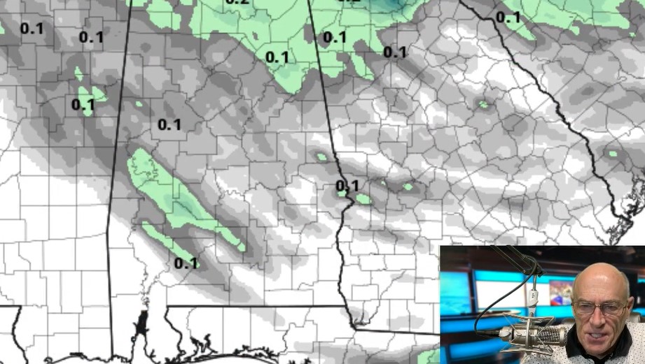
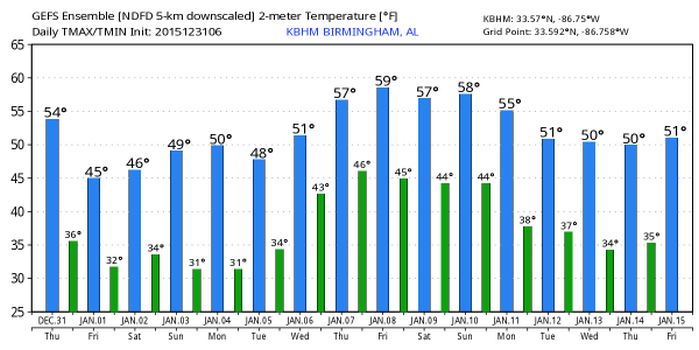
For North and Central Alabama, 2015 is going to end on a drier note, but we’ll still have to contend with the clouds. The surface frontal boundary that brought rain to nearly all of Alabama yesterday has drifted ever so slowly southward, so that the greatest threat for rain will remain over the southern counties and the Florida Panhandle. With the wind coming out of the north today, temperatures across North and Central Alabama are not expected to change much with highs in the middle 50s.
The upper air pattern will be morphing into a long wave trough over the eastern half of the country for the weekend. This will finally change the upper flow over us from southwesterly to northwesterly. This will provide several days of chilly weather with morning lows dancing around the 30-degree mark with afternoon highs in the upper 40s and lower 50s into the first of next week.
The upper trough will move into the Atlantic on Monday allowing a ridge to come over us on Tuesday providing some warmth especially to the morning lows. By Tuesday the morning lows should remain above freezing even through afternoon highs stay in the 50s. The upper ridge appears to hold over the Southeast US until the end of next week when a strong short wave trough is forecast to move across the Lower Mississippi River Valley bringing us our next shot at a rain event.
Showers and thunderstorms will continue to plague the beaches of Alabama and Northwest Florida until the weekend when rain chances should fall off to only a slight risk. Highs today will be in the 60s and then 50s will settle in for Friday and the weekend. Lows will be in the 40s. See the complete Gulf Coast 7 Day Planner here. The Gulf Coast Beach Forecast is presented by Gulf Shores Plantation by Mandoki Hospitality Vacation Rentals. Escape to Gulf Shores Plantation where memories last a lifetime.
Looking into voodoo country, the GFS continued to show an active pattern. A strong short wave moves by around the 10th and 11th promising some rain for us. The pattern goes colder around the 12th, but that colder look is short-lived with another warming ridge around the 15th of January.
I plan to have the next Weather Xtreme Video posted by 8 am or so on New Year’s Day as we roll over into another year. Enjoy the day, stay warm, and Godspeed.
For more weather updates, visit Alabamawx.com.


