James Spann: Showers headed to Alabama later today, tonight
James Spann: Heavier rain next week could bring strong storms from Alabama NewsCenter on Vimeo.
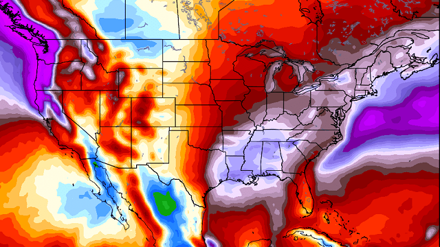
TO THE WEST: Rain continues to fall this morning through parts of Arkansas, Tennessee, Louisiana and Texas, and that is progressing our way as a short wave aloft moves eastward.
Here in Alabama, the low levels remain very dry; dewpoints are generally in the 20s, and that is the biggest obstacle for decent rain amounts around here later today. Showers will enter Northwest Alabama by early afternoon, and we will mention the potential for showers on through tonight and even early tomorrow morning. The Storm Prediction Center even suggests some thunder is possible west of a line from Huntsville to Birmingham to Demopolis.

Rain amounts for most will be one-tenth of an inch or less; a few spots could see two-tenths. This is not meaningful in breaking a drought, but it will help a bit with the wildfire problem.
THANKSGIVING DAY: Looks like we will need to hang on to some risk of light rain early tomorrow morning, mainly over East Alabama, but morning clouds should give way to a partly sunny afternoon with a high around 70 degrees. A very comfortable day.
FRIDAY THROUGH THE WEEKEND: Mostly sunny days, fair nights. The high Friday will be close to 70, dropping into the 60s over the weekend. Many places will see a light freeze early Sunday morning.
IRON BOWL: A beautiful day for football in Tuscaloosa Saturday. For our state’s biggest game of the year (Auburn at Alabama, 2:30 p.m. kickoff at Bryant Denny Stadium), the sky will be sunny, with temperatures falling from 64 degrees at kickoff into the 50s during the second half.
STORMY SETUP EARLY NEXT WEEK: A dynamic weather system will impact Alabama. The good news is that significant rain is likely, but the bad news is that strong to severe storms will be very possible.

The timing will probably change, but it seems like the main window for storms will come Tuesday, and possibly Tuesday night. Too early to really determine the severe weather potential, but we will need to watch the setup in coming days as the event gets closer. On the positive side, there’s a good chance this drops at least 1 inch of rain on North/Central Alabama.
LONG RANGE: The pattern continues to look active through December, with the European model showing potential for some very beneficial rain around here.

AT THE BEACH: Mostly sunny days and fair nights on the Gulf Coast through the weekend, with highs mostly in the 70s from Gulf Shores over to Panama City Beach. See a detailed Gulf Coast forecast here.
OTTO: The late-season hurricane will move into Central America tomorrow, and then into the Pacific Friday (when it gets a new name). The rest of the Atlantic basin is quiet.
WEATHER BRAINS: You can listen to our weekly 90-minute netcast anytime on the web, or on iTunes. This is the show all about weather featuring many familiar voices, including meteorologists at ABC 33/40.
CONNECT: You can find me on all of the major social networks:
Facebook
Twitter
Google Plus
Instagram
For more weather news and information, visit AlabamaWX.


