James Spann: Strong storms for far North Alabama late tomorrow
LOVELY FIRST DAY OF SPRING: With a good supply of sunshine, temperatures are mostly in the 78- to 82-degree range across Alabama this afternoon. Nothing on radar, and we stay dry tonight with a fair sky.
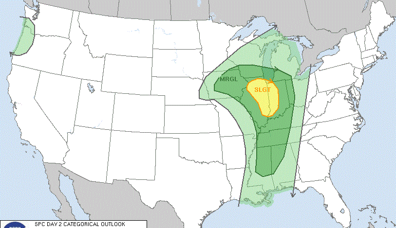
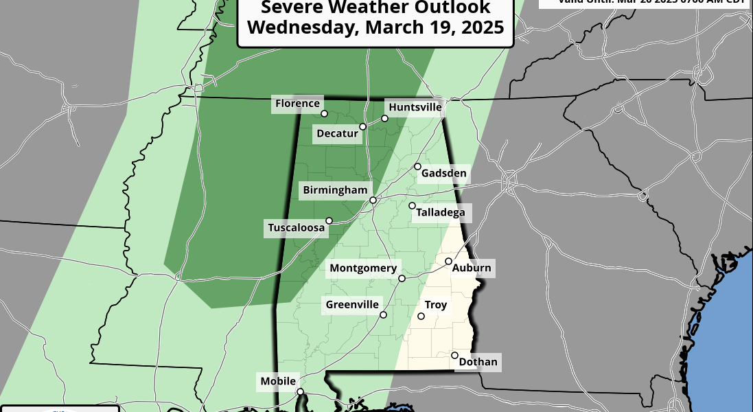
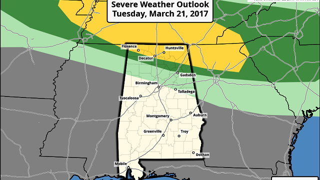
FRONT TO THE NORTH: Most of Alabama will be warm and dry tomorrow, with a high between 80 and 84 degrees, but we will mention a chance of strong to severe thunderstorms near the Tennessee state line. The Storm Prediction Center now has this region in the standard “slight risk” of severe weather.

Storms that form ahead of a surface front late tomorrow and tomorrow night across the Tennessee Valley could produce hail and strong, gusty winds; the tornado threat is very low, thanks to weak wind fields aloft. But most of Alabama will be simply warm and dry tomorrow.
MIDWEEK: We will mention a small risk of a shower Wednesday and Thursday as the front stalls over Central Alabama and dissipates; otherwise, these two days will feature a cooling trend with a mix of sun and clouds. The high Wednesday will be in the low 70s, followed by upper 60s Thursday. The chance of any one spot getting wet will be only about 1 in 5.
Friday will be dry and mild, with a partly sunny sky and a high close to 70 degrees.
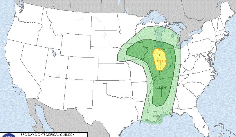
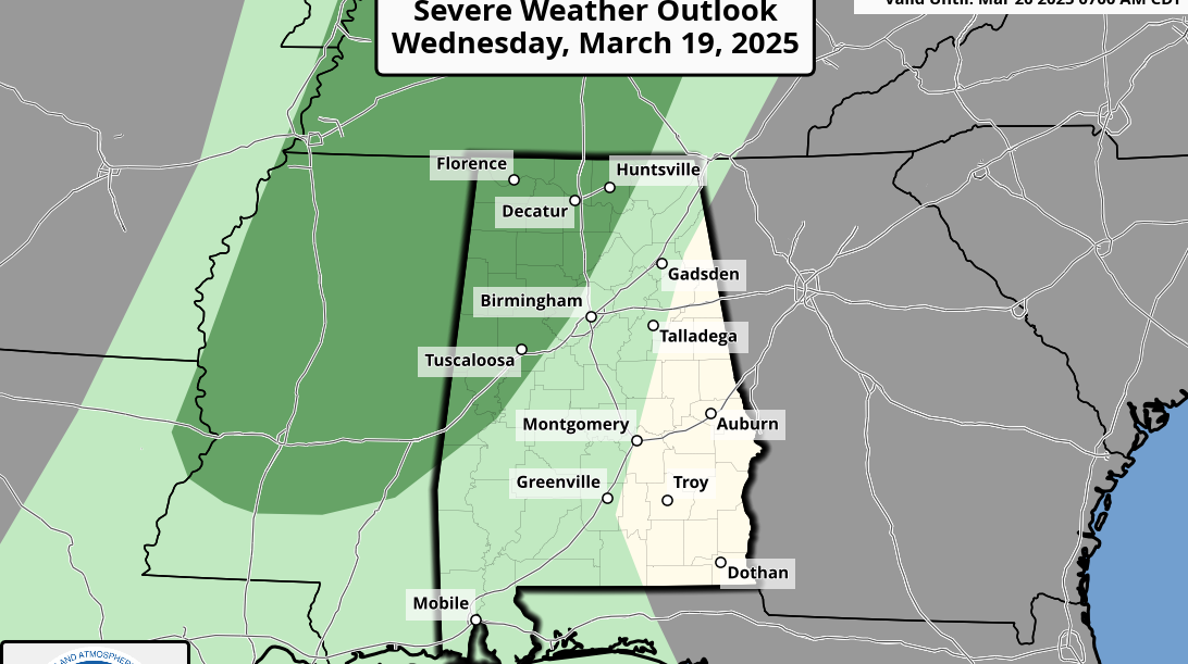
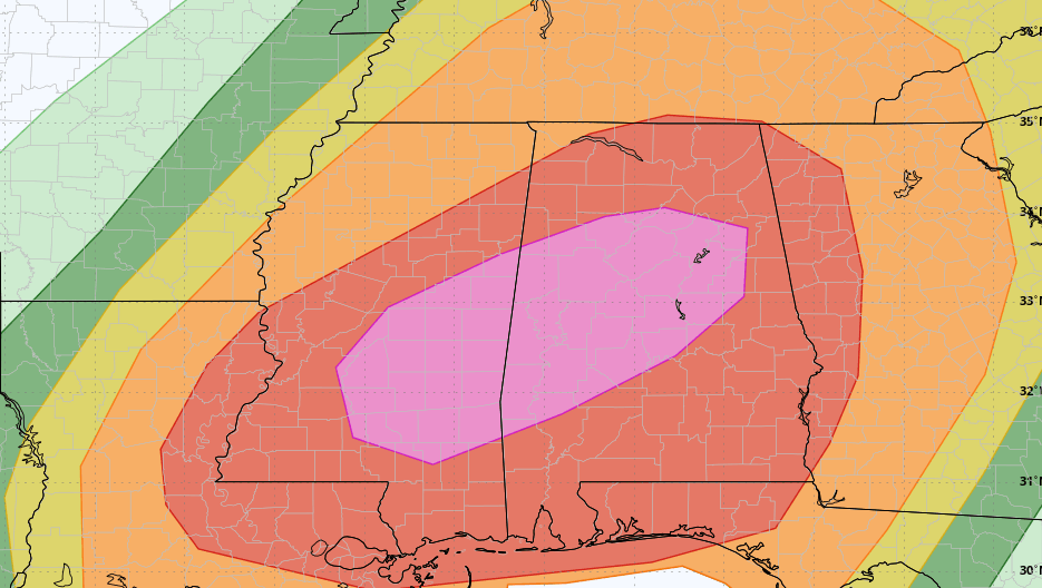
STORMY SATURDAY: The SPC has much of the state in a severe weather risk in its outlook for Saturday.

A surface low supported by a decent upper trough will be over Missouri, and with moist, unstable air in place we expect numerous showers and storms Saturday, especially during the afternoon and into Saturday night. The rain won’t be continuous, but if you have anything planned outdoors be aware of the potential for both strong storms and heavy rain. Still too early to define the specific threats; we will keep a close eye on forecast parameters as we get closer to the weekend. Rain amounts could exceed 1 inch with fairly high precipitable water values in place.
Sunday will be cloudy with a chance of lingering showers; highs over the weekend will be in the 70s.
NEXT WEEK: Another setup for strong storms is possible by mid to late week. We are getting into the core of the spring tornado season in Alabama; these kind of events are pretty common this time of the year.
STORM SPOTTER TRAINING: We will be on the road through early April offering free storm spotter classes. We need more trained spotters in Alabama. By attending, you can make the severe weather warning process better. No need to register; just come with a curious mind. And there is no age limit; kids who love weather will enjoy it. You will never look at a storm the same again. The next class is tomorrow evening in Clay County, at the Clay County Farmers Market in Lineville.

WEATHER BRAINS: You can listen to our weekly 90-minute netcast anytime on the web, or on iTunes. This is the show all about weather featuring many familiar voices, including meteorologists at ABC 33/40. We will produce this week’s show tonight at 8:30. You can watch it live here.
CONNECT: You can find me on all of the major social networks:
Facebook
Twitter
Google Plus
Instagram
Pinterest
Snapchat: spannwx
For more weather news and information, visit AlabamaWX.