James Spann: Cooling trend for Alabama through midweek, then a stormy Saturday
James Spann: Cooler days will bring average March temperatures back to Alabama from Alabama NewsCenter on Vimeo.
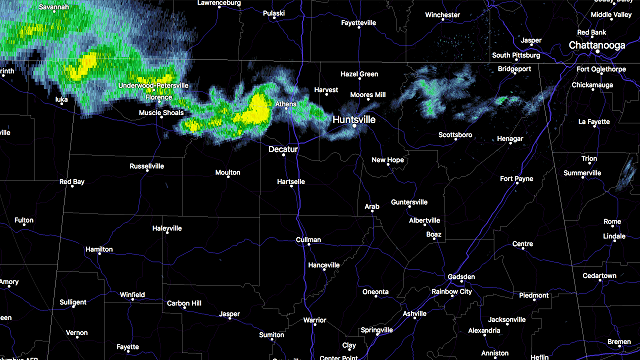
RADAR CHECK: A band of showers is over far North Alabama early this morning associated with a push of cooler air that is working southward.

Otherwise, today will be noticeably cooler with a mix of sun and clouds; most communities will see a high between 67 and 70 degrees, almost 20 degrees cooler than yesterday, when temperatures soared into the upper 80s. Birmingham wound up with an official high yesterday of 89 degrees, within one degree of the record high of 90 for March 21, set in 1907.
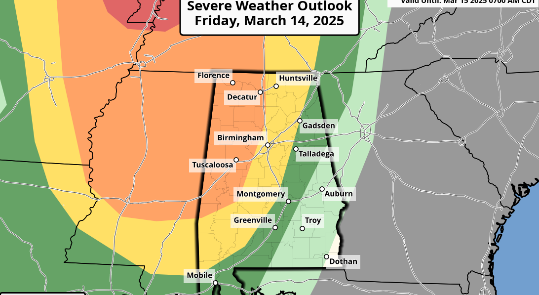
We project a high tomorrow in the mid 60s; just a small risk of showers with intervals of sunshine. Then, on Friday, the day will be dry with a partly sunny sky and a high in the 71- to 75-degree range. To the west, severe storms will likely form Friday, impacting places like Dallas, Tulsa, Shreveport and Little Rock.
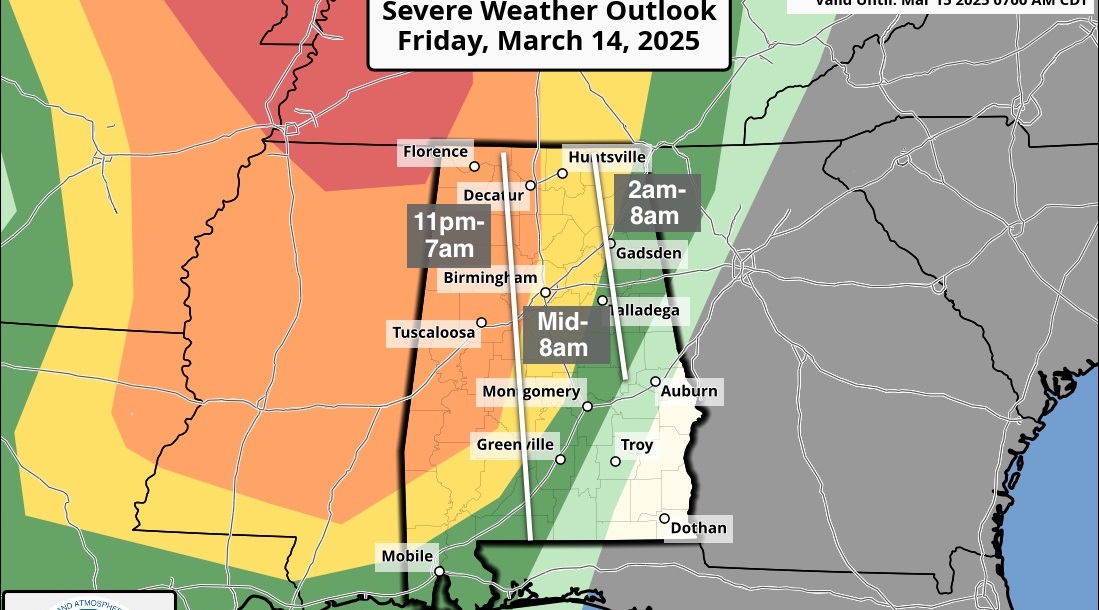
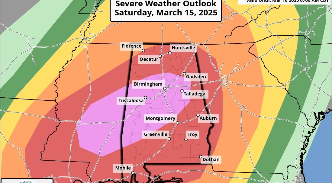
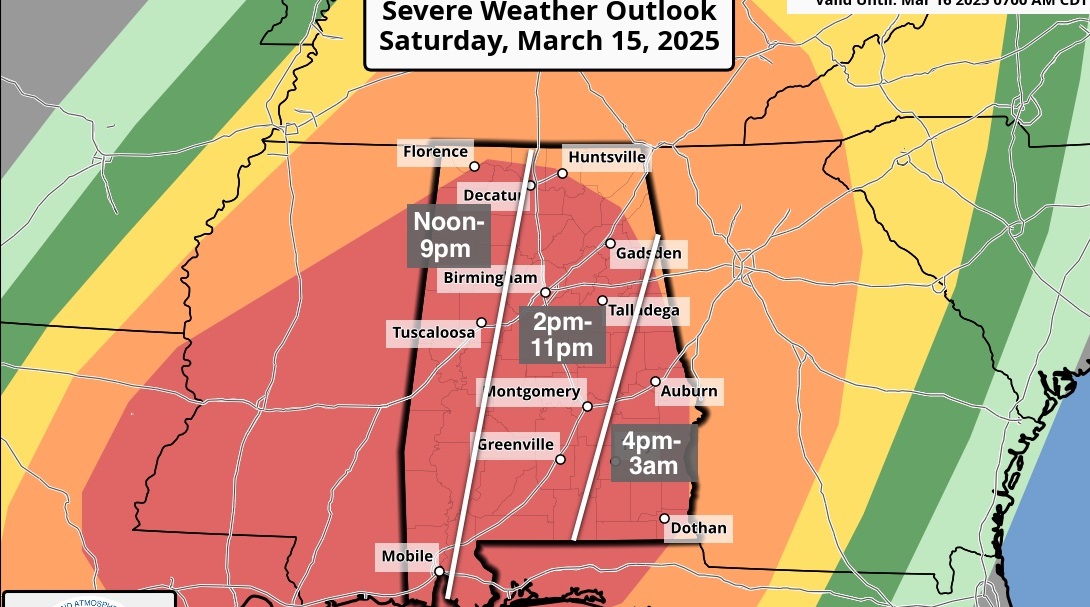
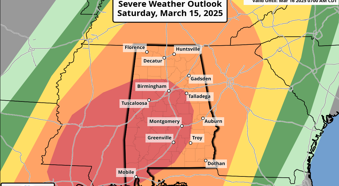
STORMY SATURDAY: A surface low, supported by an upper trough, will be over Missouri, and Alabama will be covered with a warm, moist, unstable airmass. The Storm Prediction Center has opted to put a decent part of the state in a severe weather risk.

Here is the current thinking:
- TIMING: We will open up a 12-hour window for now; the main threat of severe storms will come from noon until midnight. There is a decent chance much of Saturday morning will be dry.
- PLACEMENT: The highest risk of severe storms will be along and west of I-65 — basically the western half of the state.
- THREATS: Storms Saturday will be capable of producing hail and strong winds. With good directional shear, a tornado or two can’t be ruled out.
- RAIN: Amounts of around 1 inch are likely; we don’t expect any flooding issues.
Understand we are still 84 to 90 hours away, so this could easily change, but forecast confidence is higher now that the GFS (American) and ECMWF (European) models are in better agreement.
Showers and storms should exit the state by Sunday morning, and it now looks like Sunday afternoon will be dry. Highs over the weekend will be in the 70s.
NEXT WEEK: We stay in a moist airmass through the week. We will have some risk of showers and storms Monday and Tuesday, but the biggest-impact event comes toward the end of the week with a fairly vigorous system; this could bring another threat of severe storms to Alabama.

STORM SPOTTER TRAINING: We will be on the road through early April offering free storm spotter classes. We need more trained spotters in Alabama. By attending, you can make the severe weather warning process better. No need to register; just come with a curious mind. And there is no age limit; kids who love weather will enjoy it. You will never look at a storm the same again. The next class will be Thursday evening at the Gardendale Civic Center at 6:30.
WEATHER BRAINS: You can listen to our weekly 90-minute netcast anytime on the web, or on iTunes. This is the show all about weather featuring many familiar voices, including meteorologists at ABC 33/40.
CONNECT: You can find me on all of the major social networks:
Facebook
Twitter
Google Plus
Instagram
Pinterest
Snapchat: spannwx
For more weather news and information, visit AlabamaWX.