James Spann: Unsettled summer weather pattern continues for Alabama
James Spann: Good chance of getting wet in Alabama today from Alabama NewsCenter on Vimeo.
AIR YOU CAN WEAR: A very moist air mass will remain parked over Alabama today; the surface front near the Tennessee River will drift northward and dissipate, and once again we will deal with scattered to numerous showers and thunderstorms statewide. Yesterday, some places saw more than eight hours of rain; I don’t think the rain today will be so continuous, but a passing shower or thunderstorm is possible at any hour.
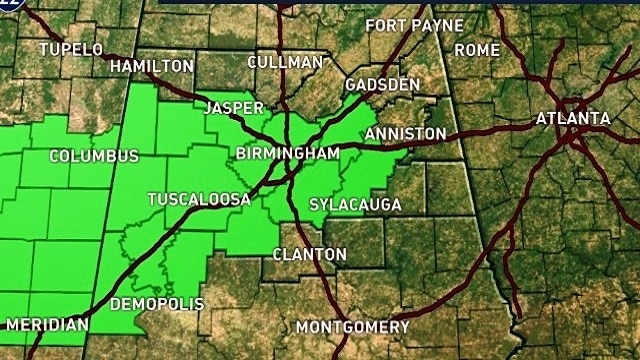
A flash flood watch remains in effect for parts of central and west Alabama, including Birmingham and Tuscaloosa.

We won’t get past the mid 80s today, well below average for mid-August in Alabama.
TOMORROW/FRIDAY: Not much change. A deep layer of tropical moisture hangs around, so we will forecast scattered to numerous showers and storms both days with more clouds than sun. Afternoon highs will be in the 84- to 88-degree range for most communities.
The Storm Prediction Center has a “marginal risk” of severe storms defined for roughly the northern half of the state Friday afternoon.

THE WEEKEND: Unsettled summer weather continues. The sun should peek out a times, but there will be plenty of clouds around with potential for a shower or thunderstorm at just about any hour of the day. Afternoon highs will hold in the mid to upper 80s.
NEXT WEEK: The primary American global model, the GFS, has been suggesting we could see drier air by the middle of the week, but the most recent run takes that idea off the table. For now we will just go with a “persistence forecast” and mention scattered and possibly numerous showers and storms daily, with highs generally in the upper 80s.

ECLIPSE WEATHER: It is simply too early for a reliable forecast. The solar eclipse is Aug. 21, and we will be able to give you a good first look by Monday. Anything now is nothing but a wild guess, and we are not in the “wild guessing” business.
FRANKLIN COULD BECOME A HURRICANE TODAY: Tropical Storm Franklin, in the Bay of Campeche, is nearing hurricane strength this morning. There’s a decent chance it becomes the first hurricane of the Atlantic season by midday; it will make landfall on the coast of Mexico well south of Brownsville, Texas, late tonight.
INVEST 99L: The disturbance east of the Leeward Islands has been fighting dry air and shear, but conditions will become more favorable for development late this week, and the National Hurricane Center gives it a 40 percent chance of developing. If a tropical system does form here, models suggest it will recurve into the open Atlantic east of the U.S.
BEACH FORECAST: Click here to see the AlabamaWx Beach Forecast Center page.
WEATHER BRAINS: You can listen to our weekly 90-minute netcast anytime on the web, or on iTunes. This is the show all about weather featuring many familiar voices, including meteorologists at ABC 33/40.
CONNECT: You can find me on all of the major social networks:
Facebook
Twitter
Google Plus
Instagram
Pinterest
Snapchat: spannwx
For more weather news and information, visit AlabamaWx.


