James Spann: Strong storms move through Alabama today
James Spann: It’s a wet, stormy day for Alabama from Alabama NewsCenter on Vimeo.
RADAR CHECK: A band of strong thunderstorms was pushing through west Tennessee and north Mississippi this morning ahead of a cold front; the line was expected to enter the northwest corner of Alabama around 7 a.m.
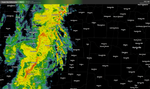
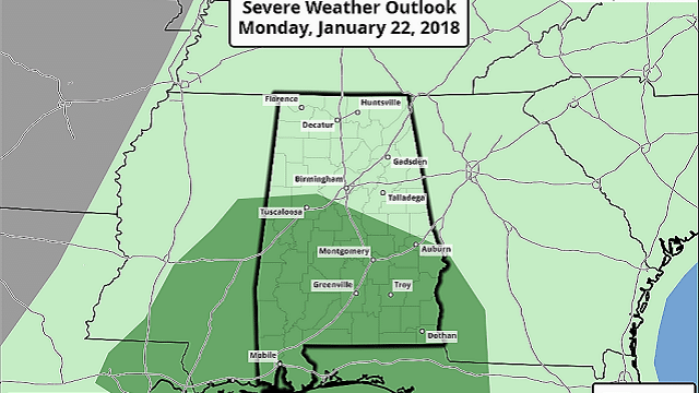
It will move steadily eastward through the state during the day; the Storm Prediction Center maintains a marginal risk of severe storms for much of Alabama.
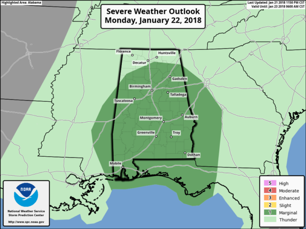
The main threat will come from gusty thunderstorm winds; the tornado threat is very low, but not zero. One good thing is that the storms are ahead of schedule, meaning there will basically be no surface-based instability available over the northern half of the state this morning. The highest severe-weather threat will be over the southern half of the state this afternoon, but even there the overall threat is fairly low.
Rain amounts will be in the one-half-inch to three-quarter-inch range for most communities, and the storms will end from west to east this afternoon. The temperature stays mild today, with a high in the 60s.
REST OF THE WEEK: Thankfully there is no Arctic air behind this system; tomorrow will be partly to mostly sunny with a high in the mid 50s, right at seasonal averages for late January. Dry weather continues Wednesday through Friday with mostly sunny days and fair nights; highs will be in the 50s, and lows well down in the 30s. A light freeze is likely both Wednesday and Thursday morning.
THE ALABAMA WEEKEND: Moisture surges northward Friday night, and Saturday will be a cloudy day with rain likely at times. The latest Global Forecast System run suggests we will need to continue some risk of rain into Sunday as well. Highs will be in the low 60s Saturday and mid 50s Sunday; rain amounts over the weekend should be around one-half inch for most places. For now, no severe storms are expected.
NEXT WEEK: The first half of the week looks mostly cool and dry with highs in the 50s and lows in the 30s; there’s some risk of showers returning by Thursday or Friday.
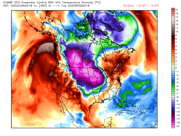
LONG RANGE: Output from the European model hints very cold, Arctic air could return to at least part of North America as we get into February. Winter is far from over.
BEACH FORECAST: Click here to see the AlabamaWx Beach Forecast Center page.
WEATHER BRAINS: You can listen to our weekly 90-minute netcast anytime on the web, or on iTunes. This is the show all about weather featuring many familiar voices, including meteorologists at ABC 33/40.
CONNECT: You can find me on all of the major social networks:
Facebook
Twitter
Google Plus
Instagram
Pinterest
Snapchat: spannwx
For more weather news and information from James Spann and his team, visit AlabamaWx.


