James Spann: Cold April mornings for Alabama
James Spann: Chilly start to the Alabama work week from Alabama NewsCenter on Vimeo.
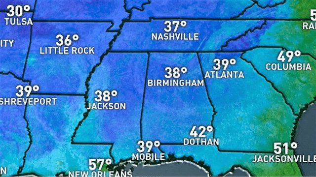
DOESN’T FEEL LIKE SPRING: Here are some temperatures just before daybreak across Alabama:
- Cullman — 32
- Haleyville — 32
- Cottondale — 33
- Thorsby — 33
- Taylorville — 34 (with frost reported)
- Hueytown — 34
- Bessemer — 34
- Anniston — 35
- Albertville — 36
- Gadsden — 36
- Birmingham — 36
- Tuscaloosa — 36
Most reporting stations still have a west wind of 5-10 mph, but where the wind is near calm there is some frost. The sky is clear, and today will feature a sunny sky, but temperatures will remain well below average, with a high between 56 and 59 degrees.
SOME FROST EARLY TOMORROW: Tonight will be clear and cold with a light wind. Most of the larger cities will see a low between 38 and 42, but colder spots will drop down into the 30- to 36-degree range because of radiational cooling, with a chance of frost. Growers, beware. Then the day tomorrow will be sunny and warmer, with a high back in the 70s.
MIDWEEK FRONT: Wednesday will be warm with a high close to 80 degrees, along with a partly sunny sky. A cold front will pass through Wednesday night, but moisture is very limited, and we will mention just a small risk of a shower Wednesday evening ahead of the front. Rain, if any, will be very light and spotty.
Thursday and Friday will be sunny and cooler, with highs generally in the low 70s. Friday morning will be another chilly one, with most places reaching the low 40s; colder pockets could see 30s again.
THE ALABAMA WEEKEND: Saturday looks like a nice spring day with ample sunshine, along with a high in the mid 70s. Clouds roll in Saturday night, and Sunday will be wet with occasional rain and a few thunderstorms. It’s too early to determine whether severe storms will be an issue; the American model (the Global Forecast System) shows the surface low a bit south of here, suggesting just a big rain event, while the European model (the ECMWF) shows the low near Memphis along with a chance of strong storms. We will have better resolution later this week. Rain amounts Sunday should be in the 1- to 2-inch range.
NEXT WEEK: Rain ends early Monday, and the rest of the week looks dry and pleasant for now.

WEEKEND RAIN TOTALS: A few storm totals from around Alabama:
- Marion Junction — 6.39 inches
- Jackson — 6.06 inches
- Dunnavant Valley Road (Shelby County) — 4.74 inches
- Mountain Brook — 3.95 inches
- Helena — 3.86 inches
- Bibbville — 3.62 inches
- Moody — 3.6 inches
- Cottondale — 3.39 inches
- Bessemer — 3.36 inches
- Locust Fork — 3.31 inches
- Grayson Valley — 2.97 inches
- Black Creek — 2.85 inches
- Coker — 2.77 inches
- Rainbow City — 2.77 inches
- Weaver — 2.38 inches
IT’S THAT TIME AGAIN: The Honda Indy Grand Prix of Alabama will be April 20-22 at Barber Motorsports Park. We have a forecast page set up for it on the blog. Click here to check it out.
BEACH FORECAST: Click here to see the AlabamaWx Beach Forecast Center page.
WEATHER BRAINS: You can listen to our weekly 90-minute netcast any time on the web, or on iTunes. This is the show all about weather featuring many familiar voices, including meteorologists at ABC 33/40. We will produce this week’s show tonight at 8:30. You can watch it live here.
CONNECT: You can find me on all of the major social networks:
Facebook
Twitter
Google Plus
Instagram
Pinterest
Snapchat: spannwx
For more weather news and information from James Spann and his team, visit AlabamaWx.


